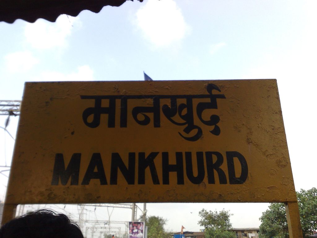
Mankhurd is a railway station on the Harbour Line of the Mumbai Suburban Railway network. It is the last stop on the line on Salsette Island before leaving for Navi Mumbai on mainland Maharashtra. The township lies on the Harbour Line and is the last stop in the city before Navi Mumbai. After Mankhurd, trains cross the Vashi Bridge before reaching Vashi, in Navi Mumbai. Mankhurd also has a railway line run by the Bombay Port Trust. Unlike many of the railway stations in Mumbai, which have 'east' and 'west' sides, this station has a 'north' and 'south' side on either side of the railway track. Bhabha Atomic Research Centre's employee township "Anushakti Nagar", Naval Employee's Township, Mandala and Trombay are some nearby accessible places from the south side of this train station and P.M.G.P. Colony, Mohite-Patil Nagar, Sonapur, Mandala are some nearby accessible places from North side. BEST (Brihanmumbai Electric Supply and Transport) public buses serve this station. Metered and non-metered auto rickshaws are common sight outside the station. There is a civil colony- SPDC Colony located about 2 kilometres away from the station road.
We use GPS information embedded into the photo when it is available.
3D mountains overlay
Adjust mountain panorama to perfectly match your photos because recorded by camera photo position might be imprecise.
Move tool
Rotate tool
Zoom
More customization
Choose which peak labels should make into the final photo and what photo title should be.
Next
Photo Location
Satellitte
Flat map
Relief map
Latitude
Longitude
Altitude
OR
Latitude
°'''
Longitude
°'''
Apply
Register Peak
Peak Name
Latitude
Longitude
Altitude
Register
Teleport
PeakVisor
This 3D model of Sagarmatha National Park in Nepal was made using the PeakVisor app topographic data. The mobile app features higher precision models worldwide, more topographic details, and works offline. Download PeakVisor maps today.
Download OBJ model
PeakVisor
The download should start shortly. If you find it useful please consider supporting the PeakVisor app.
PeakVisor for iOS and Android
Be a superhero of outdoor navigation with state-of-the-art 3D maps and mountain identification in the palm of your hand!