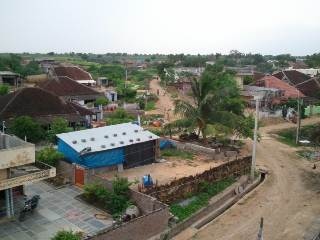
Mandepudi is a village in Guntur district of the Indian state of Andhra Pradesh. It is located in Amaravathi mandal of Guntur revenue division. Tobacco cultivation started in mid-1950 in the coastal Andhra. In this village a huge number of tobacco barens are burning day and night. Buring meaning in Telugu is "Manduta", from that "Mandepudi" came. Apart from cultivation of tobacco, farmers in this village cultivate paddy types like 2027 rice, BPT rice, and Masuri rice. A few farmers cultivate ground nuts, black chana, Toor dal, Gongura is very famous in this village due to its taste, A unique sour taste came in the leafs of gongura because of unique black soil. We can say Guntur is especially famous for Gongura because of unique sour taste due to unique black soil. Late 90s this village started cultivation of red chili and cotton. This village produce one red chili variety "Madhubala 332". This village is near to one of the oldest Lord Hanuman Temple( Gundaram) of 16 th century. Gundaram place is famous for Indian jujube, We can find 100 of trees beside the NSP cannel. This village has three primary education schools, and one ZPH school. ZPH School is located near drinking water pond, a 10 acres pond for drinking water and 10 acres of pond for cultivation. In the late 90s during the winter season these ponds are filled with immigrant birds especially white cranes from various corners of the globe. Birds' immigration has come to zero due to heavy usage of pesticides.
We use GPS information embedded into the photo when it is available.
3D mountains overlay
Adjust mountain panorama to perfectly match your photos because recorded by camera photo position might be imprecise.
Move tool
Rotate tool
Zoom
More customization
Choose which peak labels should make into the final photo and what photo title should be.
Next
Photo Location
Satellitte
Flat map
Relief map
Latitude
Longitude
Altitude
OR
Latitude
°'''
Longitude
°'''
Apply
Register Peak
Peak Name
Latitude
Longitude
Altitude
Register
Teleport
PeakVisor
This 3D model of Sagarmatha National Park in Nepal was made using the PeakVisor app topographic data. The mobile app features higher precision models worldwide, more topographic details, and works offline. Download PeakVisor maps today.
Download OBJ model
PeakVisor
The download should start shortly. If you find it useful please consider supporting the PeakVisor app.
PeakVisor for iOS and Android
Be a superhero of outdoor navigation with state-of-the-art 3D maps and mountain identification in the palm of your hand!