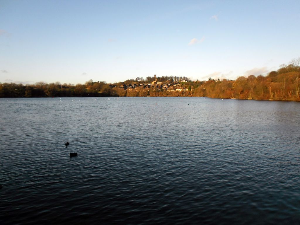
Netherton Reservoir - otherwise known as Lodge Farm Reservoir or locally known as The Rezza is a canal feeder reservoir in the Netherton district of Dudley, England. It opened in 1838, and is now used for watersports, as well as supplying water to the canal system. The Dudley Canal Line No 2 followed a circuitous route, but in the 1830s Thomas Brewin was responsible for building a more direct route. The total length of the new canal, which opened in 1838, was about 400 yards (370 m), which included a 75-yard (69 m) tunnel, known as Brewin's Tunnel. The new route enabled a reservoir to be built over the old course of the canal, together with a steam-powered pumping engine. The tunnel did not last long, as it was opened out in 1858, necessitating the construction of a bridge to carry the lane which had previously crossed over the top of the tunnel. The bridge is now called High Bridge (locally known as the "Sounding Bridge"), and the lane is called Highbridge Road. The reservoir, which was built between 1835 and 1838, acted as a storage reservoir, so that when water was plentiful, as a result of rain, it could be pumped from the canal into the reservoir, and then released back into the canal through sluices near the tunnel when it was required. The engine was installed in 1840, and drove a scoop wheel. A cottage was provided for the sluice keeper. With the nationalisation of the canals in 1948, ownership of the reservoir passed from the Birmingham Canal Navigations, with whom the Dudley Canal had amalgamated in 1846, to British Waterways. They sold it to Dudley Metropolitan Borough Council in 1966, who wanted to improve the leisure facilities within their area, and have since developed it for watersports, although it still supplies water to the canal.
Show more
Sun and Moon
Mon
Tue
Wed
Thu
Fri
Sat
Sun
May 2022
Date and time
00:00
06:00
12:00
18:00
Today
--
--
Sunrise
--
Sunset
--
Moonrise
--
Moonset
Phase
🌔 Waxing Gibbous
The perfect light time for beautiful photos:
--
Sunrise
--
Sunset
PeakVisor app
Get the app on your smartphone
New Panorama Tools
Trace location on the map
Measure distances
All the instruments are available in the context menu as well.
We use GPS information embedded into the photo when it is available.
3D mountains overlay
Adjust mountain panorama to perfectly match your photos because recorded by camera photo position might be imprecise.
Move tool
Rotate tool
Zoom
More customization
Choose which peak labels should make into the final photo and what photo title should be.
Next
Photo Location
Satellitte
Flat map
Relief map
Latitude
Longitude
Altitude
OR
Latitude
°'''
Longitude
°'''
Apply
Register Peak
Peak Name
Latitude
Longitude
Altitude
Register
Teleport
PeakVisor
This 3D model of Sagarmatha National Park in Nepal was made using the PeakVisor app topographic data. The mobile app features higher precision models worldwide, more topographic details, and works offline. Download PeakVisor maps today.
Download OBJ model
PeakVisor
The download should start shortly. If you find it useful please consider supporting the PeakVisor app.
PeakVisor for iOS and Android
Be a superhero of outdoor navigation with state-of-the-art 3D maps and mountain identification in the palm of your hand!