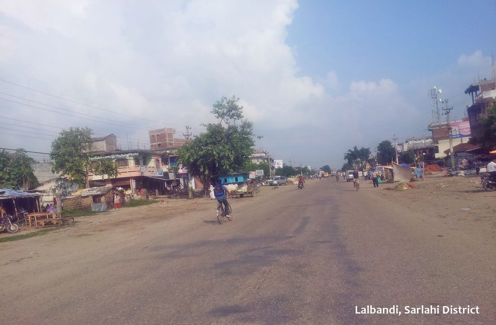
Lalbandi (Nepali: लालबन्दी) is a municipality in Sarlahi district in Madhesh Province of Nepal. The municipality was established on 18 May 2014 by merging the existing Parwanipur VDC, Netragunj VDC, Jabdi, Lalbandi and Pattharkot VDCs. At the time of the 2021 Nepal Census, it had a population of 66,419 living in 14,873 individual households. There are 17 wards in this municipality. It is the largest municipality in Madhesh Province. The office of this municipality is in ward no.6. Lalbandi Bazar, located on the East West or Mahendra highway, is one of the main trading areas within the municipality. Bordering Ishwarpur Municipality to the east and south, Haripur Municipality to the west and south, Sindhuli district to the north and Hariwan to the west, Lalbandi is the main trading site of the district. Due to increasing urbanization, increased business activity, this municipality is becoming a center of attraction in the district and is developing as the largest municipality in the district. The whole municipality is moving forward unitedly for the prosperity and development of this municipality by embracing the original slogan, "Clean, beautiful and prosperous city, Pride of Sarlahi District." The municipality is committed to the economic and social upliftment of women, indigenous nationalities, Dalits, the disabled within the municipal area. The place is famous for tomato production in whole Nepal. Tomato and other green vegetables are the chief cash crop of this place along with paddy, wheat, maize and other crops. It is the fast developing Municipality in Mid Terai region of Nepal. Bhudeo Khadya Udhyog (Hulas Foods), a subsidiary of Hulas Group is located here which is one of the biggest rice, pulse and flour manufacturing and packaging industry in Nepal.
We use GPS information embedded into the photo when it is available.
3D mountains overlay
Adjust mountain panorama to perfectly match your photos because recorded by camera photo position might be imprecise.
Move tool
Rotate tool
Zoom
More customization
Choose which peak labels should make into the final photo and what photo title should be.
Next
Photo Location
Satellitte
Flat map
Relief map
Latitude
Longitude
Altitude
OR
Latitude
°'''
Longitude
°'''
Apply
Register Peak
Peak Name
Latitude
Longitude
Altitude
Register
Teleport
PeakVisor
This 3D model of Sagarmatha National Park in Nepal was made using the PeakVisor app topographic data. The mobile app features higher precision models worldwide, more topographic details, and works offline. Download PeakVisor maps today.
Download OBJ model
PeakVisor
The download should start shortly. If you find it useful please consider supporting the PeakVisor app.
PeakVisor for iOS and Android
Be a superhero of outdoor navigation with state-of-the-art 3D maps and mountain identification in the palm of your hand!