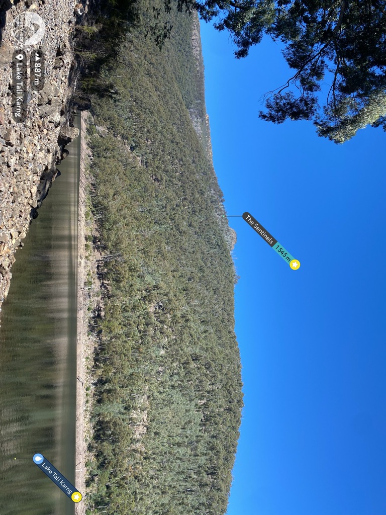
Lake Tali Karng is a natural lake in the Alpine region of Victoria, in eastern Australia. At 14 hectares (35 acres) in area and 51 metres (167 ft) in depth, it is the only deep highland lake in Victoria. It was formed by a landslide 1,500 years ago. Unlike alpine lakes in the Snowy Mountains, Lake Tali Karng is the only permanent, deep, highland lake in Australia that is not of glacial or volcanic origin. It was formed by debris falling from the Sentinel, which is 700 metres (2,300 ft) above the valley. The landslide dammed the Wellington River with the area of the landslide now known as the Valley of Destruction. The lake has no stream outlet, and has never been known to overflow, with water seeping away through the Valley of Destruction. Two creeks feed the lake, Snowden Creek and Nigothoruk Creek. Nigothoruk Creek has three waterfalls, collectively called the Snowden Falls. There is no vegetation in the lake itself because the water is slightly acidic. Its maximum depth is 51 metres (167 ft) and, due to the minimal sunlight falling on it, together with the snow-melt which feeds it, it remains cold throughout the year.
We use GPS information embedded into the photo when it is available.
3D mountains overlay
Adjust mountain panorama to perfectly match your photos because recorded by camera photo position might be imprecise.
Move tool
Rotate tool
Zoom
More customization
Choose which peak labels should make into the final photo and what photo title should be.
Next
Photo Location
Satellitte
Flat map
Relief map
Latitude
Longitude
Altitude
OR
Latitude
°'''
Longitude
°'''
Apply
Register Peak
Peak Name
Latitude
Longitude
Altitude
Register
Teleport
PeakVisor
This 3D model of Sagarmatha National Park in Nepal was made using the PeakVisor app topographic data. The mobile app features higher precision models worldwide, more topographic details, and works offline. Download PeakVisor maps today.
Download OBJ model
PeakVisor
The download should start shortly. If you find it useful please consider supporting the PeakVisor app.
PeakVisor for iOS and Android
Be a superhero of outdoor navigation with state-of-the-art 3D maps and mountain identification in the palm of your hand!