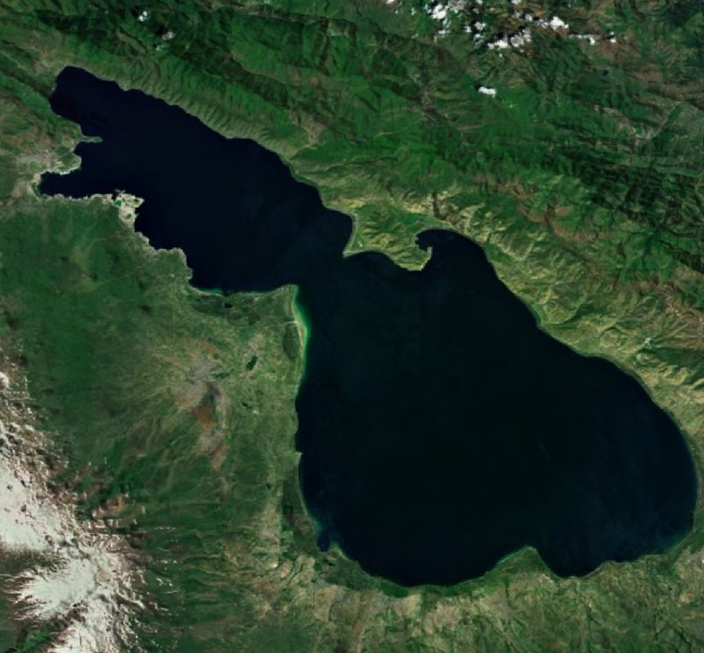
Lake Sevan (Armenian: Սևանա լիճ, romanized: Sevana lich) is the largest body of water in both Armenia and the Caucasus region. It is one of the largest freshwater high-altitude (alpine) lakes in Eurasia. The lake is situated in Gegharkunik Province, at an altitude of 1,900 m (6,234 ft) above sea level. The total surface area of its basin is about 5,000 km2 (1,900 sq mi), which makes up 1⁄6 of Armenia's territory. The lake itself is 1,242 km2 (480 sq mi), and the volume is 32.8 km3 (7.9 cu mi). It is fed by 28 rivers and streams. Only 10% of the incoming water is drained by the Hrazdan River, while the remaining 90% evaporates. Sevan has significant economic, cultural, and recreational value. Its sole major island (now a peninsula) is home to a medieval monastery. The lake provides some 90% of the fish and 80% of the crayfish catch of Armenia. Sevan was heavily exploited for irrigation of the Ararat plain and hydroelectric power generation during the Soviet period. Consequently, its water level decreased by around 20 m (66 ft) and its volume reduced by more than 40%. Later, two tunnels were built to divert water from highland rivers, which halted its decline and its level began rising. Before human intervention dramatically changed the lake's ecosystem, the lake was at an altitude of 1,916 m (6,286 ft) above sea level, 95 m (312 ft) deep, covered an area of 1,416 km2 (547 sq mi) (5% of Armenia's entire area), and had a volume of 58.5 km3 (14.0 cu mi).
We use GPS information embedded into the photo when it is available.
3D mountains overlay
Adjust mountain panorama to perfectly match your photos because recorded by camera photo position might be imprecise.
Move tool
Rotate tool
Zoom
More customization
Choose which peak labels should make into the final photo and what photo title should be.
Next
Photo Location
Satellitte
Flat map
Relief map
Latitude
Longitude
Altitude
OR
Latitude
°'''
Longitude
°'''
Apply
Register Peak
Peak Name
Latitude
Longitude
Altitude
Register
Teleport
PeakVisor
This 3D model of Sagarmatha National Park in Nepal was made using the PeakVisor app topographic data. The mobile app features higher precision models worldwide, more topographic details, and works offline. Download PeakVisor maps today.
Download OBJ model
PeakVisor
The download should start shortly. If you find it useful please consider supporting the PeakVisor app.
PeakVisor for iOS and Android
Be a superhero of outdoor navigation with state-of-the-art 3D maps and mountain identification in the palm of your hand!