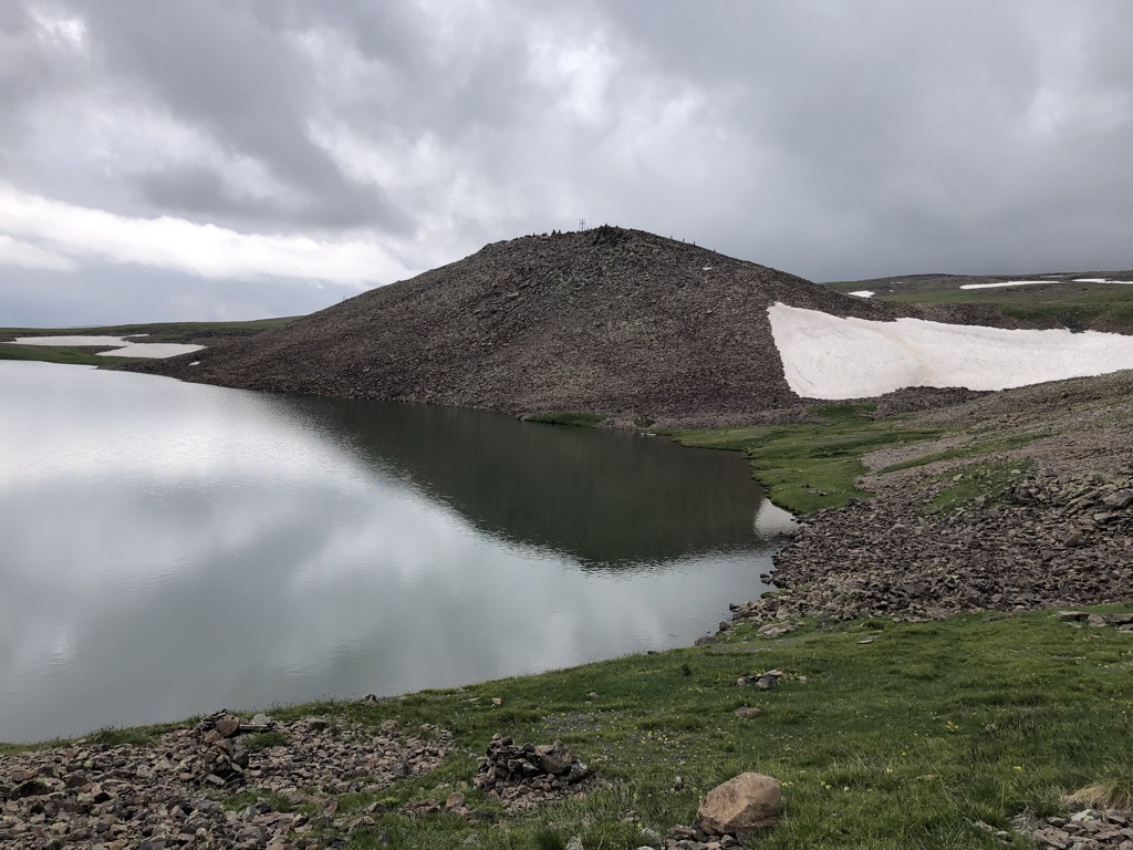
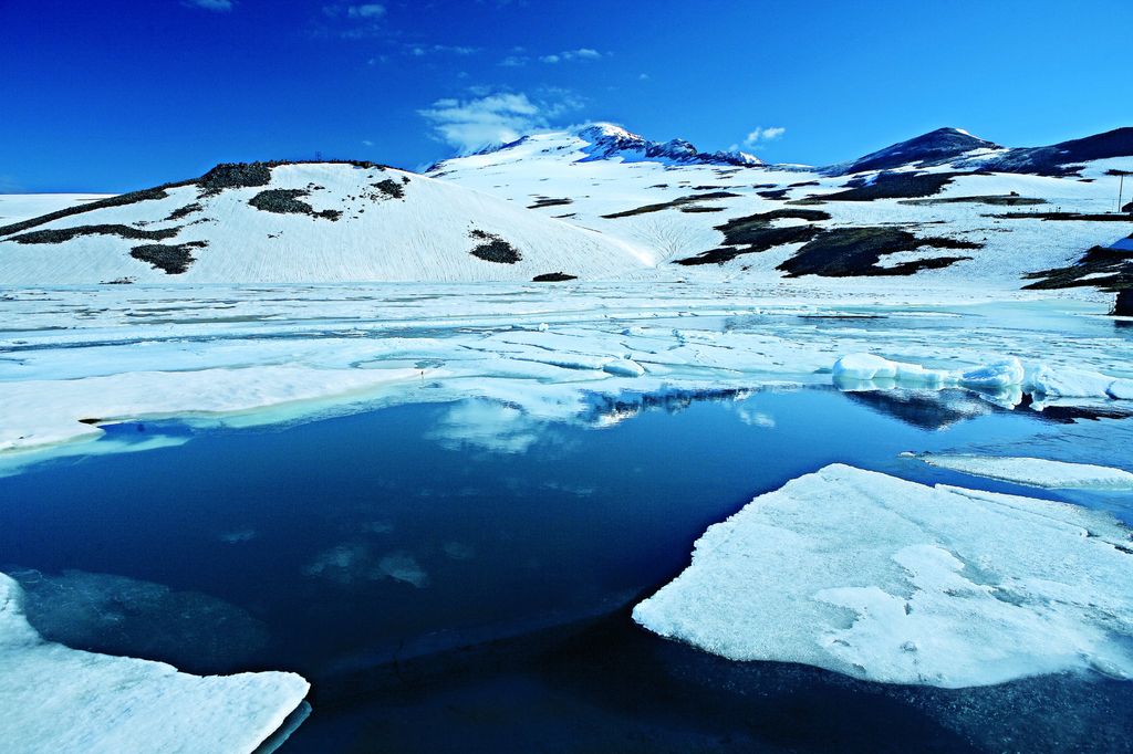
Lake Kari (Armenian: Քարի լիճ, romanized: K’ari lich, lit. 'Rock/Mountain Lake') is a freshwater lake in Armenia located on the slopes of Mount Aragats. It is located 3,185 m above sea level and has a perimeter of 1,150 m. Its depth is up to 8 m, its volume is 375,000 m2, and it has a surface area of 0.12 km2. It formed in a u-shaped valley enclosed by moraines. The water of the lake is limpid and cold and comes mainly from precipitation. It is frozen for 8–9 months a year. According to one theory, the lake is man-made and was used for irrigation purposes in the pre-Urartian period. The lake was previously the source of the Geghadzor River which flows into the plain of Shirak. In the 17th-century, Catholicos Pilippos I ordered the river source closed and connected the lake to the Amberd River, a tributary of the Kasagh. Later, this canal disappeared. There is a cosmic ray station next to the lake, founded in 1943 by physicists Abraham and Artem Alikhanyan. In 1963, the gegharkuni strain of the Sevan trout was artificially introduced to the lake. The fish did not multiply, but they grew at a faster rate than in Lake Sevan. The lake can be reached from the south by the road leading from the village of Agarak; another road starting from the Armenian alphabet monument connects to the main road from the east. The roads are closed by snow during the winter, which can last into late May. The lake is used as a starting point for climbing the southern peak of Mount Aragats.
We use GPS information embedded into the photo when it is available.
3D mountains overlay
Adjust mountain panorama to perfectly match your photos because recorded by camera photo position might be imprecise.
Move tool
Rotate tool
Zoom
More customization
Choose which peak labels should make into the final photo and what photo title should be.
Next
Photo Location
Satellitte
Flat map
Relief map
Latitude
Longitude
Altitude
OR
Latitude
°'''
Longitude
°'''
Apply
Register Peak
Peak Name
Latitude
Longitude
Altitude
Register
Teleport
PeakVisor
This 3D model of Sagarmatha National Park in Nepal was made using the PeakVisor app topographic data. The mobile app features higher precision models worldwide, more topographic details, and works offline. Download PeakVisor maps today.
Download OBJ model
PeakVisor
The download should start shortly. If you find it useful please consider supporting the PeakVisor app.
PeakVisor for iOS and Android
Be a superhero of outdoor navigation with state-of-the-art 3D maps and mountain identification in the palm of your hand!