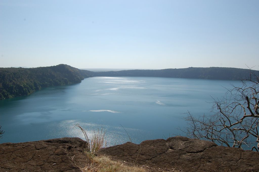
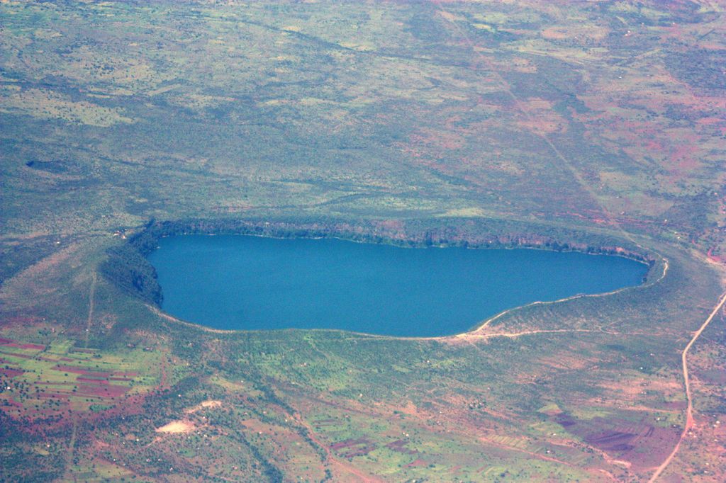
Lake Chala, also known as Lake Challa, is a crater lake that straddles the border between Kenya and Tanzania. The lake formed approximately 250,000 years ago. The lake is east of Mount Kilimanjaro, 8 kilometres (5.0 mi) north of Taveta, Kenya, and 55 kilometres (34 mi) east of Rombo District. The lake is surrounded by a steep crater rim with a maximum height of 170 metres (560 ft). Lake Chala's average annual rainfall is about 565 millimetres (22.2 in).: 215 The lake surface has an average annual evaporation of near 1,735 millimetres (68.3 in). Approximately 80 percent of the lake's inflow comes from groundwater, which is derived mostly from rainfall in the montane forest zone of Mount Kilimanjaro at an elevation of 1,800 to 2,800 metres (5,900 to 9,200 ft). It takes about 3 months for groundwater to reach the lake.: 221 The groundwater flowed into the lake at an estimated annual volume of 8,390,000 cubic metres (296,000,000 cu ft) from 1964 through 1977.
Show more
Sun and Moon
Mon
Tue
Wed
Thu
Fri
Sat
Sun
May 2022
Date and time
00:00
06:00
12:00
18:00
Today
--
--
Sunrise
--
Sunset
--
Moonrise
--
Moonset
Phase
🌔 Waxing Gibbous
The perfect light time for beautiful photos:
--
Sunrise
--
Sunset
PeakVisor app
Get the app on your smartphone
New Panorama Tools
Trace location on the map
Measure distances
All the instruments are available in the context menu as well.
We use GPS information embedded into the photo when it is available.
3D mountains overlay
Adjust mountain panorama to perfectly match your photos because recorded by camera photo position might be imprecise.
Move tool
Rotate tool
Zoom
More customization
Choose which peak labels should make into the final photo and what photo title should be.
Next
Photo Location
Satellitte
Flat map
Relief map
Latitude
Longitude
Altitude
OR
Latitude
°'''
Longitude
°'''
Apply
Register Peak
Peak Name
Latitude
Longitude
Altitude
Register
Teleport
PeakVisor
This 3D model of Sagarmatha National Park in Nepal was made using the PeakVisor app topographic data. The mobile app features higher precision models worldwide, more topographic details, and works offline. Download PeakVisor maps today.
Download OBJ model
PeakVisor
The download should start shortly. If you find it useful please consider supporting the PeakVisor app.
PeakVisor for iOS and Android
Be a superhero of outdoor navigation with state-of-the-art 3D maps and mountain identification in the palm of your hand!