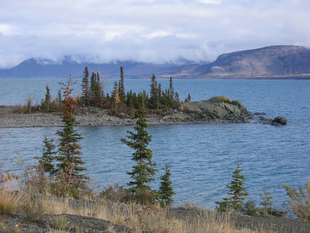
Kluane Lake is located in the southwest area of the Yukon. It is the largest lake contained entirely within Yukon at approximately 408 km2 (158 sq mi),: 1 and 81 km (50 mi) long.: 1 Kluane Lake is located approximately 60 km (37 mi): 1 northwest of Haines Junction.: 1 The Alaska Highway follows most of the south side of Kluane Lake and offers lake views. The lake has a mean depth of 31 m (102 ft) and a maximum depth of 91 m (299 ft): 1 Until 2016, Kluane Lake was fed by the A'ay Chu (Slims River), which was composed of meltwater from the Kaskawulsh Glacier, located within Kluane National Park. Kluane Lake drains into the Kluane River, whose waters flow into the Donjek River, White River, Yukon River, and eventually the Bering Sea. The lake has a high density of large-bodied lake trout and whitefish: 1 and is known for its fishing. In a startling case of climate change, over 4 days in May 2016, the Slims River suddenly disappeared, leaving windswept mud flats where the Alaska Highway crosses the diminished inlet. Voluminous glacial meltwaters were suddenly diverted from one side of North America to another — from the Bering Sea to the Gulf of Alaska. With its main water supply cut off, Kluane Lake will likely become an isolated basin within a few years, shrinking below its outlet (the Kluane River). Lack of inflow is rapidly changing the water chemistry and fish populations of Kluane Lake. Clouds of dust now frequently fill the formerly clear air. For the last 300 years until 2016, abundant meltwater from the Kaskawulsh Glacier has been channeled by ice dams to drain via the 150-meter wide Slims River northwards into Kluane Lake. Between 1956 and 2007, the Kaskawulsh glacier retreated by 655 meters, which most scientists attribute to human-caused climate change. Meltwater flooding from accelerating retreat in 2016 carved a new channel through a large ice field, diverting most flows into the Kaskawulsh River, a tributary of the Alsek, which flows into the Gulf of Alaska.
Show more
Sun and Moon
Mon
Tue
Wed
Thu
Fri
Sat
Sun
May 2022
Date and time
00:00
06:00
12:00
18:00
Today
--
--
Sunrise
--
Sunset
--
Moonrise
--
Moonset
Phase
🌔 Waxing Gibbous
The perfect light time for beautiful photos:
--
Sunrise
--
Sunset
PeakVisor app
Get the app on your smartphone
New Panorama Tools
Trace location on the map
Measure distances
All the instruments are available in the context menu as well.
We use GPS information embedded into the photo when it is available.
3D mountains overlay
Adjust mountain panorama to perfectly match your photos because recorded by camera photo position might be imprecise.
Move tool
Rotate tool
Zoom
More customization
Choose which peak labels should make into the final photo and what photo title should be.
Next
Photo Location
Satellitte
Flat map
Relief map
Latitude
Longitude
Altitude
OR
Latitude
°'''
Longitude
°'''
Apply
Register Peak
Peak Name
Latitude
Longitude
Altitude
Register
Teleport
PeakVisor
This 3D model of Sagarmatha National Park in Nepal was made using the PeakVisor app topographic data. The mobile app features higher precision models worldwide, more topographic details, and works offline. Download PeakVisor maps today.
Download OBJ model
PeakVisor
The download should start shortly. If you find it useful please consider supporting the PeakVisor app.
PeakVisor for iOS and Android
Be a superhero of outdoor navigation with state-of-the-art 3D maps and mountain identification in the palm of your hand!


_2.jpg)
_3.jpg)