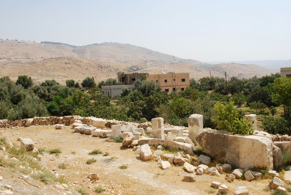
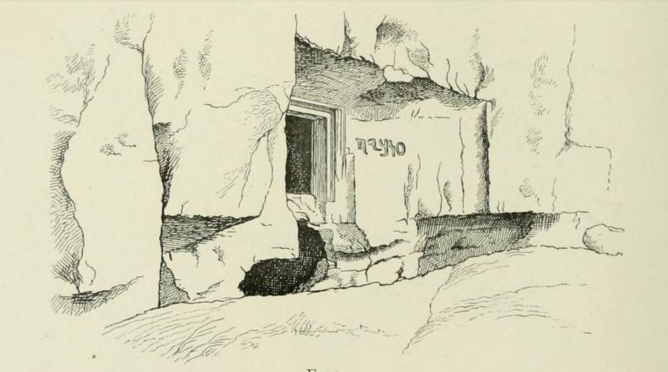
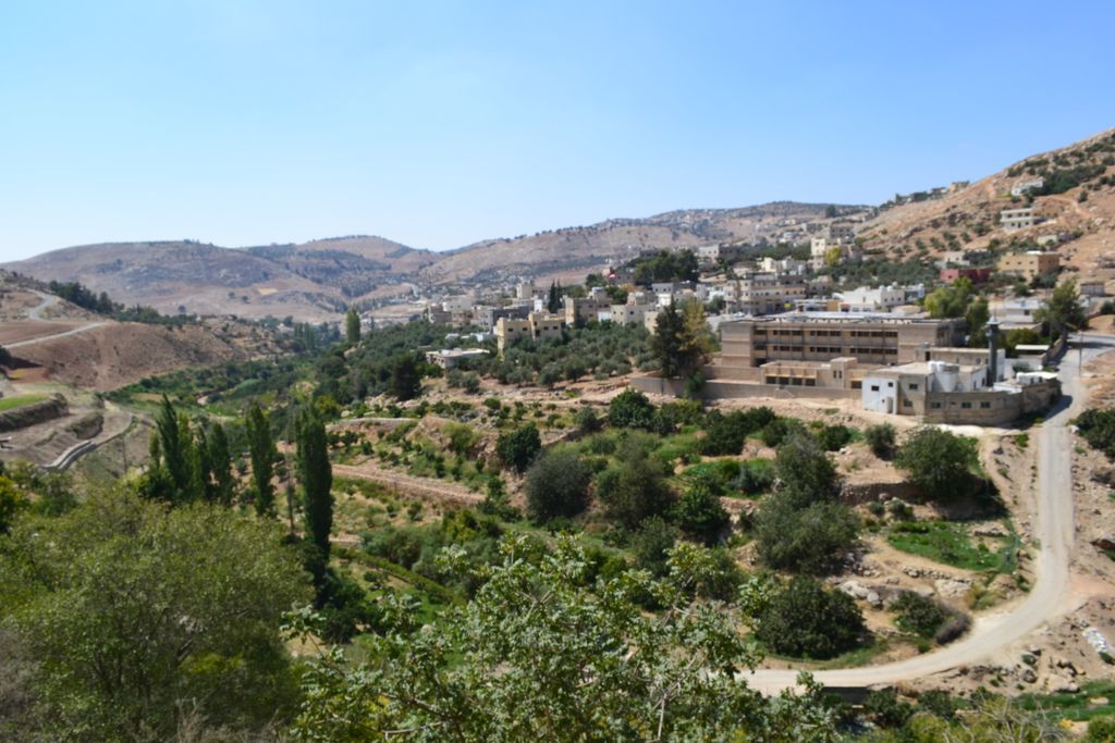
'Iraq al-Amir or Araq el-Amir (Arabic:عراق الأمير - literally, "Caves of the Prince") is the name shared by a town and nearby caves, within the municipality of Amman in the Jordan Valley. Located about 15 km southwest of the town of Wadi as-Seer, it has a population of about 6000 people, mostly members of the Abbadi tribe. It is located on hills with high and medium altitude, in an area with many springs and famous for its olive trees and other forest trees. There are many caves in the hills which were inhabited during the Copper Age. There are also remarkable Roman-Byzantine architectural remains. It is a large cave church – closed because of on-going excavations –, and a second church built outside right in front of it. The entrance of the cave can be identified by a façade decorated with a pediment with crosses. The site is called Mugharat al-Kaniseh (Cave of the Church) by the local community. About 500 metres south of the town stands an archaeological site known as Al-Iraq, dominated by a partially restored Hellenistic period palace known as Qasr al-Abd, which is dated to the late 2nd century BCE. Most scholars agree that Qasr al-Abd was built by the Tobiads, a notable Jewish family of the Second Temple period. This identification is based on a Hebrew inscription found in a nearby burial cave that mentions the name "Tobiah". Iraq Al-Amir is a stop on the Jordan Trail. It is a side trip of Region 3, Salt to Wadi Zarqa (84.4 km). It is 22.3 km from Salt or 15.2 km from Fuheis. From Iraq Al-Amir, the trail makes its way to Husban (19.5 km away).
We use GPS information embedded into the photo when it is available.
3D mountains overlay
Adjust mountain panorama to perfectly match your photos because recorded by camera photo position might be imprecise.
Move tool
Rotate tool
Zoom
More customization
Choose which peak labels should make into the final photo and what photo title should be.
Next
Photo Location
Satellitte
Flat map
Relief map
Latitude
Longitude
Altitude
OR
Latitude
°'''
Longitude
°'''
Apply
Register Peak
Peak Name
Latitude
Longitude
Altitude
Register
Teleport
PeakVisor
This 3D model of Sagarmatha National Park in Nepal was made using the PeakVisor app topographic data. The mobile app features higher precision models worldwide, more topographic details, and works offline. Download PeakVisor maps today.
Download OBJ model
PeakVisor
The download should start shortly. If you find it useful please consider supporting the PeakVisor app.
PeakVisor for iOS and Android
Be a superhero of outdoor navigation with state-of-the-art 3D maps and mountain identification in the palm of your hand!