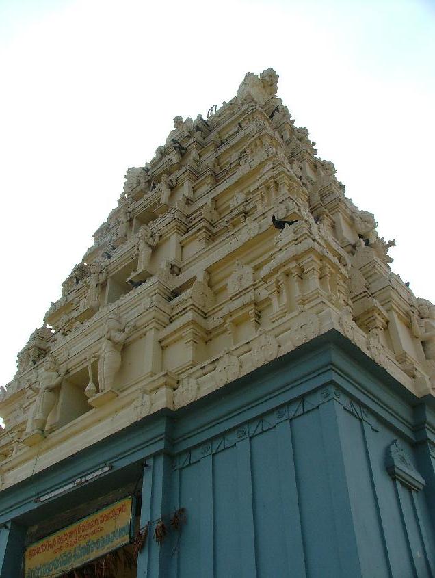
Hamsaladeevi (Telugu: హంసలదీవి, romanized: Hamsaladeevi, lit. 'Swans Island') is a village in Diviseema, Koduru Mandal, Krishna District of the Indian state of Andhra Pradesh. It is about 88 km from Vijayawada and 40 kilometres (25 miles) from Machilipatnam. The nearest city is Avanigadda. Hamsaladeevi hosts an old temple of Lord Krishna (Venugopalaswamy), constructed during the rule of Chola kings. It is one of the 108 Vishnu temples. The Krishna River converges into the Bay of Bengal right outside the village. The confluence is known as Sagara Sangamam; three colours of water can be seen there.
We use GPS information embedded into the photo when it is available.
3D mountains overlay
Adjust mountain panorama to perfectly match your photos because recorded by camera photo position might be imprecise.
Move tool
Rotate tool
Zoom
More customization
Choose which peak labels should make into the final photo and what photo title should be.
Next
Photo Location
Satellitte
Flat map
Relief map
Latitude
Longitude
Altitude
OR
Latitude
°'''
Longitude
°'''
Apply
Register Peak
Peak Name
Latitude
Longitude
Altitude
Register
Teleport
PeakVisor
This 3D model of Sagarmatha National Park in Nepal was made using the PeakVisor app topographic data. The mobile app features higher precision models worldwide, more topographic details, and works offline. Download PeakVisor maps today.
Download OBJ model
PeakVisor
The download should start shortly. If you find it useful please consider supporting the PeakVisor app.
PeakVisor for iOS and Android
Be a superhero of outdoor navigation with state-of-the-art 3D maps and mountain identification in the palm of your hand!