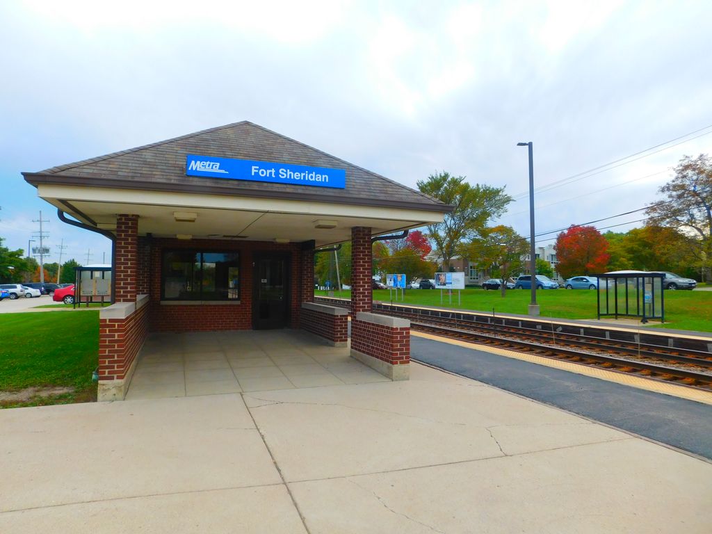
Fort Sheridan Station is one of two stations on Metra's Union Pacific North Line located in the Fort Sheridan neighborhood in Highwood, Illinois. The station is officially located at 461 West Old Elm Road, and is 25.7 miles (41.4 km) away from Ogilvie Transportation Center, the southern terminus of the Union Pacific North Line. In Metra's zone-based fare system, Fort Sheridan is located in zone 4. As of 2018, Fort Sheridan is the 156th busiest of Metra's 236 non-downtown stations, with an average of 259 weekday boardings. As of February 16, 2024, Fort Sheridan is served by 46 trains (23 in each direction) on weekdays, by 22 trains (11 in each direction) on Saturdays, and by 16 trains (eight in each direction) on Sundays and holidays. Parking at Fort Sheridan Station is maintained by the City of Highwood, and is available on both sides of the tracks. Street-side parking is available on the west side of the tracks along Western Avenue and Hyacinth Place south of West Old Elm Road, and on the east side of the tracks near both corners of West Old Elm and Sheridan roads.
Show more
Sun and Moon
Mon
Tue
Wed
Thu
Fri
Sat
Sun
May 2022
Date and time
00:00
06:00
12:00
18:00
Today
--
--
Sunrise
--
Sunset
--
Moonrise
--
Moonset
Phase
🌔 Waxing Gibbous
The perfect light time for beautiful photos:
--
Sunrise
--
Sunset
PeakVisor app
Get the app on your smartphone
New Panorama Tools
Trace location on the map
Measure distances
All the instruments are available in the context menu as well.
We use GPS information embedded into the photo when it is available.
3D mountains overlay
Adjust mountain panorama to perfectly match your photos because recorded by camera photo position might be imprecise.
Move tool
Rotate tool
Zoom
More customization
Choose which peak labels should make into the final photo and what photo title should be.
Next
Photo Location
Satellitte
Flat map
Relief map
Latitude
Longitude
Altitude
OR
Latitude
°'''
Longitude
°'''
Apply
Register Peak
Peak Name
Latitude
Longitude
Altitude
Register
Teleport
PeakVisor
This 3D model of Sagarmatha National Park in Nepal was made using the PeakVisor app topographic data. The mobile app features higher precision models worldwide, more topographic details, and works offline. Download PeakVisor maps today.
Download OBJ model
PeakVisor
The download should start shortly. If you find it useful please consider supporting the PeakVisor app.
PeakVisor for iOS and Android
Be a superhero of outdoor navigation with state-of-the-art 3D maps and mountain identification in the palm of your hand!