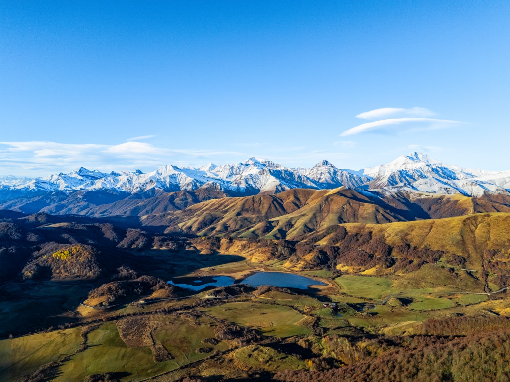
Ertso Lake (Georgian: ერწოს ტბა) is a karst lake in the Java Municipality, Shida Kartli region of Georgia. Located in Qvirila river basin, north-west side of the Ertso-Tsona depression, at 1710 m above sea level. Lake Ertso is the biggest known karst lake in Georgia. The area of surface is 0.31 km2, while the catchment area is 5.85 km2. Average depth is 2,1 m, maximal depth is 19 m. The shape of the shore line is complicated. Three permanent rivers inflows of the lake. Lake Ertso extends in a roughly longitudinal direction. Four sinkholes are filled with water. Gets its feed from snow, rainfall and underground waters. The lake surface water temperature is 23–25 °C. The water level is high during May and June and is low during August and September. The lake freezes for almost 5 months in winter. Lake Ertso is included in the "Red List of Georgia". The village of Ertso is located eastern side.
We use GPS information embedded into the photo when it is available.
3D mountains overlay
Adjust mountain panorama to perfectly match your photos because recorded by camera photo position might be imprecise.
Move tool
Rotate tool
Zoom
More customization
Choose which peak labels should make into the final photo and what photo title should be.
Next
Photo Location
Satellitte
Flat map
Relief map
Latitude
Longitude
Altitude
OR
Latitude
°'''
Longitude
°'''
Apply
Register Peak
Peak Name
Latitude
Longitude
Altitude
Register
Teleport
PeakVisor
This 3D model of Sagarmatha National Park in Nepal was made using the PeakVisor app topographic data. The mobile app features higher precision models worldwide, more topographic details, and works offline. Download PeakVisor maps today.
Download OBJ model
PeakVisor
The download should start shortly. If you find it useful please consider supporting the PeakVisor app.
PeakVisor for iOS and Android
Be a superhero of outdoor navigation with state-of-the-art 3D maps and mountain identification in the palm of your hand!