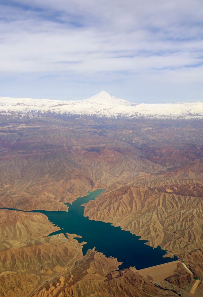
Mamloo Dam (Persian: سد ماملو), is a dam in the Central Alborz mountain range of northern Iran near to the Mount Damavand.The reservoir created by the dam has a capacity of about 250 million cubic meters and It has been built to meet the needs of agricultural water in Varamin plain, but due to the drinking water supply in Tehran, a limited amount of stored water is supplied to the plain. One of the most important effects of the insufficient supply of surface water in Varamin plain is the reduction of groundwater aquifers and land subsidence It is located 35 kilometres (22 mi) east of Tehran and 49 kilometres (30 mi) southeast of Mount Damavand.
We use GPS information embedded into the photo when it is available.
3D mountains overlay
Adjust mountain panorama to perfectly match your photos because recorded by camera photo position might be imprecise.
Move tool
Rotate tool
Zoom
More customization
Choose which peak labels should make into the final photo and what photo title should be.
Next
Photo Location
Satellitte
Flat map
Relief map
Latitude
Longitude
Altitude
OR
Latitude
°'''
Longitude
°'''
Apply
Register Peak
Peak Name
Latitude
Longitude
Altitude
Register
Teleport
PeakVisor
This 3D model of Sagarmatha National Park in Nepal was made using the PeakVisor app topographic data. The mobile app features higher precision models worldwide, more topographic details, and works offline. Download PeakVisor maps today.
Download OBJ model
PeakVisor
The download should start shortly. If you find it useful please consider supporting the PeakVisor app.
PeakVisor for iOS and Android
Be a superhero of outdoor navigation with state-of-the-art 3D maps and mountain identification in the palm of your hand!