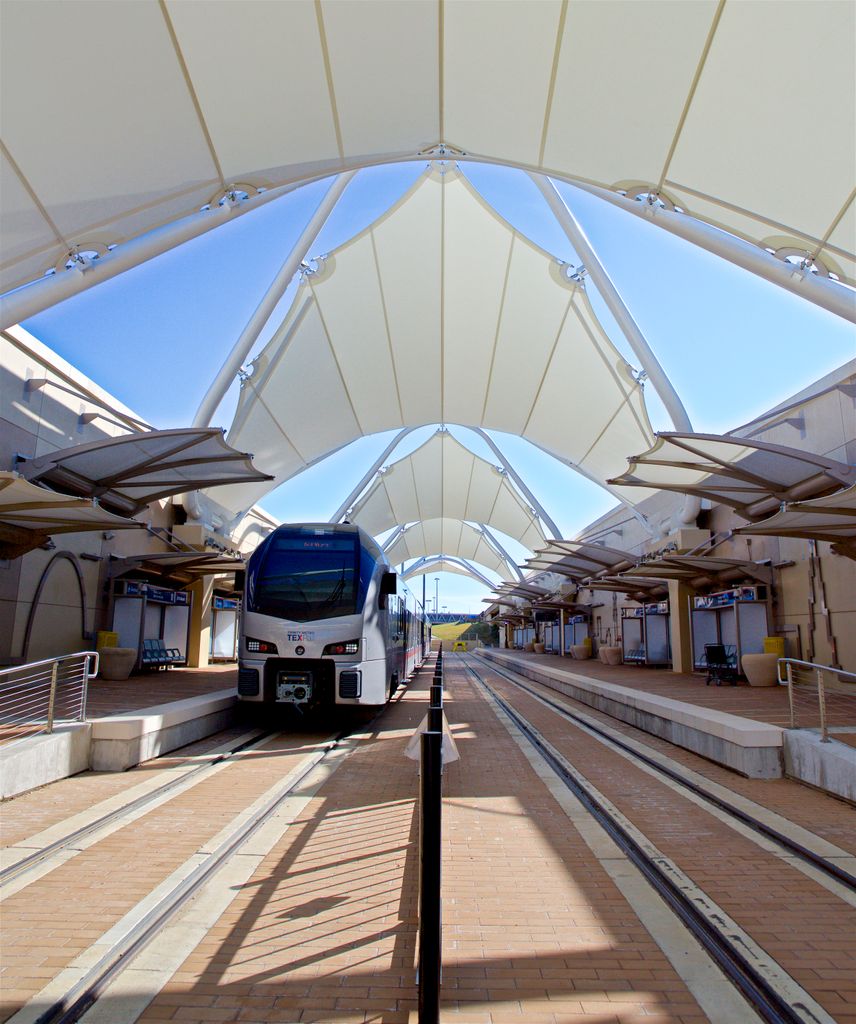
DFW Airport Terminal B station is a current terminal Trinity Metro TEXRail station and future Dallas Area Rapid Transit (DART) Silver Line station located at Dallas Fort Worth International Airport between Terminal B and is located near DFW Airport Terminal A station used by DART Light Rail. The station is the northeastern terminus of the TEXRail line which begins at T&P Station in Fort Worth. It provides a transfer point between TEXRail and the DART Orange Line via a covered walkway. It is located between International Parkway and South Service Road, in the area between Terminals A and B. An underpass and covered walkway connect the station with the lower level of Terminal B at Door B43 (named after nearby Gate B43). From there, passengers can access all other terminals using the DFW Skylink train inside the secured area of the airport, or the Terminal Link bus system outside of the secured area. A second covered walkway connects to the DFW Airport Terminal A station, making it possible for passengers to transfer between DART or TEXRail or directly access Terminal A. Terminal B station will also be the terminus of DART's Silver Line when it is completed. The station has connections to Trinity Metro route 31, the TRE Link, which boards on the arrivals level of Terminal B and offers service to CentrePort/DFW Airport station on the Trinity Railway Express commuter rail line. FlixBus intercity coaches also board from the covered walkway between this station and the Terminal A station. Dallas Area Rapid Transit TEXRail
Show more
Sun and Moon
Mon
Tue
Wed
Thu
Fri
Sat
Sun
May 2022
Date and time
00:00
06:00
12:00
18:00
Today
--
--
Sunrise
--
Sunset
--
Moonrise
--
Moonset
Phase
🌔 Waxing Gibbous
The perfect light time for beautiful photos:
--
Sunrise
--
Sunset
PeakVisor app
Get the app on your smartphone
New Panorama Tools
Trace location on the map
Measure distances
All the instruments are available in the context menu as well.
We use GPS information embedded into the photo when it is available.
3D mountains overlay
Adjust mountain panorama to perfectly match your photos because recorded by camera photo position might be imprecise.
Move tool
Rotate tool
Zoom
More customization
Choose which peak labels should make into the final photo and what photo title should be.
Next
Photo Location
Satellitte
Flat map
Relief map
Latitude
Longitude
Altitude
OR
Latitude
°'''
Longitude
°'''
Apply
Register Peak
Peak Name
Latitude
Longitude
Altitude
Register
Teleport
PeakVisor
This 3D model of Sagarmatha National Park in Nepal was made using the PeakVisor app topographic data. The mobile app features higher precision models worldwide, more topographic details, and works offline. Download PeakVisor maps today.
Download OBJ model
PeakVisor
The download should start shortly. If you find it useful please consider supporting the PeakVisor app.
PeakVisor for iOS and Android
Be a superhero of outdoor navigation with state-of-the-art 3D maps and mountain identification in the palm of your hand!