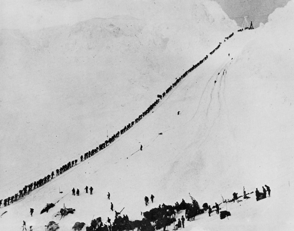
Chilkoot Pass (el. 3,759 feet or 1,146 metres) is a high mountain pass through the Boundary Ranges of the Coast Mountains in the U.S. state of Alaska and British Columbia, Canada. It is the highest point along the Chilkoot Trail that leads from Dyea, Alaska to Bennett Lake, British Columbia. The Chilkoot Trail was long a route used by the Tlingit for trade. During the Klondike Gold Rush of the late 19th century, it was used by prospectors and packers to get through the mountains. During the gold rush, three aerial tramways and several surface hoists were constructed and operated briefly over the pass. When the White Pass and Yukon Route railroad was built in neighboring White Pass, the Chilkoot Pass route fell out of favor with miners. The Pass and the Trail are administered by the national park services of the U.S. and Canada. On the B.C. side, it is administered as Chilkoot Trail National Historic Site. On the Alaska side, it is one unit of the Klondike Gold Rush National Historical Park. In the summer of 1998, the Site and the Park united to form Klondike Gold Rush International Historical Park. Modern-day visitors can hike the 33-mile (53 km) trail after registering and paying a fee.
We use GPS information embedded into the photo when it is available.
3D mountains overlay
Adjust mountain panorama to perfectly match your photos because recorded by camera photo position might be imprecise.
Move tool
Rotate tool
Zoom
More customization
Choose which peak labels should make into the final photo and what photo title should be.
Next
Photo Location
Satellitte
Flat map
Relief map
Latitude
Longitude
Altitude
OR
Latitude
°'''
Longitude
°'''
Apply
Register Peak
Peak Name
Latitude
Longitude
Altitude
Register
Teleport
PeakVisor
This 3D model of Sagarmatha National Park in Nepal was made using the PeakVisor app topographic data. The mobile app features higher precision models worldwide, more topographic details, and works offline. Download PeakVisor maps today.
Download OBJ model
PeakVisor
The download should start shortly. If you find it useful please consider supporting the PeakVisor app.
PeakVisor for iOS and Android
Be a superhero of outdoor navigation with state-of-the-art 3D maps and mountain identification in the palm of your hand!