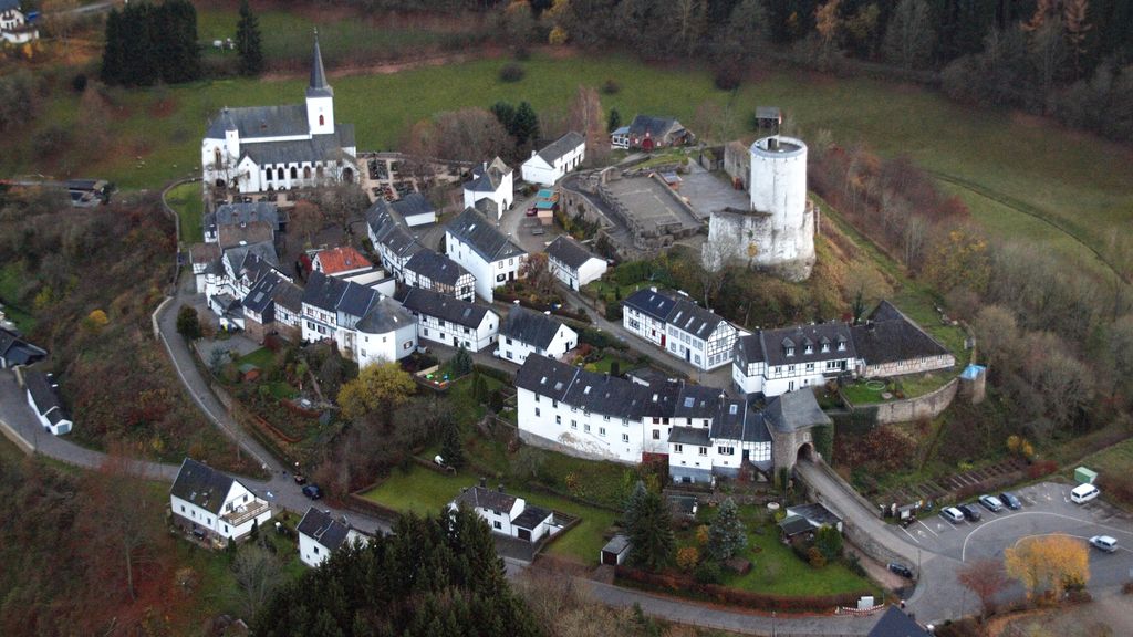
The ruins of Reifferscheid Castle (German: Burg Reifferscheid) stand at a height of 450 metres above sea level (NN) near the German-Belgian border between the mountains of the Eifel and the Ardennes in the municipality of Hellenthal. Its name probably comes from a forest clearing that belonged to a man called Rifhari, the names Rifersceith or Rifheres-sceit mean "woodland strip of Rifhari". All that has survived of the medieval hill castle are the remains of the curtain walls, a gatehouse with two flanking round towers, a gabled entrance and a round, white-plastered bergfried made of rubble stone.
We use GPS information embedded into the photo when it is available.
3D mountains overlay
Adjust mountain panorama to perfectly match your photos because recorded by camera photo position might be imprecise.
Move tool
Rotate tool
Zoom
More customization
Choose which peak labels should make into the final photo and what photo title should be.
Next
Photo Location
Satellitte
Flat map
Relief map
Latitude
Longitude
Altitude
OR
Latitude
°'''
Longitude
°'''
Apply
Register Peak
Peak Name
Latitude
Longitude
Altitude
Register
Teleport
PeakVisor
This 3D model of Sagarmatha National Park in Nepal was made using the PeakVisor app topographic data. The mobile app features higher precision models worldwide, more topographic details, and works offline. Download PeakVisor maps today.
Download OBJ model
PeakVisor
The download should start shortly. If you find it useful please consider supporting the PeakVisor app.
PeakVisor for iOS and Android
Be a superhero of outdoor navigation with state-of-the-art 3D maps and mountain identification in the palm of your hand!