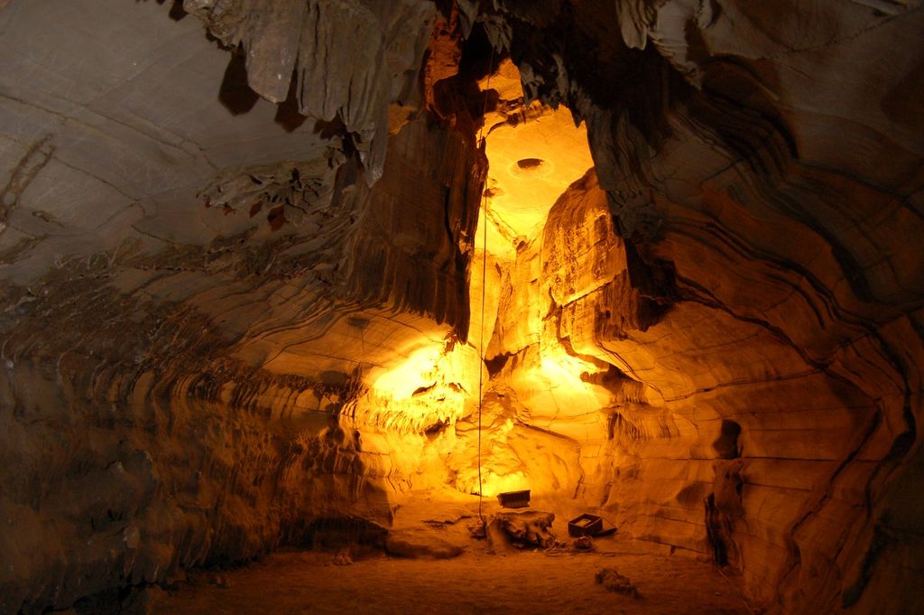
The Belum Caves, located in Nandyala district of Andhra Pradesh's Rayalaseema region, is the second largest cave system on the Indian subcontinent, known for its speleothems, such as stalactite and stalagmite formations. The Belum Caves have long passages, galleries, spacious caverns with fresh water and siphons. This cave system was formed over the course of tens of thousands of years by the constant flow of underground water from the now-disappeared river Chitravathi. The cave system reaches its deepest point (46 m (151 ft) from entrance level) at the point known as Pataalaganga. Belum Caves have a length of 3,229 m (10,593.8 ft), making them the second largest caves on the Indian Subcontinent after the Krem Liat Prah caves in Meghalaya. It is one of the centrally protected Monuments of National Importance. Belum came to scientific attention in 1884 by a British surveyor, Robert Bruce Foote and from 1982 to 1984, a team of German speleologists headed by H. Daniel Gebauer conducted a detailed exploration of the caves. In 1988, the Government of Andhra Pradesh declared the site protected, and the Andhra Pradesh Tourism Development Corporation (APTDC) developed the caves as a tourist attraction in February 2002. Today, 3.5 km (2.2 mi) of the caves have been successfully explored, though only 1.5 km (0.9 mi) is accessible to visitors. There are 16 different pathways, including the main entrance and there are deposits of quartz in the caves. The caves consist of black limestone.
We use GPS information embedded into the photo when it is available.
3D mountains overlay
Adjust mountain panorama to perfectly match your photos because recorded by camera photo position might be imprecise.
Move tool
Rotate tool
Zoom
More customization
Choose which peak labels should make into the final photo and what photo title should be.
Next
Photo Location
Satellitte
Flat map
Relief map
Latitude
Longitude
Altitude
OR
Latitude
°'''
Longitude
°'''
Apply
Register Peak
Peak Name
Latitude
Longitude
Altitude
Register
Teleport
PeakVisor
This 3D model of Sagarmatha National Park in Nepal was made using the PeakVisor app topographic data. The mobile app features higher precision models worldwide, more topographic details, and works offline. Download PeakVisor maps today.
Download OBJ model
PeakVisor
The download should start shortly. If you find it useful please consider supporting the PeakVisor app.
PeakVisor for iOS and Android
Be a superhero of outdoor navigation with state-of-the-art 3D maps and mountain identification in the palm of your hand!