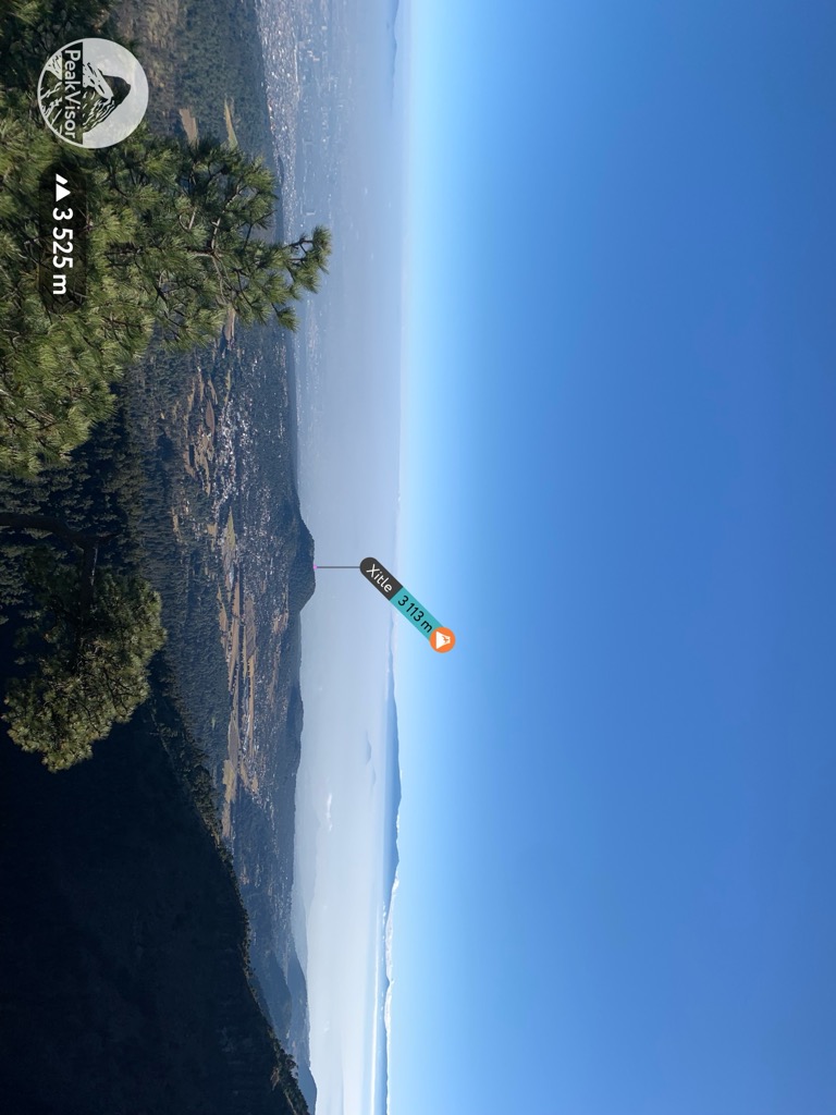
Xitle (Nahuatl pronunciation: [ʃitɬe] Nahuatl, "navel") is a monogenetic volcano in the Ajusco range in Cumbres del Ajusco National Park. It is located in the Tlalpan borough in the southwestern part of Mexico City. It is an ash cone volcano with a conical form, round base, altitude of approximately 300m, and a slope between 30° and 40°.
Xitle erupted during the period AD 245-315, according to the results of radiocarbon dating. Among the consequences of this eruption were the formation of the Pedregal de San Ángel lava fields, to the south of the Mexican Federal District. Cuicuilco, one of the most refined cities of Mesoamerica, was destroyed and covered by lava. The subsequent diaspora of the Cuicuilcans, and the attendant diffusion of their culture across most of central Mexico, influenced important cultural changes in the nearby power center of Teotihuacan.
According to some other sources, a series of big volcano eruptions, and the destruction of Cuicuilco took place in the 1st century BC.
By elevation Xitle is
# 54 out of 108 in Mexico City # 21 out of 35 in Tlalpan
By prominence Xitle is
# 30 out of 108 in Mexico City # 11 out of 35 in Tlalpan
We use GPS information embedded into the photo when it is available.
3D mountains overlay
Adjust mountain panorama to perfectly match your photos because recorded by camera photo position might be imprecise.
Move tool
Rotate tool
Zoom
More customization
Choose which peak labels should make into the final photo and what photo title should be.
Next
Photo Location
Satellitte
Flat map
Relief map
Latitude
Longitude
Altitude
OR
Latitude
°'''
Longitude
°'''
Apply
Register Peak
Peak Name
Latitude
Longitude
Altitude
Register
Teleport
PeakVisor
This 3D model of Sagarmatha National Park in Nepal was made using the PeakVisor app topographic data. The mobile app features higher precision models worldwide, more topographic details, and works offline. Download PeakVisor maps today.
Download OBJ model
PeakVisor
The download should start shortly. If you find it useful please consider supporting the PeakVisor app.
PeakVisor for iOS and Android
Be a superhero of outdoor navigation with state-of-the-art 3D maps and mountain identification in the palm of your hand!