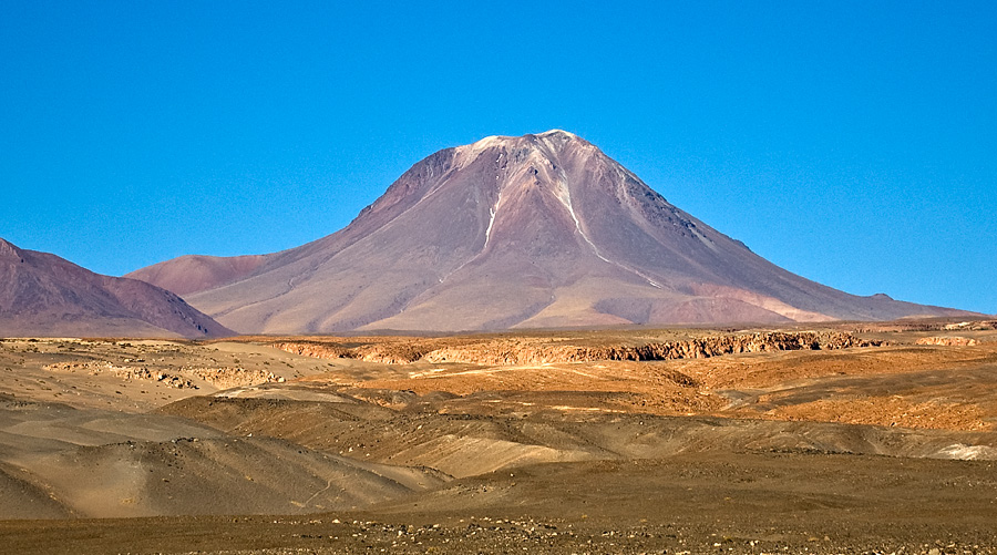
Cerro Laguna Verde is one of the many stratovolcanoes that integrate a 180 km (112 mi)-long chain east of the Gran Salar de Atacama in Chile's II Region. The mountain is located 6 km (4 mi) west of Acamarachi (also known as Cerro de Pili) and 12.5 km (8 mi) north of the Aguas Calientes (Simbad) and Lascar stratovolcanoes.
The age of the volcano, which rises 1,200 metres (3,900 ft) above the surrounding terrain is not known for certain. Earlier it was considered Pleistocene-Holocene. At some point in the past, the northern flank of the volcano collapsed. The resulting debris avalanche formed a lake in the Quebrada Portor from water dammed by the debris. The edifice has an estimated volume of 16 cubic kilometres (3.8 cu mi).
By elevation Volcán Laguna Verde is
# 79 out of 410 in Provincia de El Loa # 84 out of 973 in Región de Antofagasta
By prominence Volcán Laguna Verde is
# 39 out of 410 in Provincia de El Loa # 52 out of 973 in Región de Antofagasta
We use GPS information embedded into the photo when it is available.
3D mountains overlay
Adjust mountain panorama to perfectly match your photos because recorded by camera photo position might be imprecise.
Move tool
Rotate tool
Zoom
More customization
Choose which peak labels should make into the final photo and what photo title should be.
Next
Photo Location
Satellitte
Flat map
Relief map
Latitude
Longitude
Altitude
OR
Latitude
°'''
Longitude
°'''
Apply
Register Peak
Peak Name
Latitude
Longitude
Altitude
Register
Teleport
PeakVisor
This 3D model of Sagarmatha National Park in Nepal was made using the PeakVisor app topographic data. The mobile app features higher precision models worldwide, more topographic details, and works offline. Download PeakVisor maps today.
Download OBJ model
PeakVisor
The download should start shortly. If you find it useful please consider supporting the PeakVisor app.
PeakVisor for iOS and Android
Be a superhero of outdoor navigation with state-of-the-art 3D maps and mountain identification in the palm of your hand!