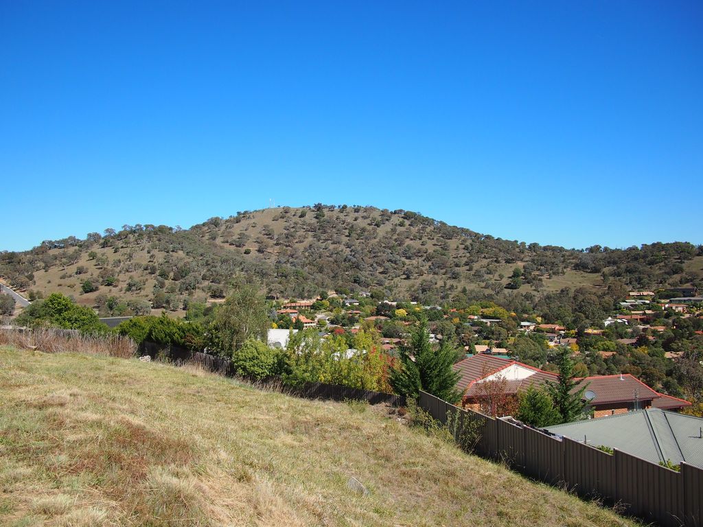
Tuggeranong Hill is located in Tuggeranong, Canberra. It is sometimes referred to as Mount Tuggeranong due to its prominence.
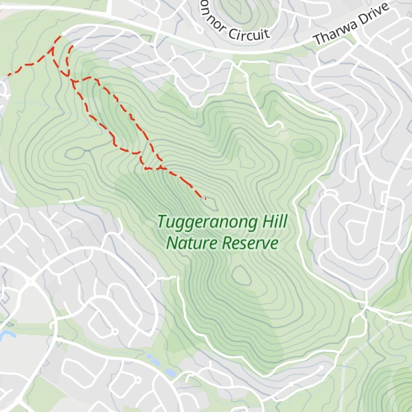
Lanyon Valley is almost completely surrounded by hills and mountains and consequently television transmissions from Black Mountain are affected. To overcome this, there is a broadcast translator on top of Tuggeranong Hill. There is a track to the repeater on top of Tuggeranong Hill for service vehicles that doubles as a fire trail.
Tuggeranong Hill is part of the Canberra Nature Park. A walk to the top of Tuggeranong Hill provides views of the Lanyon Valley and of the rest of southern Canberra.
Tuggeranong Hill stands 855 metres (2800 feet) above sea level.
There's a trail leading to the summit.
By elevation Tuggeranong Hill is
# 1 out of 1 in Tuggeranong Hill Nature Reserve # 73 out of 142 in Australian Capital Territory
By prominence Tuggeranong Hill is
# 1 out of 1 in Tuggeranong Hill Nature Reserve # 35 out of 142 in Australian Capital Territory
We use GPS information embedded into the photo when it is available.
3D mountains overlay
Adjust mountain panorama to perfectly match your photos because recorded by camera photo position might be imprecise.
Move tool
Rotate tool
Zoom
More customization
Choose which peak labels should make into the final photo and what photo title should be.
Next
Photo Location
Satellitte
Flat map
Relief map
Latitude
Longitude
Altitude
OR
Latitude
°'''
Longitude
°'''
Apply
Register Peak
Peak Name
Latitude
Longitude
Altitude
Register
Teleport
PeakVisor
This 3D model of Sagarmatha National Park in Nepal was made using the PeakVisor app topographic data. The mobile app features higher precision models worldwide, more topographic details, and works offline. Download PeakVisor maps today.
Download OBJ model
PeakVisor
The download should start shortly. If you find it useful please consider supporting the PeakVisor app.
PeakVisor for iOS and Android
Be a superhero of outdoor navigation with state-of-the-art 3D maps and mountain identification in the palm of your hand!