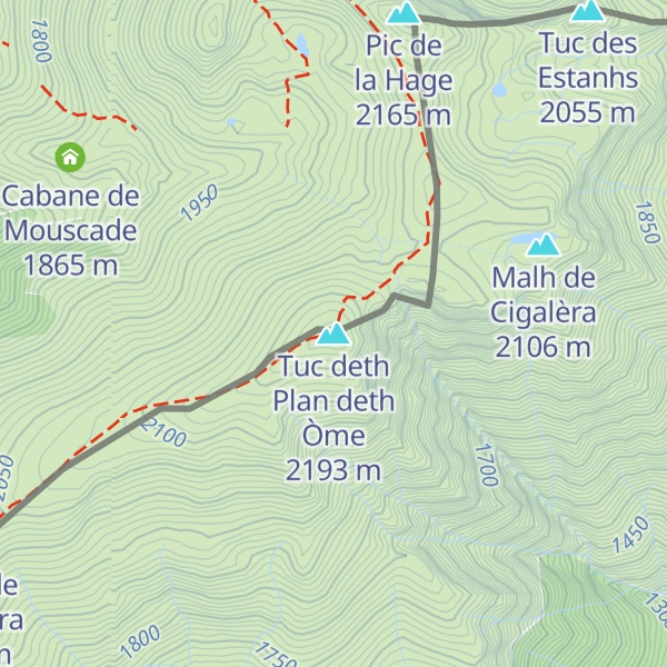
Tuc deth Plan deth Òme (2 193m/7 195ft a.s.l.) is a mountain in the Pyrenees on the border of Spain, France. The prominence is 900m/2 953ft.
There's a hiking trail (T2) leading to the summit. Tuc deth Plan deth Òme is one of the 43 peaks along the multi-day GR 10.
The nearest mountain hut is Cabane de Mouscade - Luchonais located 998m/3 273ft WNW of the summit.
By elevation Tuc deth Plan deth Òme is
# 92 out of 568 in Haute-Garonne
By prominence Tuc deth Plan deth Òme is
# 18 out of 18724 in the Pyrenees # 47 out of 81984 in Spain # 81 out of 35442 in France # 3 out of 3562 in Lleida # 6 out of 9528 in Catalonia # 7 out of 8344 in Occitania # 1 out of 568 in Haute-Garonne
We use GPS information embedded into the photo when it is available.
3D mountains overlay
Adjust mountain panorama to perfectly match your photos because recorded by camera photo position might be imprecise.
Move tool
Rotate tool
Zoom
More customization
Choose which peak labels should make into the final photo and what photo title should be.
Next
Photo Location
Satellitte
Flat map
Relief map
Latitude
Longitude
Altitude
OR
Latitude
°'''
Longitude
°'''
Apply
Register Peak
Peak Name
Latitude
Longitude
Altitude
Register
Teleport
PeakVisor
This 3D model of Sagarmatha National Park in Nepal was made using the PeakVisor app topographic data. The mobile app features higher precision models worldwide, more topographic details, and works offline. Download PeakVisor maps today.
Download OBJ model
PeakVisor
The download should start shortly. If you find it useful please consider supporting the PeakVisor app.
PeakVisor for iOS and Android
Be a superhero of outdoor navigation with state-of-the-art 3D maps and mountain identification in the palm of your hand!