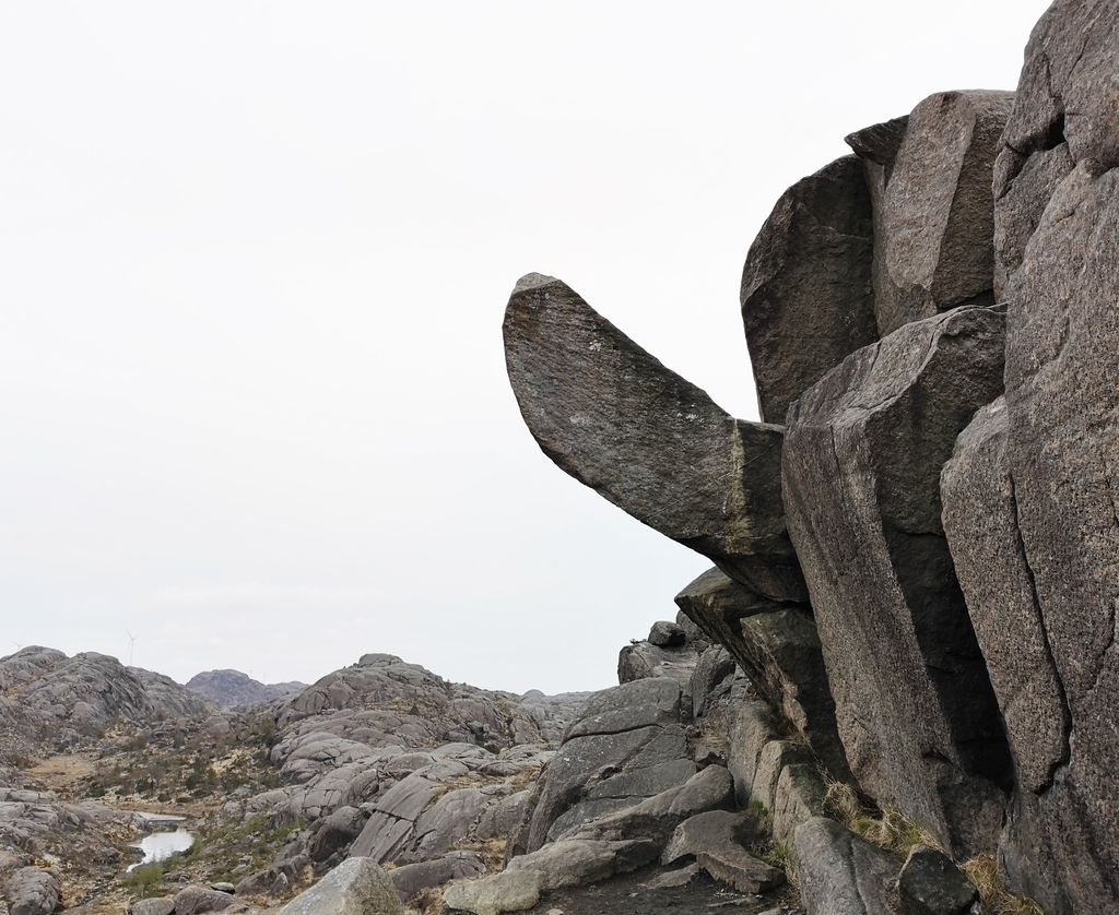
Trollpikken (the Troll's Dick) is a rock formation in Eigersund municipality, in Norway, between Kjervall and Veshovda. A rock jutting out from a cliff face to a height of almost 12 metres (39 ft) resembles an erect penis. In June 2017, the rock was severed using power tools; it was reattached the following month after a crowdfunding campaign.
The local tourist board was discussing using Trollpikken to draw tourists in a similar manner to Trolltunga (the troll's tongue) and Preikestolen (the preacher's pulpit) by providing parking when on June 24, 2017, joggers discovered that the approximately 10-tonne (9.8-long-ton; 11-short-ton) formation had been severed using power tools. 226,000 kroner was raised online to reattach it using a crane assembled on-site; a contractor told a Norwegian TV station, "We have the Viagra it takes." It was successfully reattached on July 7, using a combination of cement, glue and metal fittings. By late that month, parking and signs had been provided and NRK reported that at least one suspect had been arrested for the vandalism.
Kjetil Bentsen named the rock formation in January 2017; an effort is underway to have it marked on maps. A staff member at the Romsdal Museum indicated that numerous rock formations in Norway have similarly humorous names, although pikk is a relatively new word in the language for the penis. Bentsen and one other have applied to the Norwegian Patent Office for trademark rights to the name.
We use GPS information embedded into the photo when it is available.
3D mountains overlay
Adjust mountain panorama to perfectly match your photos because recorded by camera photo position might be imprecise.
Move tool
Rotate tool
Zoom
More customization
Choose which peak labels should make into the final photo and what photo title should be.
Next
Photo Location
Satellitte
Flat map
Relief map
Latitude
Longitude
Altitude
OR
Latitude
°'''
Longitude
°'''
Apply
Register Peak
Peak Name
Latitude
Longitude
Altitude
Register
Teleport
PeakVisor
This 3D model of Sagarmatha National Park in Nepal was made using the PeakVisor app topographic data. The mobile app features higher precision models worldwide, more topographic details, and works offline. Download PeakVisor maps today.
Download OBJ model
PeakVisor
The download should start shortly. If you find it useful please consider supporting the PeakVisor app.
PeakVisor for iOS and Android
Be a superhero of outdoor navigation with state-of-the-art 3D maps and mountain identification in the palm of your hand!