Tinto is an isolated hill in the Southern Uplands of Scotland. It comprises little more than one top, which stands on the west bank of the River Clyde, some 8 kilometres (5 mi) west of Biggar. The peak is also called "Tinto Tap", with the name Tinto possibly deriving from the Scottish Gaelic word teinnteach, meaning "fiery", which may refer to its ancient past as a look out beacon. Further known as the "Hill of Fire" it is also suggested exposed red hue felsite rock visible in many places on the hill helped gave rise to this name due to the effect seen when a setting sun illuminates the hillside.
At the summit sits "Tinto Cairn", and with a diameter of 45 m (148 ft) and a height of 6 m (20 ft) it is one of the largest Bronze Age round cairns in Scotland, most of which are found at lower elevations.
An old Scots children's rhyme tells of the "kist in the mist" at "Tintock tap", kist being the Scots word for "chest".
It is accessible for walking and is one of the premier locations for hanggliding and paragliding. Tinto is located near the small villages of Thankerton and Wiston.
Tinto is also the venue for one of the most popular hill running races in Scotland which is held annually in November.
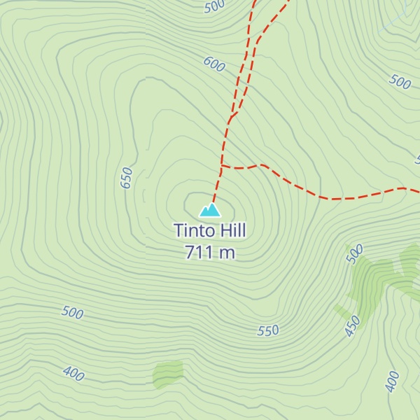
There's a hiking trail (T2) leading to the summit.
By elevation Tinto Hill is
# 4 out of 494 in South Lanarkshire # 51 out of 6530 in the Southern Scotland and Isle of Man
By prominence Tinto Hill is
# 1 out of 494 in South Lanarkshire # 13 out of 6530 in the Southern Scotland and Isle of Man
We use GPS information embedded into the photo when it is available.
3D mountains overlay
Adjust mountain panorama to perfectly match your photos because recorded by camera photo position might be imprecise.
Move tool
Rotate tool
Zoom
More customization
Choose which peak labels should make into the final photo and what photo title should be.
Next
Photo Location
Satellitte
Flat map
Relief map
Latitude
Longitude
Altitude
OR
Latitude
°'''
Longitude
°'''
Apply
Register Peak
Peak Name
Latitude
Longitude
Altitude
Register
Teleport
PeakVisor
This 3D model of Sagarmatha National Park in Nepal was made using the PeakVisor app topographic data. The mobile app features higher precision models worldwide, more topographic details, and works offline. Download PeakVisor maps today.
Download OBJ model
PeakVisor
The download should start shortly. If you find it useful please consider supporting the PeakVisor app.
PeakVisor for iOS and Android
Be a superhero of outdoor navigation with state-of-the-art 3D maps and mountain identification in the palm of your hand!