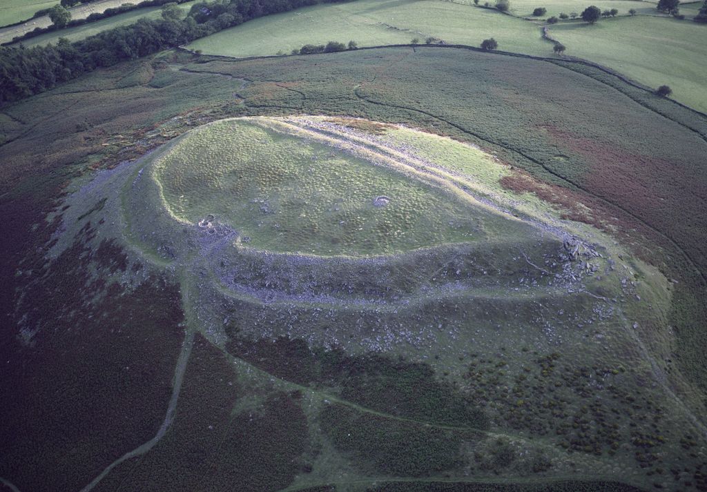
Crug Hywel is an Iron Age Celtic hillfort, with a clearly visible earth and stone ditch and rampart. Crug Hywel is approached by a couple of public footpaths across farmland from Crickhowell and Llanbedr and visited by the Beacons Way. It lies within an area designated as open country over which the public have the right to roam.
The name is sometimes given to the flat-topped hill itself, which is also called Table Mountain in English. Located at the southern edge of the Black Mountains in south-east Wales, it rises to 451 m above sea level, from the southern flank of Pen Cerrig-calch (701 m), and overlooks the town of Crickhowell, whose name derives from Crug Hywel.
The Welsh name Mynydd y Begwn is also used for this summit. As a result, it has been suggested that the name Crug Hywel (which means 'Hywel's mound') may originally have referred to the castle mound in Crickhowell.
There's a trail leading to the summit. Table Mountain is one of the 9 peaks along the multi-day Beacons Way.
We use GPS information embedded into the photo when it is available.
3D mountains overlay
Adjust mountain panorama to perfectly match your photos because recorded by camera photo position might be imprecise.
Move tool
Rotate tool
Zoom
More customization
Choose which peak labels should make into the final photo and what photo title should be.
Next
Photo Location
Satellitte
Flat map
Relief map
Latitude
Longitude
Altitude
OR
Latitude
°'''
Longitude
°'''
Apply
Register Peak
Peak Name
Latitude
Longitude
Altitude
Register
Teleport
PeakVisor
This 3D model of Sagarmatha National Park in Nepal was made using the PeakVisor app topographic data. The mobile app features higher precision models worldwide, more topographic details, and works offline. Download PeakVisor maps today.
Download OBJ model
PeakVisor
The download should start shortly. If you find it useful please consider supporting the PeakVisor app.
PeakVisor for iOS and Android
Be a superhero of outdoor navigation with state-of-the-art 3D maps and mountain identification in the palm of your hand!