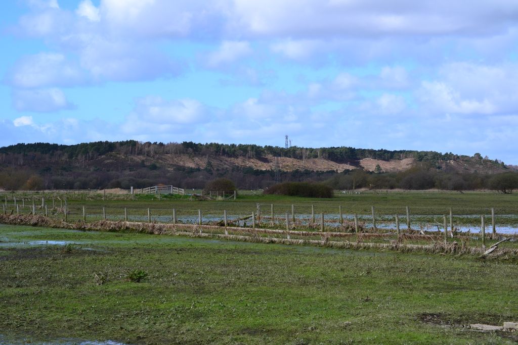
St Catherine's Hill is a 53-metre (174 ft) hill in the borough of Christchurch which, together with Ramsdown and Blackwater hills, forms a ridge between the Avon and Stour valleys. It is a Site of Special Scientific Interest with some areas additionally designated as Special Protection Areas and/or Special Areas of Conservation. The hill provides a range of habitats with both wet and dry heathland, coniferous and broadleaf woodland and scrubland; and is home to some rare flora and fauna including the sand lizard, smooth snake, silver-studded blue butterfly and two types of carnivorous plant.
Humans have been visiting the hill as far back as the Bronze Age and there are a number of ancient monuments sited there, including several tumuli, a Roman signal station and what is thought to be an Iron Age animal pound. The military have made extensive use of the area since at least the Roman occupation; it served as training ground for troops during the Crimean War and both World Wars, and was the site of a nuclear bunker during the Cold War. Most visitors today use the hill as an area to exercise their dogs or for other recreational activities such as cycling, jogging and horse riding.
There's a trail leading to the summit.
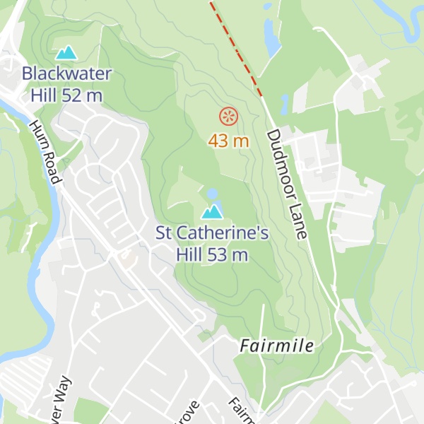
By elevation St Catherine's Hill is
# 6 out of 7 in Bournemouth, Christchurch and Poole
By prominence St Catherine's Hill is
# 1 out of 7 in Bournemouth, Christchurch and Poole
We use GPS information embedded into the photo when it is available.
3D mountains overlay
Adjust mountain panorama to perfectly match your photos because recorded by camera photo position might be imprecise.
Move tool
Rotate tool
Zoom
More customization
Choose which peak labels should make into the final photo and what photo title should be.
Next
Photo Location
Satellitte
Flat map
Relief map
Latitude
Longitude
Altitude
OR
Latitude
°'''
Longitude
°'''
Apply
Register Peak
Peak Name
Latitude
Longitude
Altitude
Register
Teleport
PeakVisor
This 3D model of Sagarmatha National Park in Nepal was made using the PeakVisor app topographic data. The mobile app features higher precision models worldwide, more topographic details, and works offline. Download PeakVisor maps today.
Download OBJ model
PeakVisor
The download should start shortly. If you find it useful please consider supporting the PeakVisor app.
PeakVisor for iOS and Android
Be a superhero of outdoor navigation with state-of-the-art 3D maps and mountain identification in the palm of your hand!