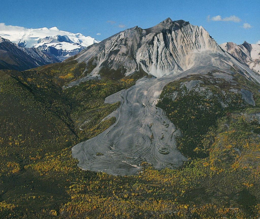
Sourdough Peak is a 6,201-foot (1,890 meter) mountain summit located at the southern edge of the Wrangell Mountains, in the U.S. state of Alaska. The peak is situated in Wrangell-St. Elias National Park and Preserve, 7 mi (11 km) east-southeast of McCarthy, on the north bank of the Nizina River. The peak is notable for a rock glacier on its south slope. The peak's name was used by early prospectors as reported in 1908 by the USGS. A "sourdough" is defined as an experienced prospector or an old-timer in the western US or Canada, because they always carried sourdough starter with them. Sourdough Peak's nearest higher neighbor is Porphyry Mountain, 5.1 miles to the northwest.
By elevation Sourdough Peak is
# 89 out of 109 in Wrangell–St. Elias National Park
By prominence Sourdough Peak is
# 41 out of 109 in Wrangell–St. Elias National Park
We use GPS information embedded into the photo when it is available.
3D mountains overlay
Adjust mountain panorama to perfectly match your photos because recorded by camera photo position might be imprecise.
Move tool
Rotate tool
Zoom
More customization
Choose which peak labels should make into the final photo and what photo title should be.
Next
Photo Location
Satellitte
Flat map
Relief map
Latitude
Longitude
Altitude
OR
Latitude
°'''
Longitude
°'''
Apply
Register Peak
Peak Name
Latitude
Longitude
Altitude
Register
Teleport
PeakVisor
This 3D model of Sagarmatha National Park in Nepal was made using the PeakVisor app topographic data. The mobile app features higher precision models worldwide, more topographic details, and works offline. Download PeakVisor maps today.
Download OBJ model
PeakVisor
The download should start shortly. If you find it useful please consider supporting the PeakVisor app.
PeakVisor for iOS and Android
Be a superhero of outdoor navigation with state-of-the-art 3D maps and mountain identification in the palm of your hand!