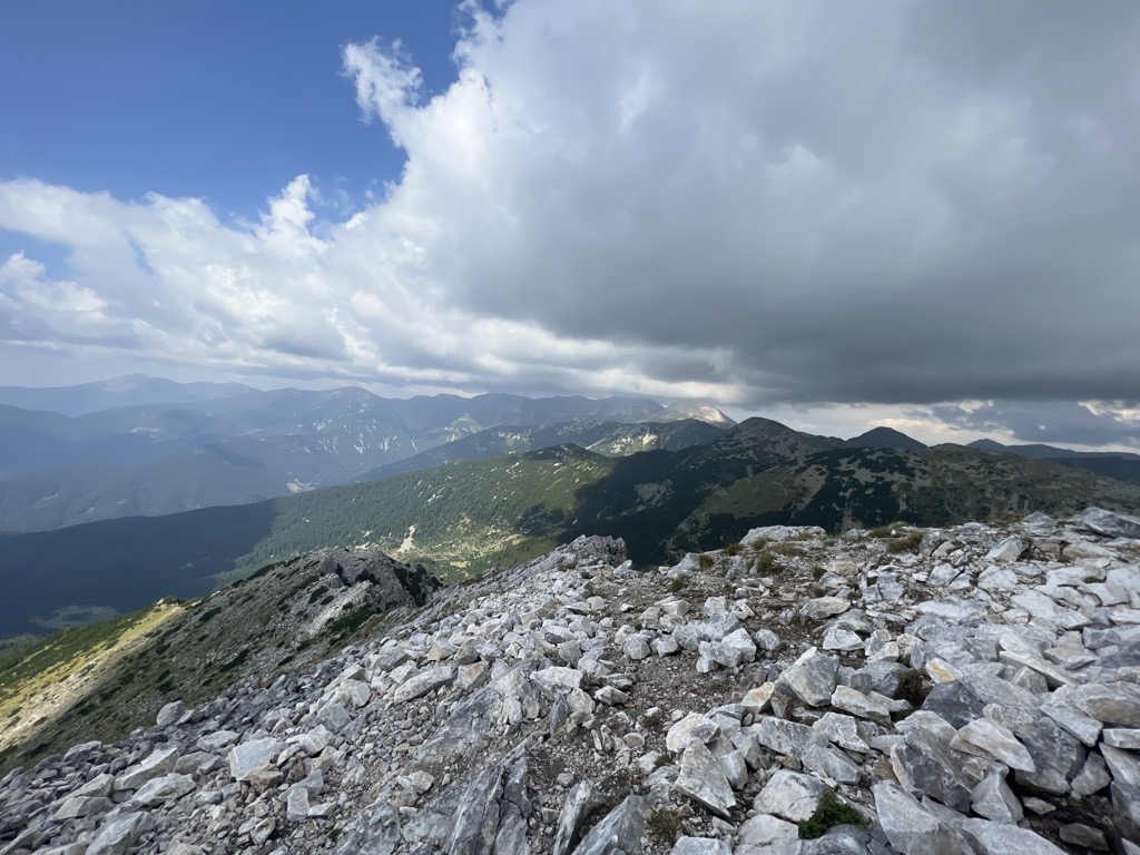
Sinanitsa (Bulgarian: Синаница [siˈnanit͡sɐ]) is a marble peak in the northern part of the Pirin Mountains of southwestern Bulgaria. 2,516 metres (8,255 feet) high, Sinanitsa gives its name to the Sinanitsa Lateral Ridge, one of the four best pronounced lateral ridges in Pirin. Sinanitsa is also known as Chukata (Чуката [ˈt͡ʃukɐtɐ]), Varovita Chuka (Варовита чука [vɐroˈvitɐ ˈt͡ʃukɐ]) or The Split Peak (Разцепения връх, Raztsepenia vrah [rɐsˈt͡sɛpɛnijɐ ˈvrɤx]), the latter because of its unusual south face.
Though it gives its name to the entire ridge due to its characteristic shape, the "enchantingly beautiful" Sinanitsa is in fact lower than the ridge's highest point, Gergiytsa, which measures 2,589 m (8,494 ft) metres and lies to the northwest. Sinanitsa is commonly regarded as one of the most beautiful peaks in Pirin and Bulgaria. On clear days, the summit is easily visible from the town of Sandanski.
The etymology of Sinanitsa's name is debated. It stems either from the Bulgarian word for "blue" (син, sin), due to the peak appearing in that colour from a distance, or from the Arabic word sinan (سنان). The latter would describe it as a "spearhead" peak, referencing its sharp contours.
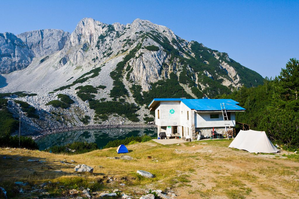
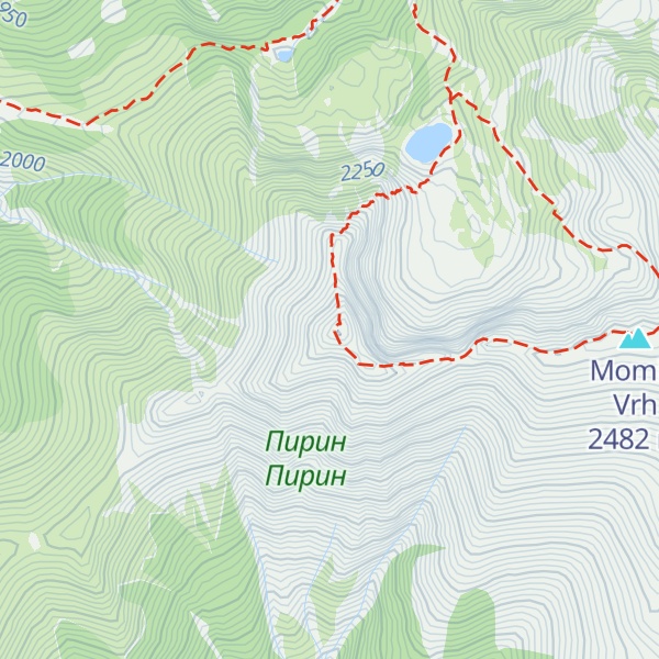
The Sinanishko Lake lies in the eponymous cirque to the north-northwest of Sinanitsa, at 2,181 m (7,156 ft). The Sinanitsa River, a tributary of the Vlahinska River that subsequently flows into the Struma, originates from the lake's underground waters. The Sinanitsa Gate is a steep and rocky col on the ridge connecting the Sinanitsa cirque with the Spano Pole cirque to the southeast. The Sinanitsa Hut is situated by the shores of the lake, within direct view of the summit. The summit can be reached in approximately an hour from the hut.
Sinanitsa's steep eastern face is a popular destination for alpine climbing. The route follows a vertical wall around 200 m (660 ft) high, with a climbing grade of 4b. It was first scaled by Andrey Todorov and Vasil Nastev on 12 July 1949; the first winter ascent was accomplished on 27 April 1955 by Encho Petkov and Yordan Machirski.
There's a demading hiking trail (T3) leading to the summit.
The nearest mountain hut is Sinanitsa Hut located 833m/2 733ft NE of the summit.
By elevation Sinanitsa is
# 68 out of 93 in Pirin National Park # 90 out of 451 in Blagoevgrad
By prominence Sinanitsa is
# 23 out of 93 in Pirin National Park # 82 out of 451 in Blagoevgrad
We use GPS information embedded into the photo when it is available.
3D mountains overlay
Adjust mountain panorama to perfectly match your photos because recorded by camera photo position might be imprecise.
Move tool
Rotate tool
Zoom
More customization
Choose which peak labels should make into the final photo and what photo title should be.
Next
Photo Location
Satellitte
Flat map
Relief map
Latitude
Longitude
Altitude
OR
Latitude
°'''
Longitude
°'''
Apply
Register Peak
Peak Name
Latitude
Longitude
Altitude
Register
Teleport
PeakVisor
This 3D model of Sagarmatha National Park in Nepal was made using the PeakVisor app topographic data. The mobile app features higher precision models worldwide, more topographic details, and works offline. Download PeakVisor maps today.
Download OBJ model
PeakVisor
The download should start shortly. If you find it useful please consider supporting the PeakVisor app.
PeakVisor for iOS and Android
Be a superhero of outdoor navigation with state-of-the-art 3D maps and mountain identification in the palm of your hand!