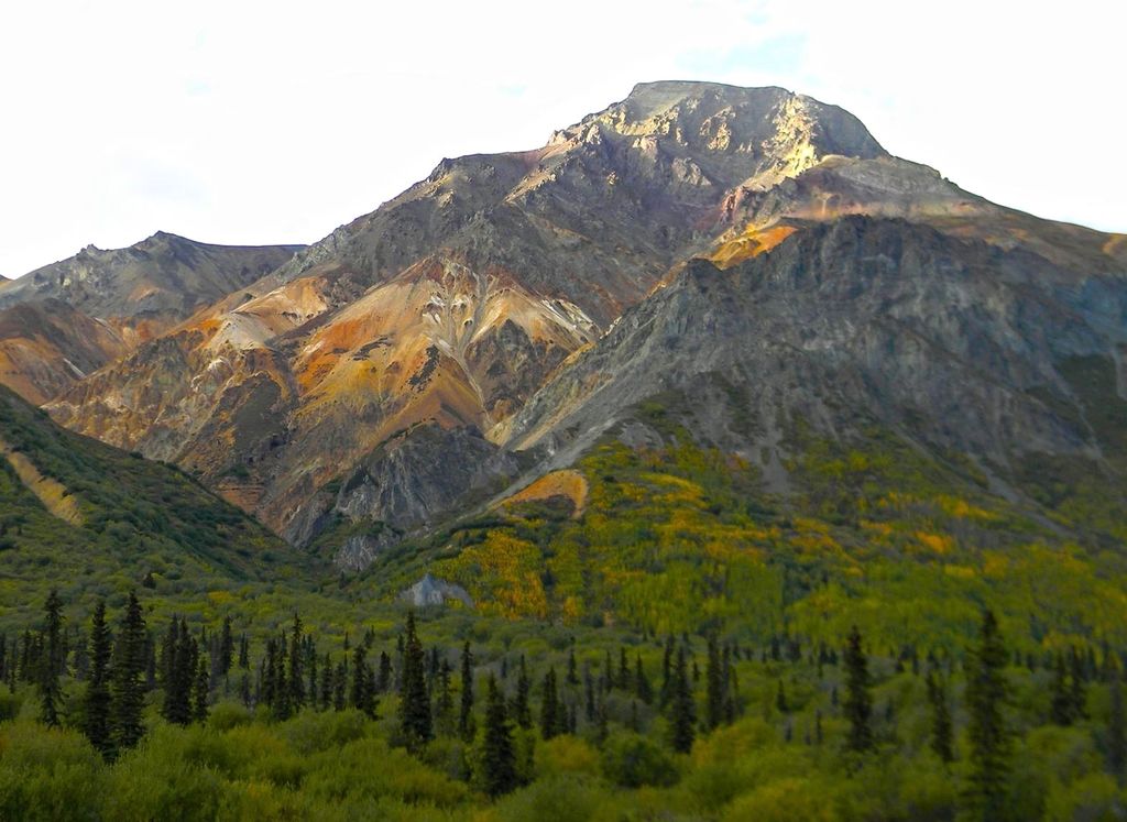
Sheep Mountain is a 6,223-foot (1,897 m) elevation summit located 50 mi (80 km) northeast of Palmer in the southern Talkeetna Mountains of the U.S. state of Alaska. This landmark is set midway between Palmer and Glennallen, with the Glenn Highway traversing the southern base of this mountain at mile 113. The mountain is situated 1.6 mi (3 km) west-southwest of Gunsight Mountain, and 10.75 mi (17 km) northeast of Mount Wickersham. The mountain's local name was reported in 1906 by U.S. Geological Survey. It is called Beznae, meaning "(a type of) Stone", in the Ahtna language.
We use GPS information embedded into the photo when it is available.
3D mountains overlay
Adjust mountain panorama to perfectly match your photos because recorded by camera photo position might be imprecise.
Move tool
Rotate tool
Zoom
More customization
Choose which peak labels should make into the final photo and what photo title should be.
Next
Photo Location
Satellitte
Flat map
Relief map
Latitude
Longitude
Altitude
OR
Latitude
°'''
Longitude
°'''
Apply
Register Peak
Peak Name
Latitude
Longitude
Altitude
Register
Teleport
PeakVisor
This 3D model of Sagarmatha National Park in Nepal was made using the PeakVisor app topographic data. The mobile app features higher precision models worldwide, more topographic details, and works offline. Download PeakVisor maps today.
Download OBJ model
PeakVisor
The download should start shortly. If you find it useful please consider supporting the PeakVisor app.
PeakVisor for iOS and Android
Be a superhero of outdoor navigation with state-of-the-art 3D maps and mountain identification in the palm of your hand!