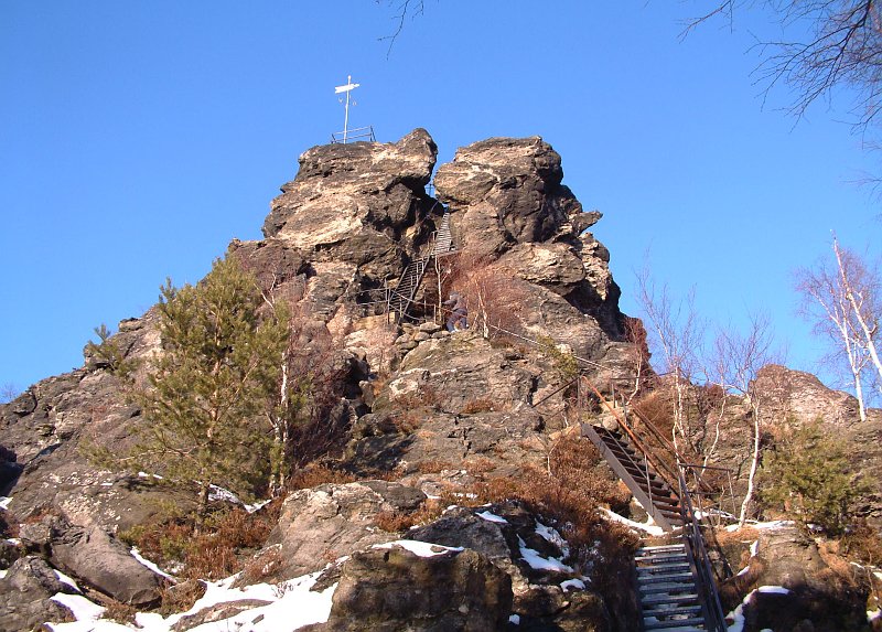
The Scharfenstein (English: Sharp Stone) is a rock and about 25 metres high, situated in the Lusatian Mountains. It sits on a mountain with an elevation of 569 metres in the German southeastern state of Saxony. Due to its distinctive shape it is also called the "Upper-Lusatian Matterhorn" by the locals. The rock can be accessed via ladders and a staircase from the south and is one of the most famous look-outs in the Zittau Mountains.
There's a hiking trail (T1) called Kleine Felsengasse leading to the summit. Scharfenstein is one of the 25 peaks along the LG-Gelber Punkt.
The nearest mountain hut is Schutzhütte unterm Scharfenstein located 330m/1 084ft S of the summit.
We use GPS information embedded into the photo when it is available.
3D mountains overlay
Adjust mountain panorama to perfectly match your photos because recorded by camera photo position might be imprecise.
Move tool
Rotate tool
Zoom
More customization
Choose which peak labels should make into the final photo and what photo title should be.
Next
Photo Location
Satellitte
Flat map
Relief map
Latitude
Longitude
Altitude
OR
Latitude
°'''
Longitude
°'''
Apply
Register Peak
Peak Name
Latitude
Longitude
Altitude
Register
Teleport
PeakVisor
This 3D model of Sagarmatha National Park in Nepal was made using the PeakVisor app topographic data. The mobile app features higher precision models worldwide, more topographic details, and works offline. Download PeakVisor maps today.
Download OBJ model
PeakVisor
The download should start shortly. If you find it useful please consider supporting the PeakVisor app.
PeakVisor for iOS and Android
Be a superhero of outdoor navigation with state-of-the-art 3D maps and mountain identification in the palm of your hand!