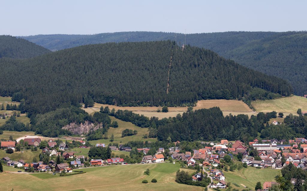
The Rinkenkopf is a mountain, 760 m high, on the territory of Baiersbronn in the Northern Black Forest. The wooded mountain ridge is bounded in the south by the Murg valley and in the northeast by the valley of the Tonbach. To the northwest a roughly 50-metre-deep saddle (the Sattelei) separates it from the foothills of the Grindenschwarzwald.
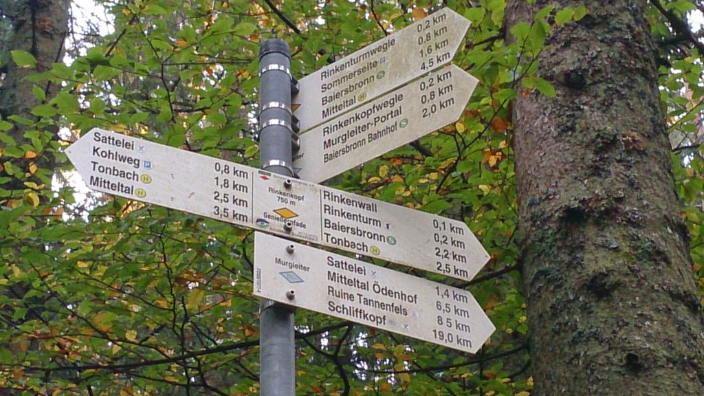
On the mountain are the Rinkenwall (Rinkenmauer), Rinken Tower (Rinkenturm) and two transmission towers. Several hiking trails lead there, including the Murgleiter and der Genießerpfad to the Sattelei Hut.
There's a trail leading to the summit.
The nearest mountain hut is Schutzhütte Rinkenturm located 198m/651ft ESE of the summit.
We use GPS information embedded into the photo when it is available.
3D mountains overlay
Adjust mountain panorama to perfectly match your photos because recorded by camera photo position might be imprecise.
Move tool
Rotate tool
Zoom
More customization
Choose which peak labels should make into the final photo and what photo title should be.
Next
Photo Location
Satellitte
Flat map
Relief map
Latitude
Longitude
Altitude
OR
Latitude
°'''
Longitude
°'''
Apply
Register Peak
Peak Name
Latitude
Longitude
Altitude
Register
Teleport
PeakVisor
This 3D model of Sagarmatha National Park in Nepal was made using the PeakVisor app topographic data. The mobile app features higher precision models worldwide, more topographic details, and works offline. Download PeakVisor maps today.
Download OBJ model
PeakVisor
The download should start shortly. If you find it useful please consider supporting the PeakVisor app.
PeakVisor for iOS and Android
Be a superhero of outdoor navigation with state-of-the-art 3D maps and mountain identification in the palm of your hand!