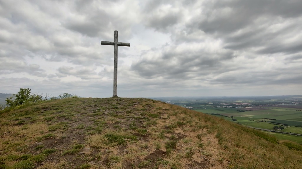
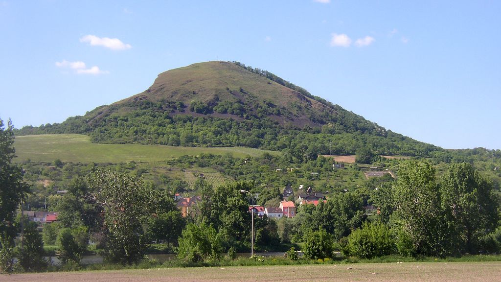
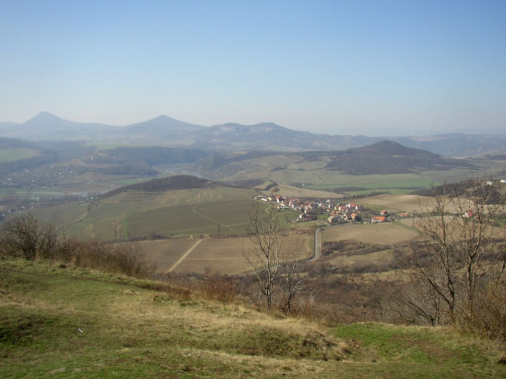
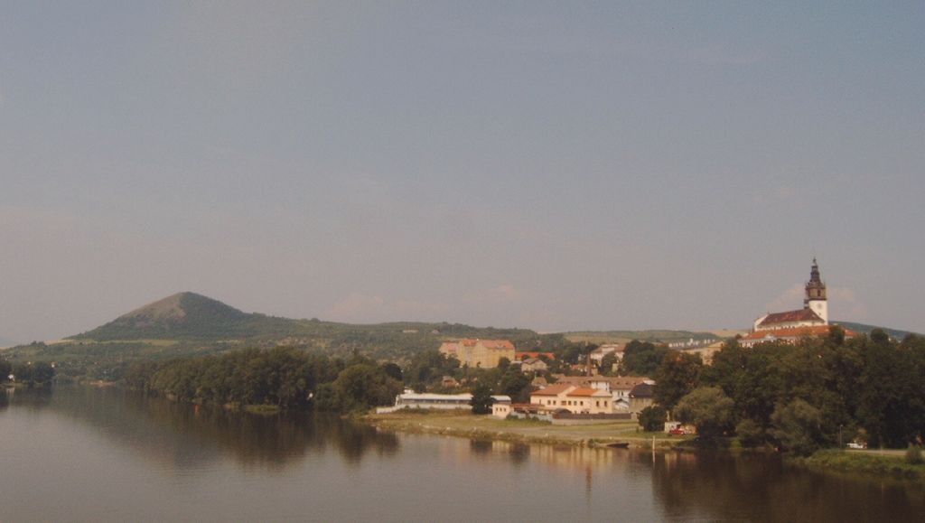
Radobýl (German: Radebeule; 399 metres (1,309 ft)) is a basalt hill in České středohoří mountains, Czech Republic. It rises above village of Žalhostice on right bank of the Elbe River 3 km west of Litoměřice. Part of the hill with abandoned basalt quarry and rich rock steppe flora is under protection as Radobýl Nature Monument (Přírodní památka Radobýl). The hill is a popular hiking destination. From huge metallic cross (erected in 1991) on the bare summit there is almost 360-degrees panoramic view of central part of České středohoří Mts., Litoměřice, Terezín and Lovosice.
In 1944–1945, the Richard I and II subterranean factories were excavated under Radobýl by forced laborers of Leitmeritz concentration camp.
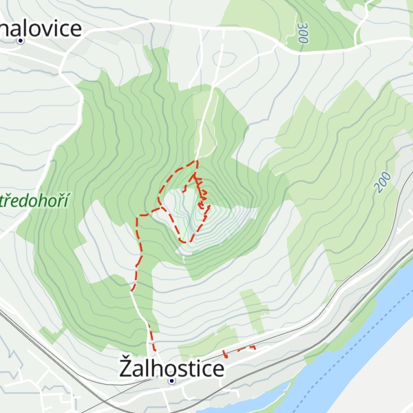
There's a hiking trail (T1) leading to the summit.
By elevation Radobýl is
# 1 out of 1 in PP Radobýl
By prominence Radobýl is
# 48 out of 233 in CHKO České středohoří # 1 out of 1 in PP Radobýl
We use GPS information embedded into the photo when it is available.
3D mountains overlay
Adjust mountain panorama to perfectly match your photos because recorded by camera photo position might be imprecise.
Move tool
Rotate tool
Zoom
More customization
Choose which peak labels should make into the final photo and what photo title should be.
Next
Photo Location
Satellitte
Flat map
Relief map
Latitude
Longitude
Altitude
OR
Latitude
°'''
Longitude
°'''
Apply
Register Peak
Peak Name
Latitude
Longitude
Altitude
Register
Teleport
PeakVisor
This 3D model of Sagarmatha National Park in Nepal was made using the PeakVisor app topographic data. The mobile app features higher precision models worldwide, more topographic details, and works offline. Download PeakVisor maps today.
Download OBJ model
PeakVisor
The download should start shortly. If you find it useful please consider supporting the PeakVisor app.
PeakVisor for iOS and Android
Be a superhero of outdoor navigation with state-of-the-art 3D maps and mountain identification in the palm of your hand!