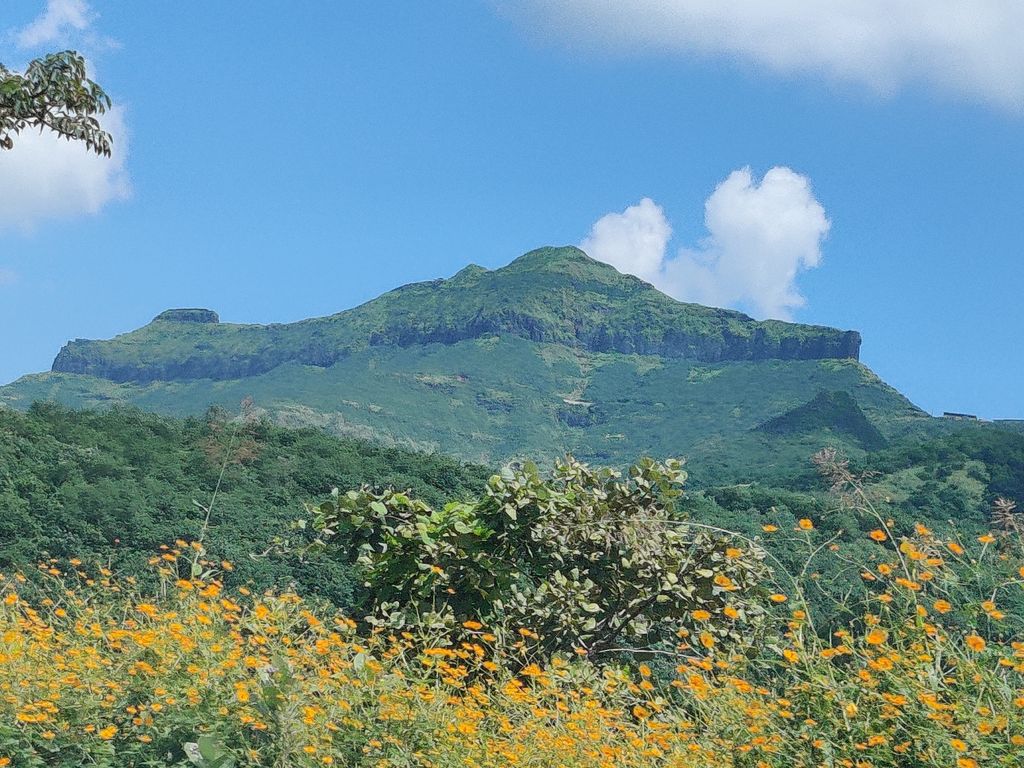
Purandar Fort is a mountain fort in Pune district in Western Indian state of Maharashtra, India. The fort stands at 1,374 metres (4,508 ft) above the sea level in the Western Ghats, 50 kilometres (31 mi) to the southeast of Pune.
The twin forts of Purandar and Vajragad (or Rudramal) of which the latter is the smaller of the two, is located on the eastern side of the main fort rising 1,347 metres (4,419 ft) above sea level. The village of Purandar takes its name from this fort. It is the birthplace of Dharmaveer Chatrapati Sambhaji Maharaj.
By elevation Purandar is
# 1 out of 3 in Purandhar # 14 out of 554 in Maharashtra
By prominence Purandar is
# 49 out of 1529 in the Western Ghats # 1 out of 3 in Purandhar # 22 out of 554 in Maharashtra
We use GPS information embedded into the photo when it is available.
3D mountains overlay
Adjust mountain panorama to perfectly match your photos because recorded by camera photo position might be imprecise.
Move tool
Rotate tool
Zoom
More customization
Choose which peak labels should make into the final photo and what photo title should be.
Next
Photo Location
Satellitte
Flat map
Relief map
Latitude
Longitude
Altitude
OR
Latitude
°'''
Longitude
°'''
Apply
Register Peak
Peak Name
Latitude
Longitude
Altitude
Register
Teleport
PeakVisor
This 3D model of Sagarmatha National Park in Nepal was made using the PeakVisor app topographic data. The mobile app features higher precision models worldwide, more topographic details, and works offline. Download PeakVisor maps today.
Download OBJ model
PeakVisor
The download should start shortly. If you find it useful please consider supporting the PeakVisor app.
PeakVisor for iOS and Android
Be a superhero of outdoor navigation with state-of-the-art 3D maps and mountain identification in the palm of your hand!