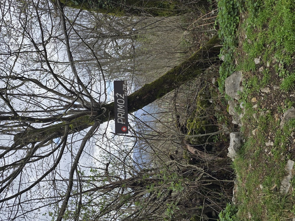
Primož (pronounced ['pɾiːmɔʃ]) is a 718-meter (2,356 ft) high hill overgrown with trees, and is a part of a ridge separating the Pivka Basin from the Reka Valley. It is located in the Municipality of Pivka in the Inner Carniola region of Slovenia. It has many marked trails and a gravel road leading to its peak. There is a historical trail intended for tourists with many information signs around its peak. It served an important military role during the Second World War because it contained many tunnels and bunkers used by Italian army. It is named after Saints Primus and Felician Church, which was abandoned in the eighteenth century with practically no ruins remaining.
We use GPS information embedded into the photo when it is available.
3D mountains overlay
Adjust mountain panorama to perfectly match your photos because recorded by camera photo position might be imprecise.
Move tool
Rotate tool
Zoom
More customization
Choose which peak labels should make into the final photo and what photo title should be.
Next
Photo Location
Satellitte
Flat map
Relief map
Latitude
Longitude
Altitude
OR
Latitude
°'''
Longitude
°'''
Apply
Register Peak
Peak Name
Latitude
Longitude
Altitude
Register
Teleport
PeakVisor
This 3D model of Sagarmatha National Park in Nepal was made using the PeakVisor app topographic data. The mobile app features higher precision models worldwide, more topographic details, and works offline. Download PeakVisor maps today.
Download OBJ model
PeakVisor
The download should start shortly. If you find it useful please consider supporting the PeakVisor app.
PeakVisor for iOS and Android
Be a superhero of outdoor navigation with state-of-the-art 3D maps and mountain identification in the palm of your hand!