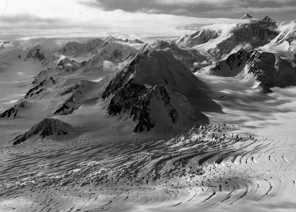
Pilot Peak is an 8,670-foot (2,643 m) elevation glaciated summit located 27 mi (43 km) northwest of Valdez in the Chugach Mountains of the U.S. state of Alaska. Set on land managed by Chugach National Forest, this remote peak is situated 6.5 mi (10 km) east of Mount Einstein, and 5.7 mi (9 km) southwest of Tazlina Tower. The mountain was so named in 1955 by Lawrence E. Nielsen "because it is a very distinctive landmark that helped guide us back to camp in our explorations during 1955." Nielsen was leader of the Chugach Mountains Expedition which was sponsored by the Arctic Institute of North America. This name was officially adopted by the U.S. Board on Geographic Names in 1965.
We use GPS information embedded into the photo when it is available.
3D mountains overlay
Adjust mountain panorama to perfectly match your photos because recorded by camera photo position might be imprecise.
Move tool
Rotate tool
Zoom
More customization
Choose which peak labels should make into the final photo and what photo title should be.
Next
Photo Location
Satellitte
Flat map
Relief map
Latitude
Longitude
Altitude
OR
Latitude
°'''
Longitude
°'''
Apply
Register Peak
Peak Name
Latitude
Longitude
Altitude
Register
Teleport
PeakVisor
This 3D model of Sagarmatha National Park in Nepal was made using the PeakVisor app topographic data. The mobile app features higher precision models worldwide, more topographic details, and works offline. Download PeakVisor maps today.
Download OBJ model
PeakVisor
The download should start shortly. If you find it useful please consider supporting the PeakVisor app.
PeakVisor for iOS and Android
Be a superhero of outdoor navigation with state-of-the-art 3D maps and mountain identification in the palm of your hand!