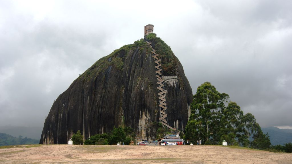
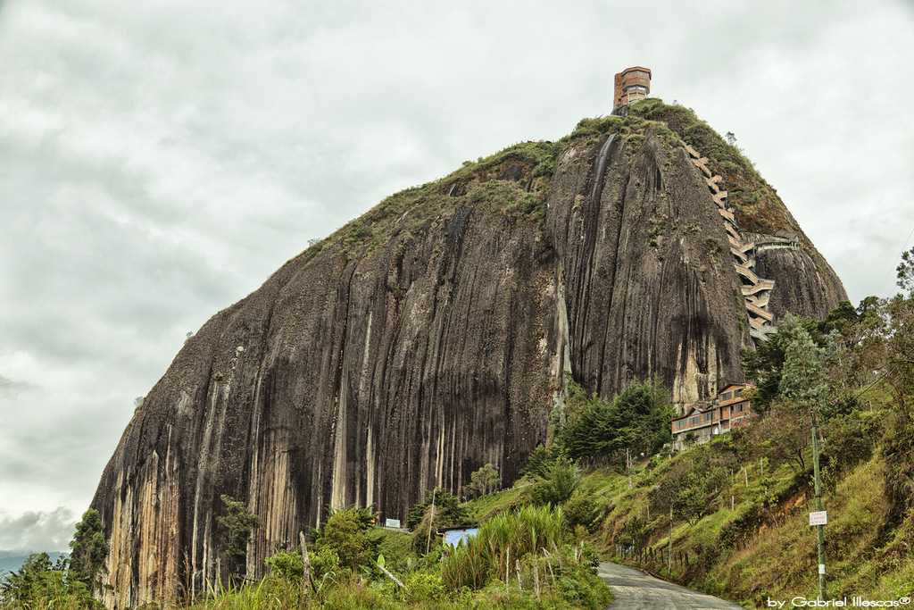
The Rock of Guatapé (Spanish: El Peñón de Guatapé) (Tahamí language: Mojarrá) is a landmark inselberg in Colombia. It is located in the town and municipality of Guatapé, Antioquia. It is also known as The Stone of El Peñol, or simply La Piedra or El Peñol (La Piedra de El Peñol), as the town of El Peñol, which borders Guatapé, has also historically claimed the rock as their own and thus has led to different names for the site.
The landform is a granitic rock remnant that has resisted weathering and erosion, likely as result of being less fractured than the surrounding bedrock. The Peñón de Guatapé is an outcrop of the Antioquia Batholith and towers up to 200 meters (656 feet) above its base. Visitors can scale the rock via a staircase with 708 steps built into one side. There is an entrance fee of COL$25,000 in order to climb to the top of the rock.
Near the base of the Rock, there are food and market stalls for shopping. The entire area where the rock is located contains many photo opportunities for visitors. Colorful murals of the rock painted by local artists decorate the insides of the restaurants and stores. A VIP area includes signs where tourists can take pictures with the name of the town and La Piedra behind it. A bronze statue of Luis Eduardo Villegas López sits at the bottom of the rock. The statue was made by sculptor Mario Hernández C. to honor López as the first to climb to the top of the rock. The sculpture was installed on February 25, 2008. About halfway up the stairs, there is a shrine to the Virgin Mary. The summit contains a three-story viewpoint tower, a convenience store, and a seating area. The top of the rock is surrounded by a railing that contains zocalos. Right outside of La Piedra visitors can book helicopter tours that will fly around the rock.
We use GPS information embedded into the photo when it is available.
3D mountains overlay
Adjust mountain panorama to perfectly match your photos because recorded by camera photo position might be imprecise.
Move tool
Rotate tool
Zoom
More customization
Choose which peak labels should make into the final photo and what photo title should be.
Next
Photo Location
Satellitte
Flat map
Relief map
Latitude
Longitude
Altitude
OR
Latitude
°'''
Longitude
°'''
Apply
Register Peak
Peak Name
Latitude
Longitude
Altitude
Register
Teleport
PeakVisor
This 3D model of Sagarmatha National Park in Nepal was made using the PeakVisor app topographic data. The mobile app features higher precision models worldwide, more topographic details, and works offline. Download PeakVisor maps today.
Download OBJ model
PeakVisor
The download should start shortly. If you find it useful please consider supporting the PeakVisor app.
PeakVisor for iOS and Android
Be a superhero of outdoor navigation with state-of-the-art 3D maps and mountain identification in the palm of your hand!


_2017-04-10.jpg)


