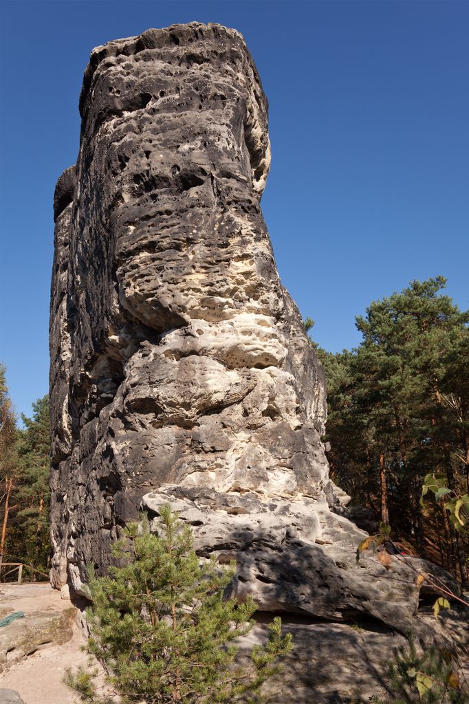
The Nonne (also Nonnenstein) is a roughly 18-metre-high, isolated, standing sandstone rock and climbing peak in Saxon Switzerland in Germany. The rock is located southeast of Rathen, east of the rock chain of Rauenstein.
In the Middle Ages the rock was used in the 15th century as a watchtower (Burgwarte), similar to that on the other side of the Elbe, Neurathen Castle. To that end the rock crevice below the summit plateau was widened into an artificial cave, used as a guardhouse. On the eastern side there are more traces of hammers. In addition, an artificial, earth embankment, about 35 m long, was built. Archaeological investigations ins 1963 brought to light pieces of ceramic, the spindle whorl of a spindle, the site of a hearth and fragments of charcoal.
In 1888 the Nonne was climbed for the first time for fun and without using ladders. Hitherto the rocks had always been climbed with the aid of ladders even after the watchtower had closed. The Alte Weg ("Old Way", grade II in the Saxon climbing grade system) has since become a popular climbing route especially for beginners. This has however resulted in erosion damage on the surrounding areas of forest and hillsides.
There's a trail leading to the summit.
The nearest mountain hut is Lottersteighütte located 1 502m/4 929ft ESE of the summit.
We use GPS information embedded into the photo when it is available.
3D mountains overlay
Adjust mountain panorama to perfectly match your photos because recorded by camera photo position might be imprecise.
Move tool
Rotate tool
Zoom
More customization
Choose which peak labels should make into the final photo and what photo title should be.
Next
Photo Location
Satellitte
Flat map
Relief map
Latitude
Longitude
Altitude
OR
Latitude
°'''
Longitude
°'''
Apply
Register Peak
Peak Name
Latitude
Longitude
Altitude
Register
Teleport
PeakVisor
This 3D model of Sagarmatha National Park in Nepal was made using the PeakVisor app topographic data. The mobile app features higher precision models worldwide, more topographic details, and works offline. Download PeakVisor maps today.
Download OBJ model
PeakVisor
The download should start shortly. If you find it useful please consider supporting the PeakVisor app.
PeakVisor for iOS and Android
Be a superhero of outdoor navigation with state-of-the-art 3D maps and mountain identification in the palm of your hand!


.jpg)


