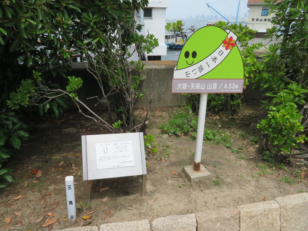
Mount Tenpō (天保山, Tenpōzan) located in Minato-ku, Osaka is currently Japan's second lowest mountain. (The lowest mountain title is now held by Mount Hiyori in Sendai, Miyagi Prefecture - like Mount Tempo, Hiyori is a man-made structure, and gained its title as the shortest mountain following subsidence after the 2011 Tōhoku earthquake and tsunami.) The definition of a "mountain" used here is any elevation described as a mountain on a topographic map published by the Geographical Survey Institute of Japan, though it is disputed that the mountain lacks credibility because it is not a natural part of the landscape. The mountain's peak is 4.53 meters above sea level, and will bear more resemblance to a hill than a mountain to the casual observer. A small port is located nearby, and much of the mountain's surface has been converted into a park.
We use GPS information embedded into the photo when it is available.
3D mountains overlay
Adjust mountain panorama to perfectly match your photos because recorded by camera photo position might be imprecise.
Move tool
Rotate tool
Zoom
More customization
Choose which peak labels should make into the final photo and what photo title should be.
Next
Photo Location
Satellitte
Flat map
Relief map
Latitude
Longitude
Altitude
OR
Latitude
°'''
Longitude
°'''
Apply
Register Peak
Peak Name
Latitude
Longitude
Altitude
Register
Teleport
PeakVisor
This 3D model of Sagarmatha National Park in Nepal was made using the PeakVisor app topographic data. The mobile app features higher precision models worldwide, more topographic details, and works offline. Download PeakVisor maps today.
Download OBJ model
PeakVisor
The download should start shortly. If you find it useful please consider supporting the PeakVisor app.
PeakVisor for iOS and Android
Be a superhero of outdoor navigation with state-of-the-art 3D maps and mountain identification in the palm of your hand!