Scan the QR code and open PeakVisor on your phone
There are 605 named mountains in the Kii Mountains (紀伊山地) of Japan; the highest and most prominent is Mt. Hakkyogadake (八経ヶ岳).
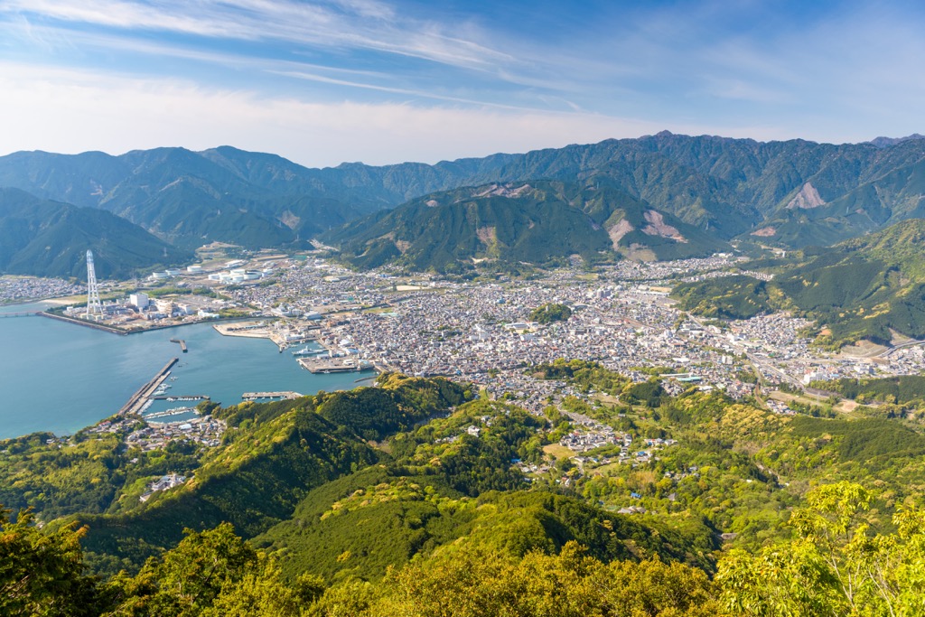
The Kii Mountains, covering most of the Kii Peninsula, are a prominent range in the southern part of Japan's main island. Located south of the Japan Median Tectonic Line, the Kii Mountains stretch across the Mie (三重県), Nara (奈良県), and Wakayama (和歌山県) prefectures.
The extensive Kii Mountains span 4,000 km (2,485 mi) from northeast to southwest. Encircling Mt Hakkyogadake are other prominent peaks of Mt. Misen (弥山), Mt. Myojogatake (明星ヶ岳), Mt. Busshogadake (仏生嶽), and Mt. Shakagadake (釈迦ヶ岳). The Kii Mountains are composed of shale, limestone, and sandstone sedimentary rock layers from the Cretaceous to Lower Miocene epoch.
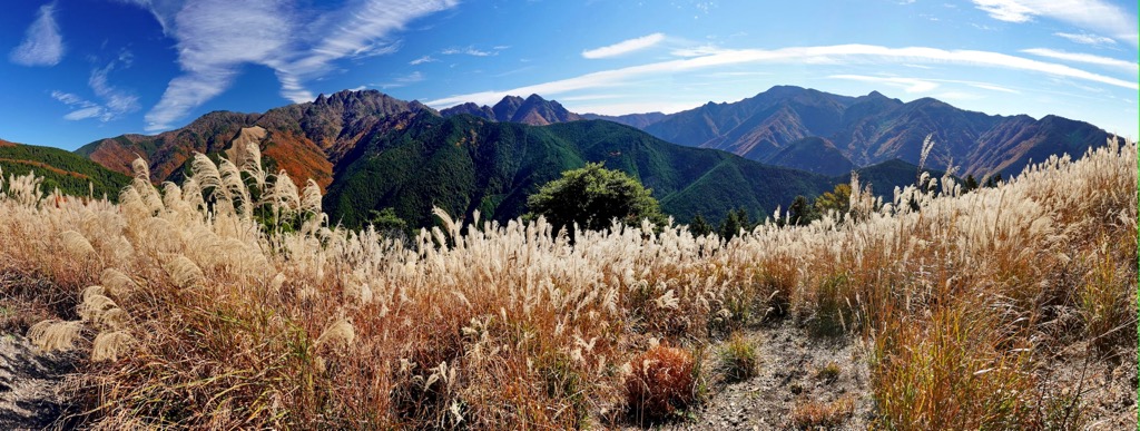
Mt. Hakkyogadake, also known as Mt. Hakkyo, translates as ‘eight Buddhist scriptures.’ According to legend, the father of the Shugendō (修験者) religion known as ‘En no Gyoja’ buried these holy texts on Mt. Hakkyogadake’s summit during Japan’s Heian period (794 to 1185). As the Kii Mountains were the birthplace of Shugendō, the corridor is steeped in spiritual importance; numerous shrines and temples exist throughout the mountains. The area is a UNESCO World Cultural and Heritage Site known as ‘Sacred Sites and Pilgrimage Routes.’
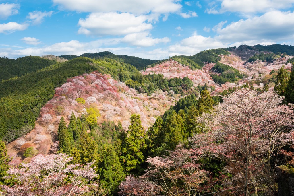
Another area of significance is Yoshino-Kumano National Park (吉野熊野国立公園), protecting vast forests, rare flora, and diverse wildlife. Home to the Kumano Kodo (熊野古道) pilgrimage walk, this rugged region is notable for the Kumano Sanzan, which are the three grand shrines of Kumano, and Yoshio cherry blossoms. A shower of rose petals blooms across the mountainside every springtime, adding to the exquisite scenery.
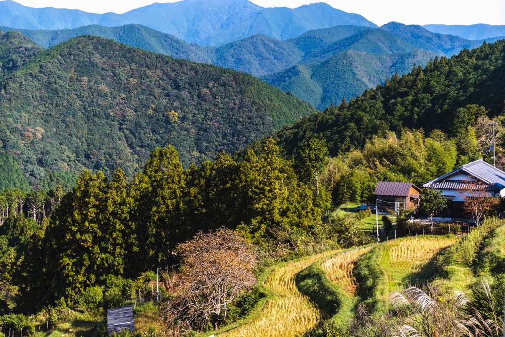
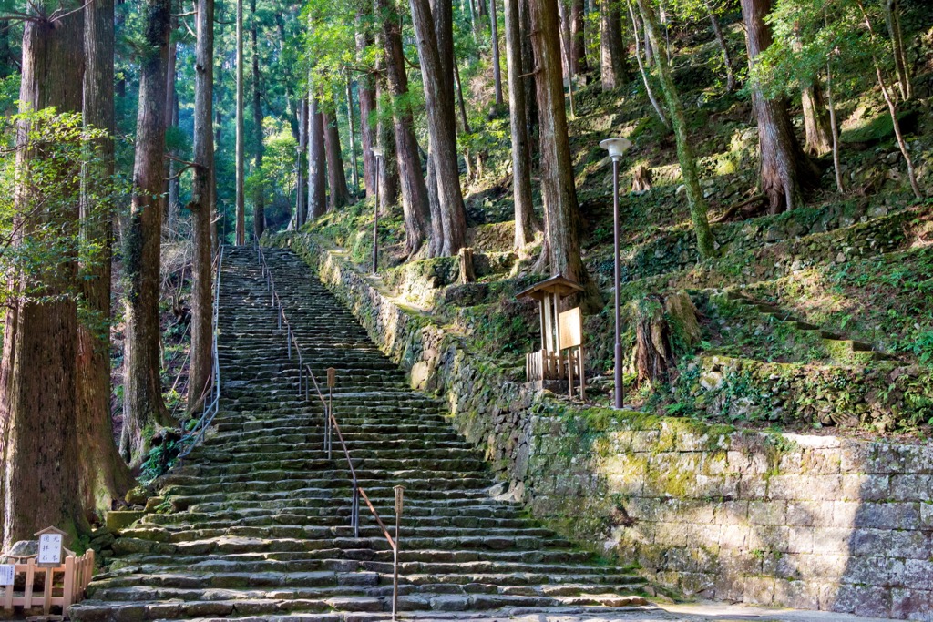
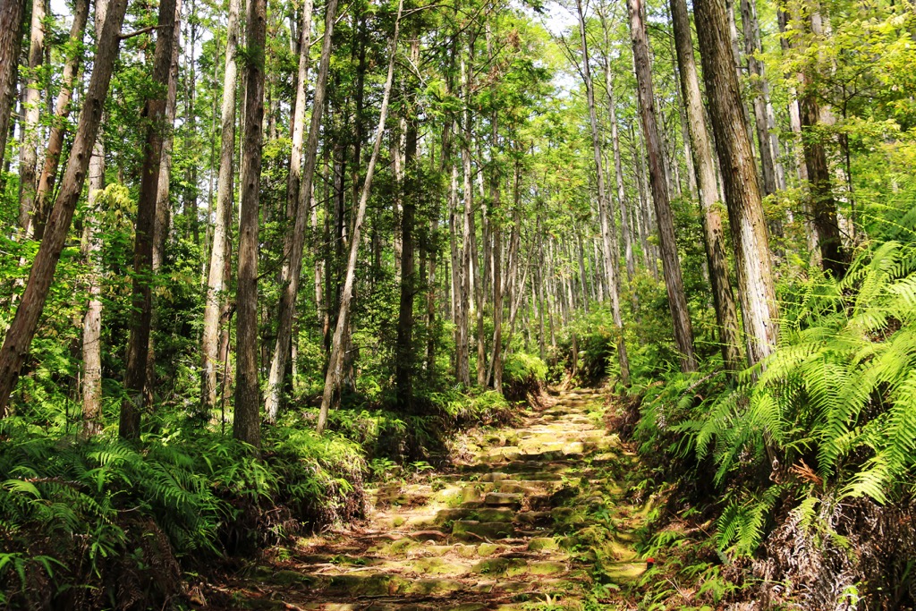
Comprising a network of ancient pilgrimage trails, the Kumano Kodo holds deep cultural and spiritual reverence similar to the Camino de Santiago in Spain. Pilgrims, hikers, and nature enthusiasts traverse various routes, exploring the mountains, valleys, and traditional villages that afford stunning landscapes.
The integration with nature, warm hospitality, and historical preservation make the Kumano Kodo a cherished destination. To connect with Japan’s heritage on this mountainous journey, you can either walk the entire series of trails or select the path best suited to your hiking preferences.
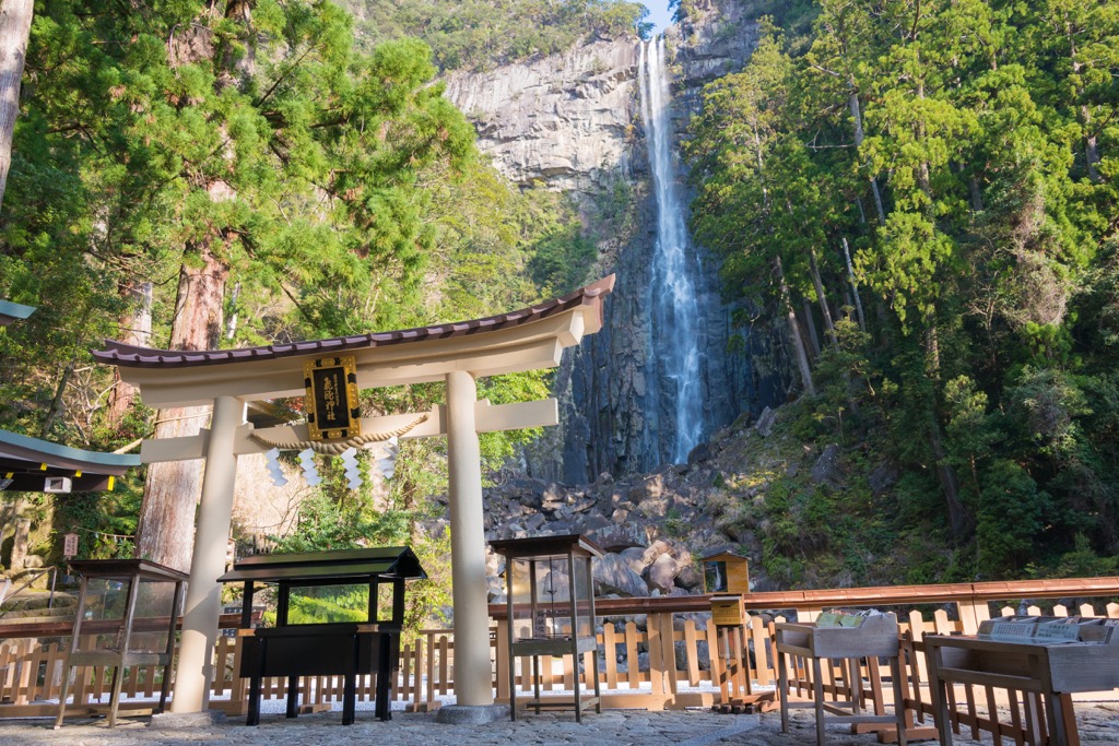
Often termed the Imperial Route, the Kumano Kodo’s core trail is the gateway to the Kumano Sanza. These three grand shrines are Kumano Hongu Taisha (熊野本宮大社), Kumano Hayatama Taisha (熊野速玉大社), and Kumano Nachi Taisha (熊野那智大社). Steeped in over 1,000 years of history, its rich culture and spiritual acclaim attract a multitude of hikers.
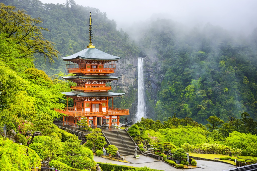
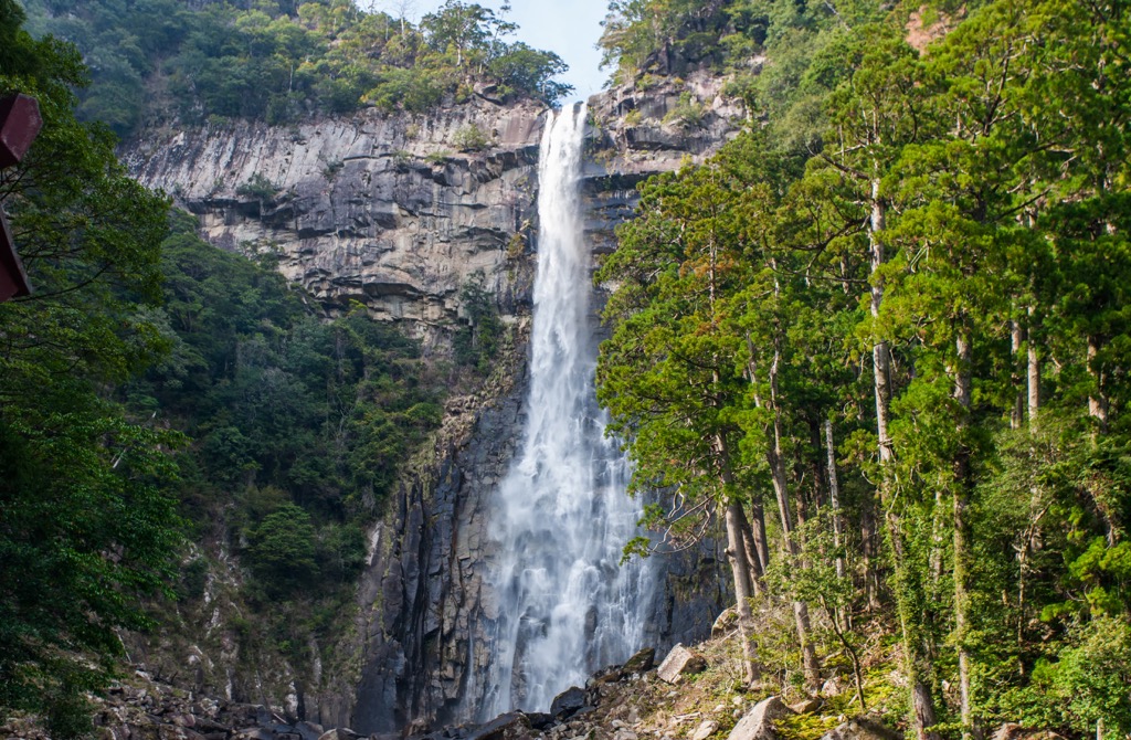
Stretching 87 km (54 mi) from Tanabe (田辺市) on the west coast of the Kii Peninsula to the magnificent Nachi Waterfall on the east coast, this enchanting route takes four to six days to complete. Along the way, you’ll traverse ancient forests, bamboo groves, and cobbled paths and encounter stone monuments, small villages, and hot springs.
The pilgrimage also includes visits to other significant shrines and temples like Takijirioji-gu Togo (滝尻王子宮十郷神社), Tsugizakura-oji (継桜王子), and Hosshinmon-oji (発心門王子), allowing for both a physical and spiritual journey through Japan's cultural heritage.
Characterized by its rippling path in the Kii Mountains, the Kohechi Route links the Kumano Hongu Taisha directly across the mountainous terrain into Koyasan (高野山).
A more challenging route than the Nakahechi Route, the 70 km (43 mi) path features steep ascents and descents - four mountain passes exceed 1,000 meters (3,281 ft) - and offers fewer accommodation options. One particular prominent peak is Obakedake (伯母子岳), measuring 1,344 meters (4,409 ft).
Adventurers who embark on the Kohechi Route are rewarded with breathtaking vistas, serene natural beauty, and a profound sense of solitude. Along the way, you’ll encounter ancient settlements, picturesque mountainous villages, and a variety of ‘onsens’ (hot springs), such as the Totstukawa Onsen.
Embark on an extraordinary coastal adventure along the Ohechi Route, a 72 km (45 mi) trail tracing the southern coast of the Kii Peninsula from Tanabe to Nachikatsuura (那智勝浦町). The trail overlooks the Pacific Ocean and the picturesque fishing villages, pristine beaches, and dramatic cliffs that adorn the path. Travelers often take five days to complete this route.
Beyond the natural splendor, encounters with cultural and historical landmarks define this journey; one example is the Sodo-ji Temple (上富田町) which showcases the region's deep-rooted traditions. Immerse yourself in the coastal ambiance, take in the awe-inspiring views, and embrace the unhurried pace as you tread this unforgettable pilgrimage along the captivating Ohechi Route.
The Iseji Route is another coastal trek beginning north of Nachikatsuura at the Kumano Hayatama Taisha. Extending 165 km (103 mi) northeast towards the Ise (伊勢市) in the Mie Prefecture, the extraordinary trail winds its path through a diverse landscape tapestry.
Highlights of this route are the enchanting bamboo forests and the serene Maruyama Senmaida (丸山千枚田) rice fields that overlook majestic mountainscapes. Along the way, you’ll pass Shichiri Mihama (七里御浜), Japan’s longest beach, a 22 km (14 mi) shoreline of dark gravel and brilliant blue sea. For sweeping views of this bay and the rolling coastal hills, ascend Mt. Binshi (便石山).
Connecting Japan’s former capitals of Kyoto (京都市) and Nara (奈良市) to Tanabe, the Kiiji Route spans 170 km (106 mi) of four distinct routes. Along the first section, the trail passes encounter historic towns and temples, such as Uji (宇治) and Horyuji Temple (法隆寺), then enters the Kii Mountains en route to Koyaguchi.
You’ll progress along rivers and undulating fields to Wakayama, from where the path hugs the western coastline to Tanabe. The last section of the trial is the most challenging, traversing several mountain passes, but it also affords the best views. Admire the sapphire Wakayama Bay overlooking the emerald hills of Shikoku Island (四国) in the west.
Discover the awe-inspiring Ōmine Okugake Michi Trail, an arduous yet rewarding pathway that joins the renowned cherry blossom haven of Yoshino (吉野町) with the sacred Mt Ōmine (大峰山), also known as Mt Sanjogadake, in the northern Nara Prefecture to the Kumano Hongu Taisha in the south.
This challenging pilgrimage route has captivated ascetic Buddhist monks for ages, treating adventurers to breathtaking mountain scenery. Two peaks populate this trail, Mt Ōmine and Mt Tamaki (玉置山). However, for spiritual reasons, Mt Ōmine is off-limits to women climbers, who can bypass the hill.
Navigating the arduous path, you’re rewarded with awe-inspiring views of towering peaks, lush forests, and cascading waterfalls, painting a vivid backdrop throughout the seasons.
Nara and Osaka, two of Japan’s top tourist destinations, lie close to the Kii Mountains. One a traditional empire, the other a modern hub, both cities attract travelers for differing reasons.
As Japan’s ancient capital from 710 to 784 AD, Nara is the birthplace of Japanese civilization. Renowned for its history and culture, Nara boasts well-preserved temples, traditional architecture, and beautiful gardens, making it a popular destination for travelers.
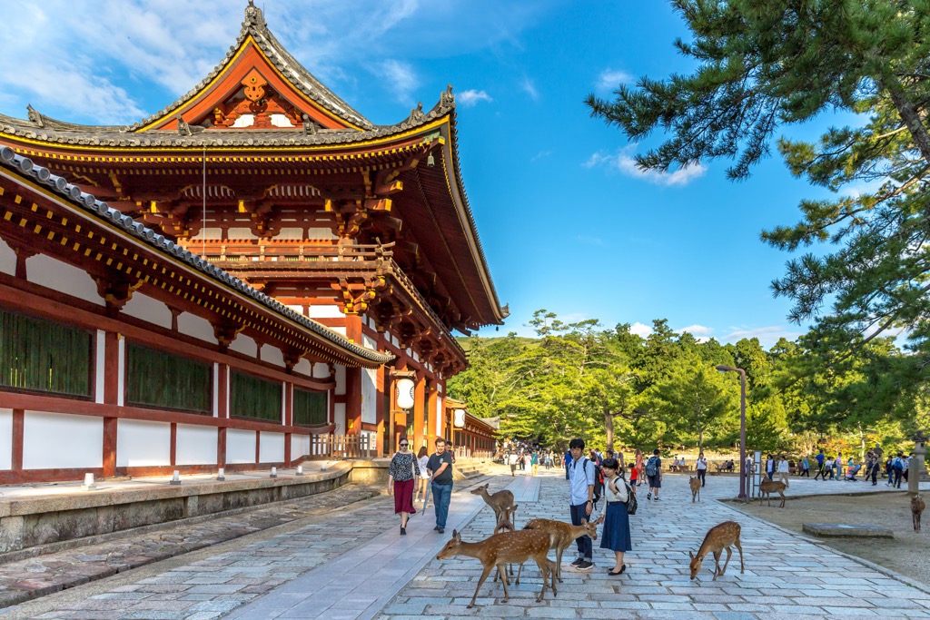
Visit one of Nara’s most prominent attractions to gaze at freely roaming deer and marvel at several landmarks. The most famous is Toda-ji Temple (東大寺), which houses Daibutsu, a giant bronze Buddha statue. This iconic wooden shrine is a UNESCO World Heritage Site for its remarkable architectural and artistic achievements.
Head to Isuien Garden (依水園) to appreciate the harmonious blend of natural scenery and Japanese garden design. Stroll around the lush vegetation encircling the lotus pond in the front garden. The rear garden features a contemplative setting of arranged rocks and a minimalist design. Stop at one of the charming teahouses in the gardens for refreshments while admiring the garden's natural beauty.
For scenic views of Nara, climb the 350-meter (1,148 ft) Mt Wakakusu (若草山) behind Nara Park. The views are particularly lovely in spring when cherry blossom season abounds. The summit provides a panoramic vista that showcases the beauty of the cityscape, as well as iconic landmarks such as Todai-ji Temple, Kasuga Taisha Shrine, and Nara Park. It's a fantastic spot for photographers, nature lovers, and anyone looking to admire the stunning scenery.

Osaka, Japan's third-largest city, is a vibrant and dynamic destination that offers a unique blend of history, culture, and modernity. A more modern city than Nara, Osaka features flashing signage, contemporary architecture, and a bustling entertainment district. Known as the ‘Kitchen of Japan,’ explore Osaka’s exceptional culinary scene, from street food to countless restaurants.
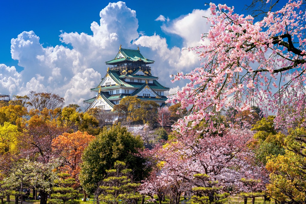
A magnificent symbol of the city, Osaka Castle (大坂城) is a 16th-century fortress known for its impressive architecture and beautiful surrounding park. Explore the castle's interior museum to learn about its history and enjoy panoramic views from the top floor. Then stroll along the 2 sq km (0.7 sq mi) grounds of Osaka Castle Park, admiring the scenic moat and seasonal cherry blossoms, azaleas, and plum blossoms.
A must-visit for its vibrant atmosphere, neon lights, and fantastic street food, there is plenty to see and do in the bustling entertainment district of Dōtonbori (道頓堀). Amble along the canals, try local delicacies, explore Japan’s shopping scene, and soak in the energetic ambiance of this pulsating neighborhood.