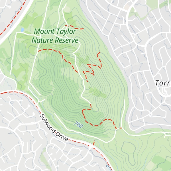
Mount Taylor is a prominent hill with an elevation of 856 metres (2,808 ft) AHD that is located between the Woden Valley, Weston Creek district and Tuggeranong Valley, in Canberra, within the Australian Capital Territory, Australia. Mount Taylor is part of the Canberra Nature Park and is surrounded by the suburbs of Kambah, Fisher, Waramanga, Chifley, Pearce, and Torrens. There are walking tracks to the peak. While there is no public road access to the peak there is a fire trail up the mountain from the end of Waldock St, Chifley where there is also a car park and picnic tables. The fire trail (also known as the management trail) is normally closed to public vehicular access by locked gates, but the gates contain access points for walkers. The trail is especially popular with families and older walkers as it provides the easiest and most leisurely access to the peak. Originally a dirt road, it was partially sealed in 2009 on the steeper grades to make it safer for walkers and mountain bike riders.
There's a trail leading to the summit.
By elevation Mount Taylor is
# 1 out of 1 in Mount Taylor Nature Reserve # 72 out of 142 in Australian Capital Territory
By prominence Mount Taylor is
# 1 out of 1 in Mount Taylor Nature Reserve # 22 out of 142 in Australian Capital Territory
We use GPS information embedded into the photo when it is available.
3D mountains overlay
Adjust mountain panorama to perfectly match your photos because recorded by camera photo position might be imprecise.
Move tool
Rotate tool
Zoom
More customization
Choose which peak labels should make into the final photo and what photo title should be.
Next
Photo Location
Satellitte
Flat map
Relief map
Latitude
Longitude
Altitude
OR
Latitude
°'''
Longitude
°'''
Apply
Register Peak
Peak Name
Latitude
Longitude
Altitude
Register
Teleport
PeakVisor
This 3D model of Sagarmatha National Park in Nepal was made using the PeakVisor app topographic data. The mobile app features higher precision models worldwide, more topographic details, and works offline. Download PeakVisor maps today.
Download OBJ model
PeakVisor
The download should start shortly. If you find it useful please consider supporting the PeakVisor app.
PeakVisor for iOS and Android
Be a superhero of outdoor navigation with state-of-the-art 3D maps and mountain identification in the palm of your hand!