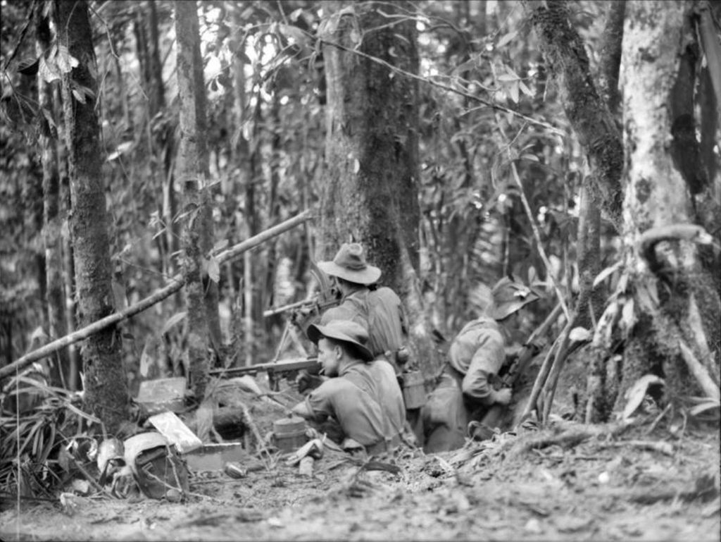
The Battle of Mount Tambu was a series of actions fought in the Salamaua area of the Territory of New Guinea between Allied and Japanese forces, which took place between 16 July and 18 August 1943, during World War II. The battle formed part of the wider Salamaua–Lae campaign and was fought in the final stages of the campaign, which had seen a combined Australian and US force advance from Wau towards Salamaua following the repulse of the Japanese attack on Wau in late January and early February 1943. After several frontal assaults on the position by Australian and US infantrymen were rebuffed by determined Japanese defenders, an indirect approach was sought and flanking moves were undertaken to cut off the Japanese supply route along the Komiatum Track. This succeeded in eventually forcing the Japanese off the position as they withdrew to avoid encirclement.
We use GPS information embedded into the photo when it is available.
3D mountains overlay
Adjust mountain panorama to perfectly match your photos because recorded by camera photo position might be imprecise.
Move tool
Rotate tool
Zoom
More customization
Choose which peak labels should make into the final photo and what photo title should be.
Next
Photo Location
Satellitte
Flat map
Relief map
Latitude
Longitude
Altitude
OR
Latitude
°'''
Longitude
°'''
Apply
Register Peak
Peak Name
Latitude
Longitude
Altitude
Register
Teleport
PeakVisor
This 3D model of Sagarmatha National Park in Nepal was made using the PeakVisor app topographic data. The mobile app features higher precision models worldwide, more topographic details, and works offline. Download PeakVisor maps today.
Download OBJ model
PeakVisor
The download should start shortly. If you find it useful please consider supporting the PeakVisor app.
PeakVisor for iOS and Android
Be a superhero of outdoor navigation with state-of-the-art 3D maps and mountain identification in the palm of your hand!