Mount Hotham is a mountain located in the Victorian Alps of the Great Dividing Range, in the Australian state of Victoria. The mountain is located approximately 357 kilometres (222 mi) north east of Melbourne, 746 kilometres (464 mi) from Sydney, and 997 kilometres (620 mi) from Adelaide by road. The nearest major road to the mountain is the Great Alpine Road. The mountain is named after Charles Hotham, Governor of Victoria from 1854 to 1855.
Mount Hotham's summit rises to an altitude of 1,862 metres (6,109 ft) AHD.
Mount Hotham Alpine Resort, a commercial alpine resort, is located on the slopes of Mount Hotham summit and nearby mountains.
Administratively, the mountain is within Mount Hotham Alpine Resort unincorporated area, land which is managed by Alpine Resorts Victoria. This unincorporated area is surrounded by Alpine Shire
There's a trail leading to the summit.
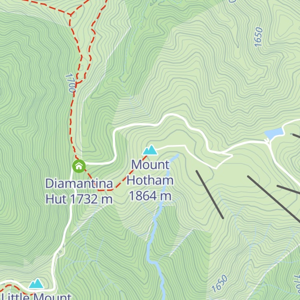
The nearest mountain hut is Diamantina Hut located 555m/1 822ft W of the summit.
By elevation Mount Hotham is
# 11 out of 2097 in Victoria # 87 out of 21731 in Australia # 80 out of 12558 in the Great Dividing Range
We use GPS information embedded into the photo when it is available.
3D mountains overlay
Adjust mountain panorama to perfectly match your photos because recorded by camera photo position might be imprecise.
Move tool
Rotate tool
Zoom
More customization
Choose which peak labels should make into the final photo and what photo title should be.
Next
Photo Location
Satellitte
Flat map
Relief map
Latitude
Longitude
Altitude
OR
Latitude
°'''
Longitude
°'''
Apply
Register Peak
Peak Name
Latitude
Longitude
Altitude
Register
Teleport
PeakVisor
This 3D model of Sagarmatha National Park in Nepal was made using the PeakVisor app topographic data. The mobile app features higher precision models worldwide, more topographic details, and works offline. Download PeakVisor maps today.
Download OBJ model
PeakVisor
The download should start shortly. If you find it useful please consider supporting the PeakVisor app.
PeakVisor for iOS and Android
Be a superhero of outdoor navigation with state-of-the-art 3D maps and mountain identification in the palm of your hand!