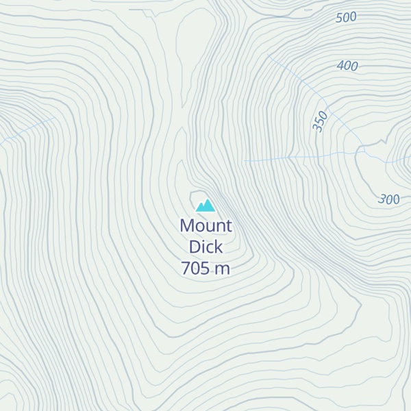
Mount Dick is a 705-metre (2313 ft) peak on Adams Island, the second-largest of New Zealand's Auckland Island chain. It is the highest point in the Auckland Islands. Mount Dick is on the rim of an extinct volcano, the crater of which now forms Carnley Harbour, which separates Adams Island from the larger Auckland Island.
This mountain was named after Richard “Dickey” Sayers, who moved from Wellington with his family to the Wairarapa in 1859.
By elevation Mount Dick is
# 1 out of 32 in Auckland Islands - Motu Maha Marine Reserve
By prominence Mount Dick is
# 1 out of 32 in Auckland Islands - Motu Maha Marine Reserve
We use GPS information embedded into the photo when it is available.
3D mountains overlay
Adjust mountain panorama to perfectly match your photos because recorded by camera photo position might be imprecise.
Move tool
Rotate tool
Zoom
More customization
Choose which peak labels should make into the final photo and what photo title should be.
Next
Photo Location
Satellitte
Flat map
Relief map
Latitude
Longitude
Altitude
OR
Latitude
°'''
Longitude
°'''
Apply
Register Peak
Peak Name
Latitude
Longitude
Altitude
Register
Teleport
PeakVisor
This 3D model of Sagarmatha National Park in Nepal was made using the PeakVisor app topographic data. The mobile app features higher precision models worldwide, more topographic details, and works offline. Download PeakVisor maps today.
Download OBJ model
PeakVisor
The download should start shortly. If you find it useful please consider supporting the PeakVisor app.
PeakVisor for iOS and Android
Be a superhero of outdoor navigation with state-of-the-art 3D maps and mountain identification in the palm of your hand!