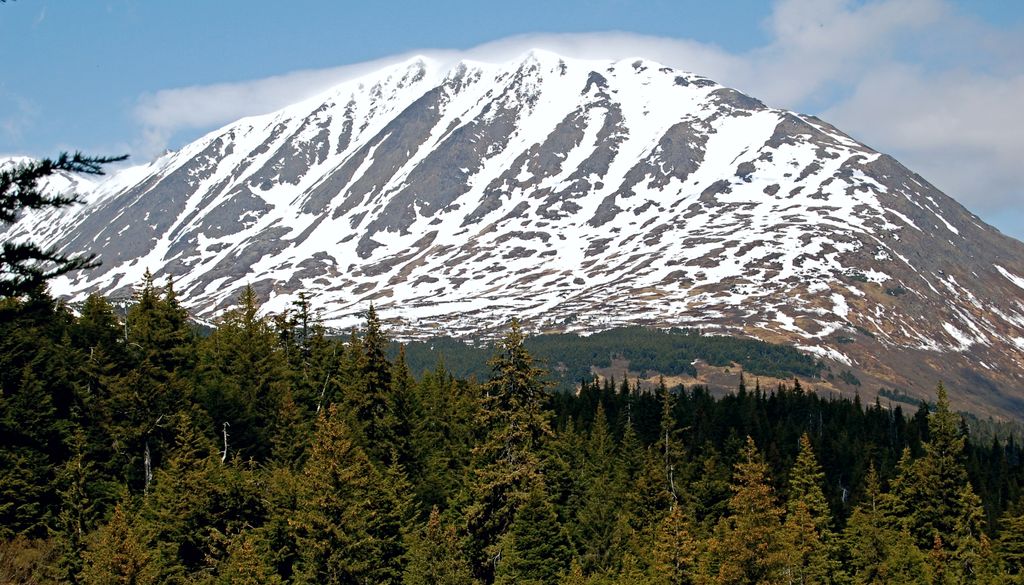
Mount Adair is a prominent 5,178-foot (1,578 m) double summit mountain located in the Kenai Mountains, on the Kenai Peninsula, in the U.S. state of Alaska. The east summit is higher than the 4,940-foot west peak. The mountain is situated in Chugach National Forest, 6.8 mi (11 km) north of Mount Ascension, 7.2 mi (12 km) west of Andy Simons Mountain, and 17 mi (27 km) north of Seward, Alaska. Precipitation runoff from the mountain drains into Kenai Lake. Mount Adair's local name was reported in 1951 by the U.S. Geological Survey.
By elevation Mount Adair is
# 50 out of 200 in Kenai Peninsula
By prominence Mount Adair is
# 32 out of 200 in Kenai Peninsula # 47 out of 575 in the Chugach Mountains # 68 out of 847 in the South-Central Alaska
We use GPS information embedded into the photo when it is available.
3D mountains overlay
Adjust mountain panorama to perfectly match your photos because recorded by camera photo position might be imprecise.
Move tool
Rotate tool
Zoom
More customization
Choose which peak labels should make into the final photo and what photo title should be.
Next
Photo Location
Satellitte
Flat map
Relief map
Latitude
Longitude
Altitude
OR
Latitude
°'''
Longitude
°'''
Apply
Register Peak
Peak Name
Latitude
Longitude
Altitude
Register
Teleport
PeakVisor
This 3D model of Sagarmatha National Park in Nepal was made using the PeakVisor app topographic data. The mobile app features higher precision models worldwide, more topographic details, and works offline. Download PeakVisor maps today.
Download OBJ model
PeakVisor
The download should start shortly. If you find it useful please consider supporting the PeakVisor app.
PeakVisor for iOS and Android
Be a superhero of outdoor navigation with state-of-the-art 3D maps and mountain identification in the palm of your hand!