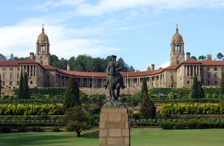
Meintjeskop is a hill in Pretoria on which the Union Buildings (die Uniegebou(e) in Afrikaans) were constructed.
Marthinus Wessel Pretorius, later to become first president of the Transvaal Republic, was the original owner of the farm 'Elandsfontein' on which Meintjeskop stands. In 1856 Andries Francois du Toit (1813–1883), in exchange for a Basuto pony, acquired part of the farm, which he named Arcadia. He was also Pretoria’s first magistrate and was responsible for planning the layout of the city. During this period he sold his land for £1200 to Stephanus Jacobus Meintjes (1819–1887), and by 1870 it bore the name Meintjeskop.
Meintjeskop is part of the Witwatersberg Ridge, which runs east–west through Pretoria. Geologically it forms part of the Pretoria Group of the Transvaal sequence.
By elevation Meintjieskop is
# 95 out of 112 in Gauteng # 35 out of 51 in City of Tshwane Metropolitan Municipality # 73 out of 193 in the Magaliesberg
By prominence Meintjieskop is
# 37 out of 112 in Gauteng # 12 out of 51 in City of Tshwane Metropolitan Municipality # 79 out of 193 in the Magaliesberg
We use GPS information embedded into the photo when it is available.
3D mountains overlay
Adjust mountain panorama to perfectly match your photos because recorded by camera photo position might be imprecise.
Move tool
Rotate tool
Zoom
More customization
Choose which peak labels should make into the final photo and what photo title should be.
Next
Photo Location
Satellitte
Flat map
Relief map
Latitude
Longitude
Altitude
OR
Latitude
°'''
Longitude
°'''
Apply
Register Peak
Peak Name
Latitude
Longitude
Altitude
Register
Teleport
PeakVisor
This 3D model of Sagarmatha National Park in Nepal was made using the PeakVisor app topographic data. The mobile app features higher precision models worldwide, more topographic details, and works offline. Download PeakVisor maps today.
Download OBJ model
PeakVisor
The download should start shortly. If you find it useful please consider supporting the PeakVisor app.
PeakVisor for iOS and Android
Be a superhero of outdoor navigation with state-of-the-art 3D maps and mountain identification in the palm of your hand!