
Scan the QR code and open PeakVisor on your phone
The Magaliesberg is a prominent geological feature spanning Gauteng and North West provinces in the northern part of South Africa. There are 196 named mountains in Magaliesberg; the highest and the most prominent is Kransberg, measuring 2,059 meters (6,755 ft).
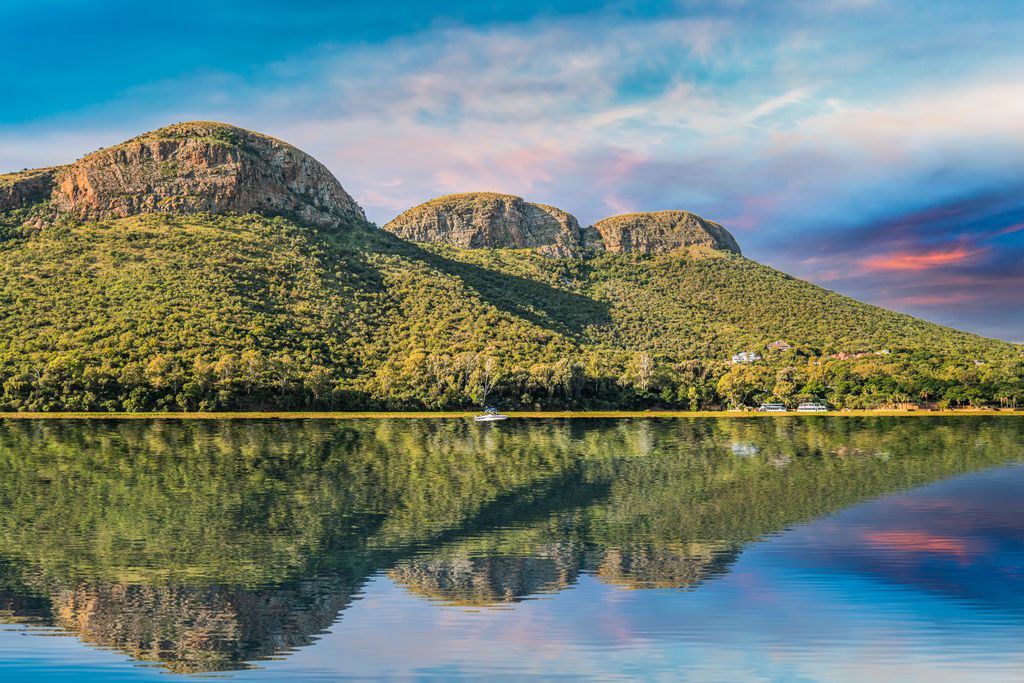
The Magaliesberg is one of the world’s oldest mountain ranges, with rock that is more than two billion years old. Stretching 125 km (78 mi) from Pretoria in the east to Rustenburg in the west, the range rises an average of 330 meters (1,083 ft) above the surrounding plains.
The Magaliesberg separates the lower-lying, hotter bushveld to the north from the cooler Highveld to the south. It has a temperate climate with summer rainfall in the form of thunderstorms, averaging 650 mm (26 in) annually.
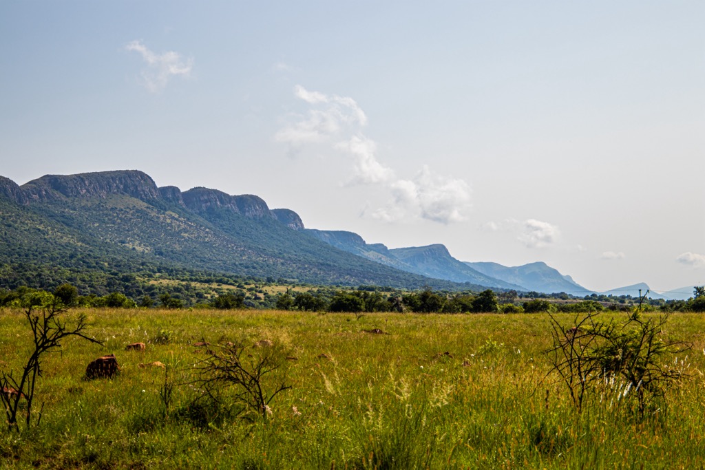
The range has a unique and varied topography that provides a multitude of habitats and ecological niches for a rich biodiversity. The north-facing slopes are more gently tilted and have deep kloofs, or ravines, eroded by water and wind. In contrast, the south-facing slopes are steeper and more sun-exposed.
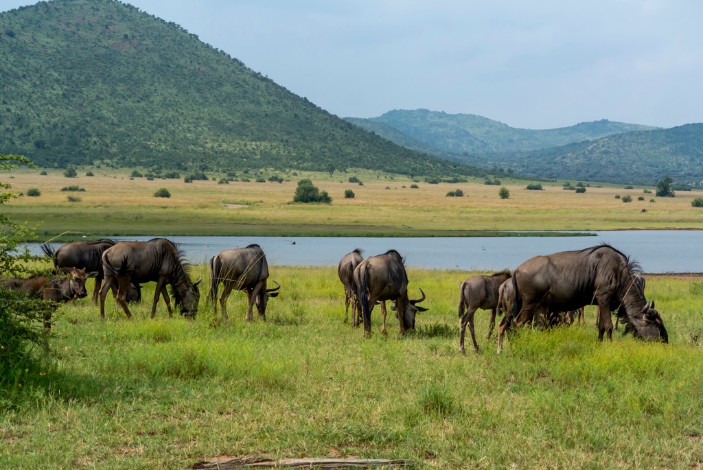
The plateau on top of the range has many rocky outcrops and caves; the Magaliesberg also has several rivers, streams, waterfalls, springs, wetlands, and dams that supply water to the region and support aquatic life.
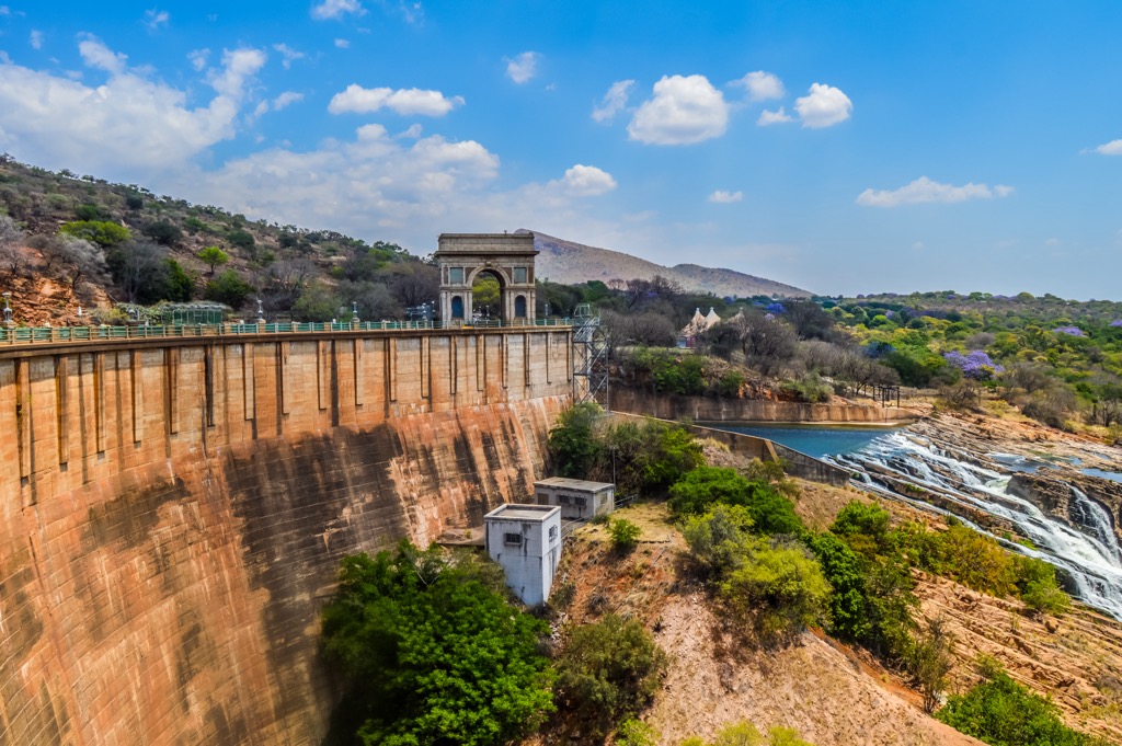
Many locals and tourists visit the Hartbeespoort Dam and the Magaliesberg Biosphere Reserve. The reserve is a UNESCO site that covers an area of 357,870 ha (884,316 ac) and lies at the interface of two great African biomes, the Central Grassland Plateaux and the sub-Saharan savannah, and the remnants of a third biome, the Afro‐montane forest.
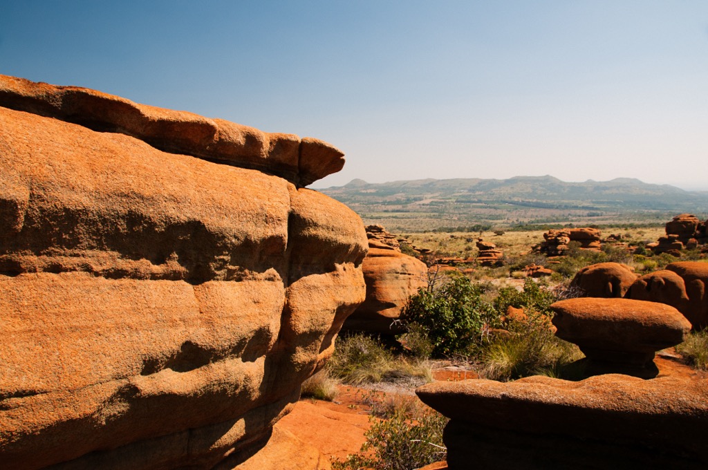
The Magaliesberg is composed mainly of quartzites, shales, chert, and dolomite deposited as sediments in an ancient inland basin about 2 billion years ago. Later, a great upwelling of molten magma formed the Bushveld Igneous Complex, which tilted the deposits along the edges and created the curved mountain ranges we see today.
The rocks of the Magaliesberg are among the oldest exposed volcanic rocks in the country. They show evidence of ripple marks, cross-bedding, mud cracks, fossils, and other features that indicate their origin as marine or lacustrine sediments. In addition, the rocks contain sills and dykes of dolerite that filled the sediment layer’s cracks during the igneous intrusion. These intrusions eroded over time, especially on the dip slopes, forming deep kloofs or ravines.
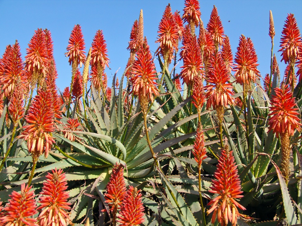
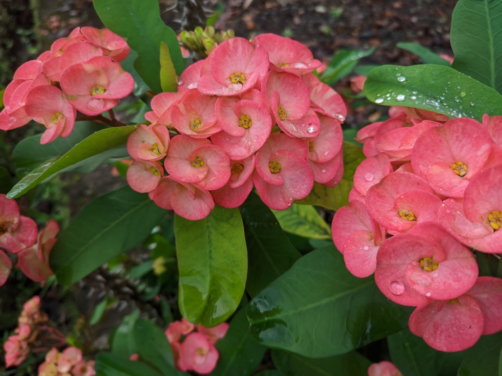
Like many parts of South Africa, the ecology of the Magaliesberg is diverse. Some notable floral species endemic or near-endemic to the Magaliesberg are fez aloe, fairy elephant’s feet, Dragon’s head lily, and Protea caffra. The range also hosts various tree species, such as Acacia karroo, white stinkwood, river bushwillow, olive, and real yellowwood.
The range has a varied topography that provides a multitude of habitats and ecological niches. The Magaliesberg contains 14 different vegetation types, 90 indigenous mammal species, 443 bird species, 46 amphibian species, 113 reptile species, 64 fish species, and over 130 butterfly species.
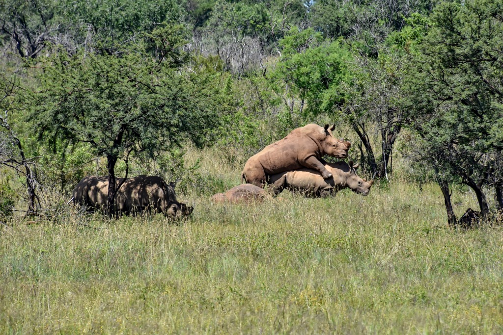
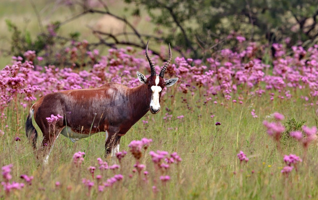
Some of the wildlife inhabiting the Magaliesberg are the white rhino, forest shrew, sable antelope, leopard, and brown hyena. The range also supports a diverse avifauna, such as the Cape vulture, Verreaux’s eagle, crimson-breasted shrike, and the southern double-collared sunbird.
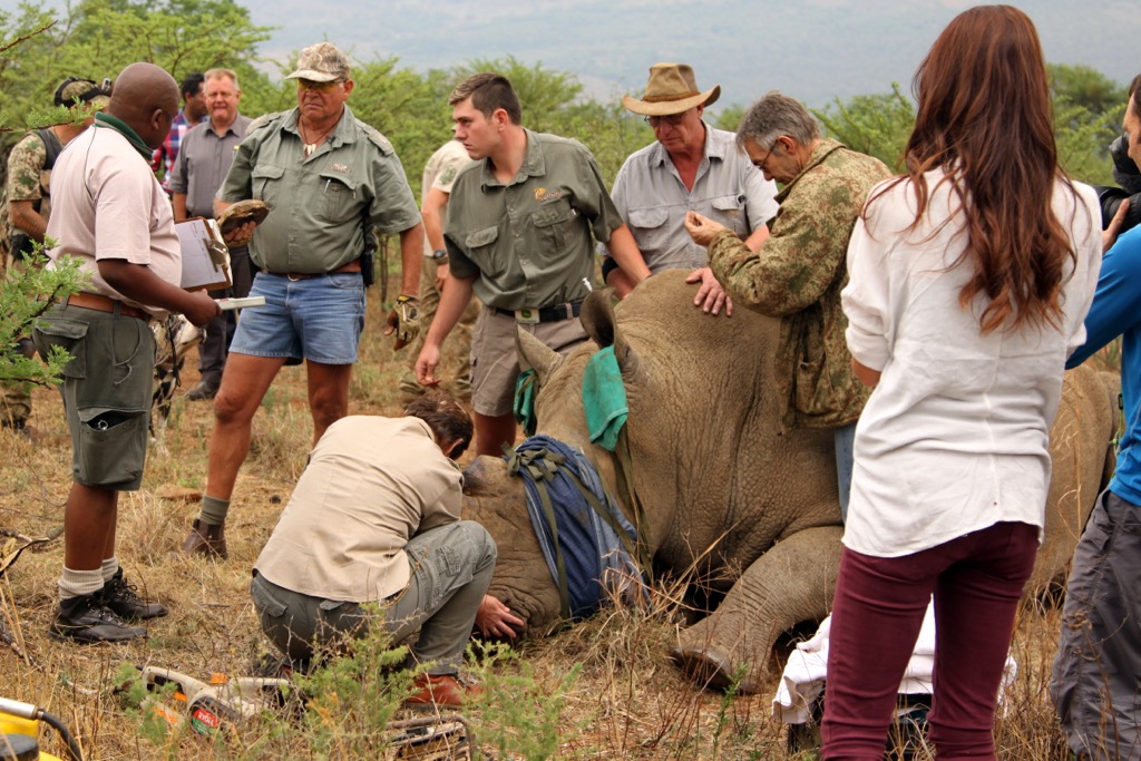
Rangers and wildlife biologists have been de-horning rhinos to eliminate the chance of poaching; a rhino without its horn is of no value to poachers. Biologists also implant tracking chips for more information on the location and movement of rhinos.
The Magaliesberg is one of the world’s oldest sites of human occupation, dating back to at least 2 million years ago when early human species, such as Australopithecus africanus and Paranthropus robustus, lived in the nearby Sterkfontein Caves, which are part of the Cradle of Humankind World Heritage Site.
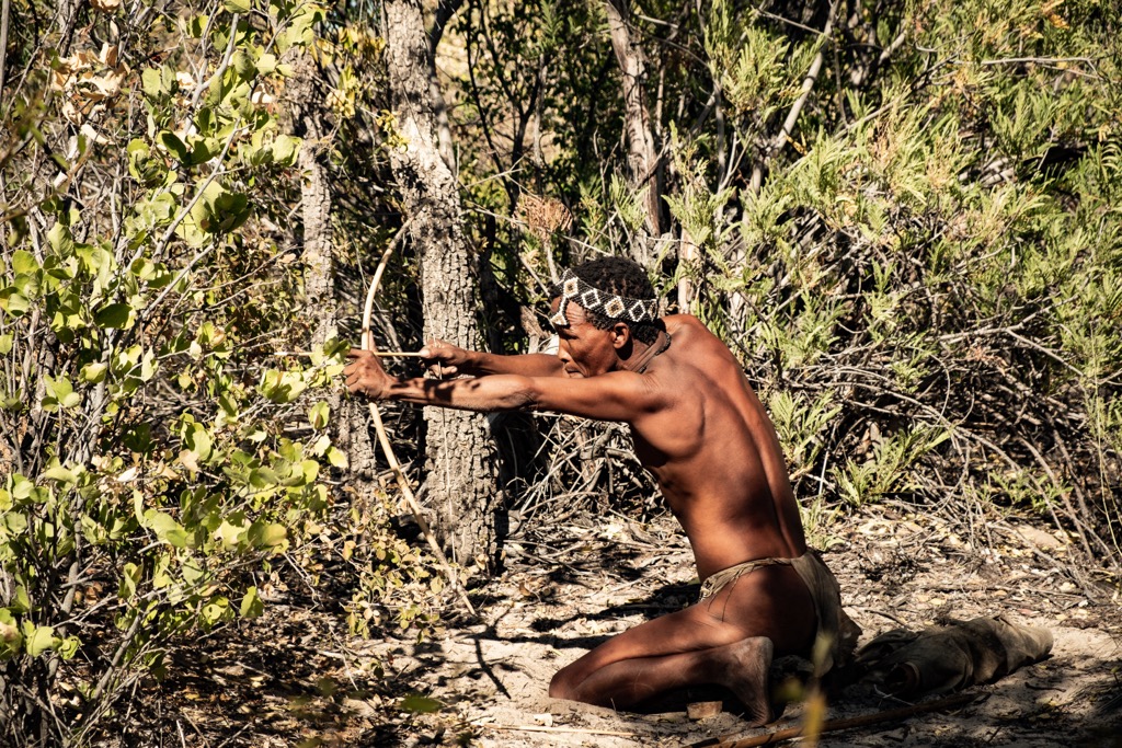
The first modern humans to inhabit the Magaliesberg were the San Peoples, also known as Bushmen, who arrived between 25,000 and 10,000 years ago. They were hunter-gatherers who lived in harmony with nature and left behind many rock art paintings and engravings that depict their daily lives.
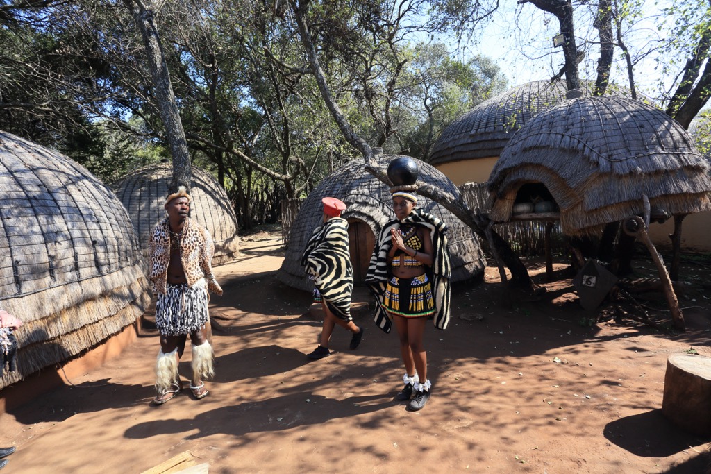
The San were later displaced by Bantu-speaking peoples, who migrated from Central Africa around 2,000 years ago. They brought iron technology, agriculture, and livestock and established settlements and kingdoms throughout Southern Africa.
Over the centuries, the Magaliesberg has witnessed numerous wars and conflicts involving diverse factions and invaders. Notable events include the Mfecane in the early 19th century, marked by widespread warfare and chaos in Southern Africa due to the Zulu kingdom's expansion under Shaka. This period led to significant social and political changes as groups fled or fought for survival.
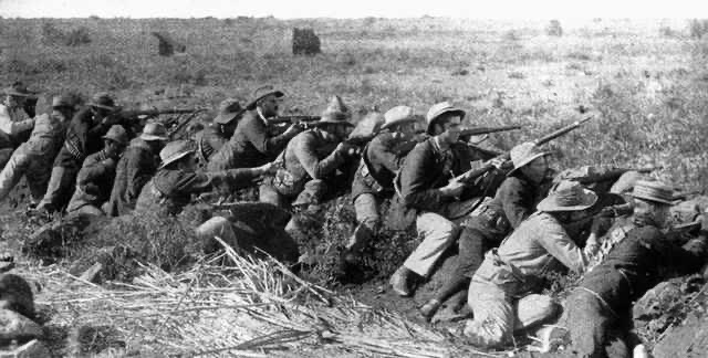
The Anglo-Boer Wars occurred in the late 19th and early 20th centuries, featuring battles, sieges, and guerrilla actions in the strategically significant Magaliesberg, with the British Empire pitted against the Boer republics (original white Dutch settlers).
Moreover, during the Apartheid era from 1948 to 1994, the Magaliesberg became a site of resistance against racial segregation and oppression, serving as a refuge for activists and exiles in the struggle for freedom and democracy.
The Magaliesberg is now a protected natural environment that preserves its rich geological, ecological, and cultural heritage.

The Kransberg Hiking Trail is a challenging trail in the Marakele National Park that leads through the Magaliesberg. The route is about 25 km (15.5 mi) long and is best tackled in two days, with an overnight stay at a rustic hut near the summit of Kransberg.
Hikers begin the trail at the Kgaswane Nature Reserve, where you can see wildlife, such as zebra, wildebeest, kudu, and impala. The route then ascends steeply through a rocky gorge, with views of the Buffelspoort Dam and the surrounding valleys. The trail continues along the ridge of the Magaliesberg, passing by some interesting rock formations and caves.
The trail's highlight is the summit of Kransberg, which offers a panoramic view of the landscape and the distant city of Pretoria. Hikers descend through a forested valley, passing waterfalls and streams before ending at the Olifantsnek Dam.

The Aasvoëlbad Hiking Trails are a set of trails located on the farm Aasvoëlbad, named after the Cape Griffin Vultures that breed on the southern slope of Nadia’s Peak. Aasvoëlbad Farm spans over 200 ha (494 ac) on the northern slopes of the Magaliesberg in Bokfontein Brits. It’s home to various wildlife such as springbok, impala, gnus, hartebeest, kudu, blesbuck, and zebra.
Two well-marked trails cover 6.5 km (4 mi) and 4.5 km (3 mi) and offer various features, such as refreshing rock pools to cool off in. The farm also has a labyrinth walk, which is a path for meditation. The walk can be divided into three stages: entering the labyrinth, reaching the center, and returning to normal life.
The Aasvoëlbad Hiking Trails are a great way to experience the beauty and diversity of the Magaliesberg Biosphere Reserve, proclaimed by UNESCO in 2016. The trails are also close to other attractions, such as Hartebeespoort Dam, Lesedi Cultural Village, and Cradle of Humankind.
Shelter Rock Hiking Trail is a popular and scenic trail in the Magaliesberg. The trail is about 8 km (5 mi) long and starts at the Shelter Rock Base Camp, where hikers can park their cars and pay the entrance fee.
Hikers climb and make their way up the southern slopes of the Magaliesberg, traversing the foothills of Vaalkop. Key features along the trail include the remnants of an Iron Age village, a 1,000-year-old olive tree, and a sandstone rock garden with a collection of spires. In addition, two Boer War Forts lie on the mountain, where soldiers fought and defended their positions during the conflict between Britain and the Boer Republics in the late 19th and early 20th centuries.
The Rustig Hiking Trail is an adventurous trail in the Magaliesberg, located on a family farm called Rustig. The trail offers various options for different levels of fitness and experience, ranging from 3 km (1.8 mi) to 18 km (11 mi) in length.
Throughout the trek, hikers view the surrounding mountains of Nadia’s Peak, Vaalkop, and Krokodilberg and encounter some wildlife, such as baboons, antelopes, and birds. Grasslands, forests, rocky slopes, and cliffs are all part of the trail's varied terrain.
The Hennops Hiking Trail is in the Hennops River Valley, part of the Magaliesberg Biosphere Reserve. It is conveniently located near Pretoria and Johannesburg, making it a popular choice for day trips or weekend getaways.
Hikers register and pay the entrance fee at the trail’s starting point at Hadeda Camp in the foothills of Skurweberg. There are four hiking trails to choose from: the 2 km (1.2 mi) Dassie Trail, 5 km (3 mi) Zebra Trail, and 10 km (6 mi) Krokodilberg Trail. Each trail has a different degree of difficulty, elevation gain, and points of interest.
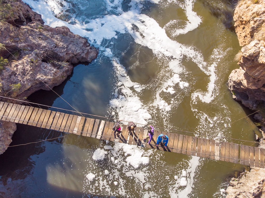
Two unique features on the trail are the river crossings across a suspension bridge and via cable car. Zebras, wildebeest, impalas, kudus, and monkeys are common throughout the route. There are also many indigenous trees and birds along the river and in the forests.
In addition, historical sites add to the trail’s intrigue. These include Oude Muragie, the ruins of an old settlement; dolomite mines and ovens, where lime was extracted in the past; and stone mounts, where ancient people performed rituals.
The De Wildt Euphorbia Loop Trail is a moderate hiking trail in the Magaliesberg Biosphere Reserve. The trail is about 10 km (6.2 mi) long and takes about 4 hours to complete.
Commencing at the Magaliesberg Mountain Sanctuary Park, the trail follows a well-marked path through the scenic mountain landscape, passing by various rock formations, streams, waterfalls, and pools.
The trail is named after the Euphorbia plants that grow abundantly along the route, with distinctive green stems and red flowers. While on the trail, hikers look onto the surrounding hills of Daspoortant, Chosspile, and Mooiuitsig, as well as the Hartbeespoort Dam in the distance.
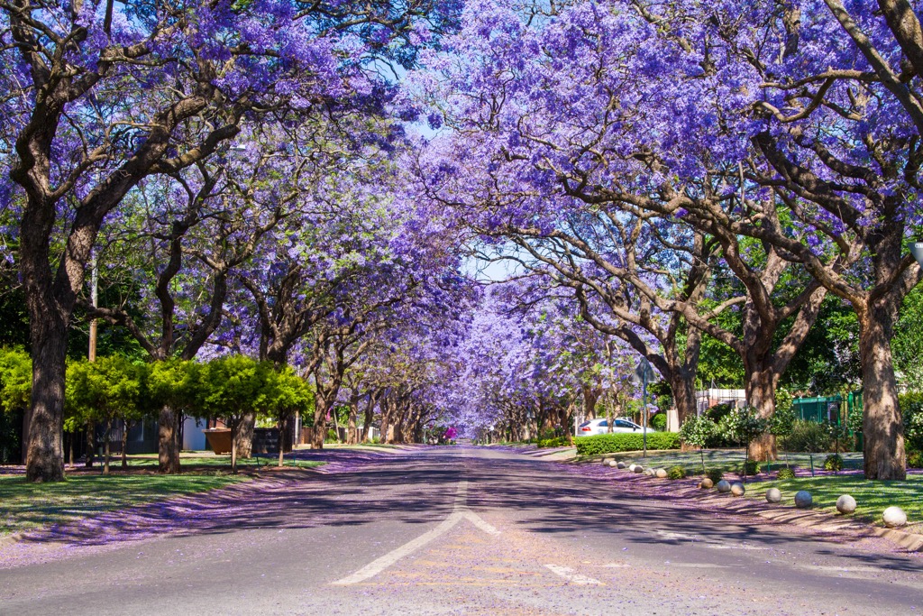
Pretoria, also known as the Jacaranda City due to the abundance of these purple-blossomed trees, is one of South Africa's three capital cities, along with Cape Town and Bloemfontein. It serves as the executive capital, hosting the official residence of the President and many government ministries. This city of many contrasts is located in Gauteng province and is known for its nature, historical monuments, and cultural diversity.
Those who wish to explore Pretoria’s greenery should visit Pretoria National Botanic Garden, which showcases the rich flora of South Africa. Visitors can observe more than half of the country’s tree species, as well as many flowering plants, cycads, aloes, and other collections. It also holds the National Herbarium and offers numerous hiking trails.
For a chance to spot wildlife, the Rietvlei Nature Reserve is a 3,800 ha (9,390 ac) sanctuary home to The Big Five: lions, rhinos, buffaloes, elephants, and leopards. Visitors can also see other wild animals, such as cheetahs, zebras, giraffes, and antelopes. You can explore the reserve by car, on foot, or horseback.
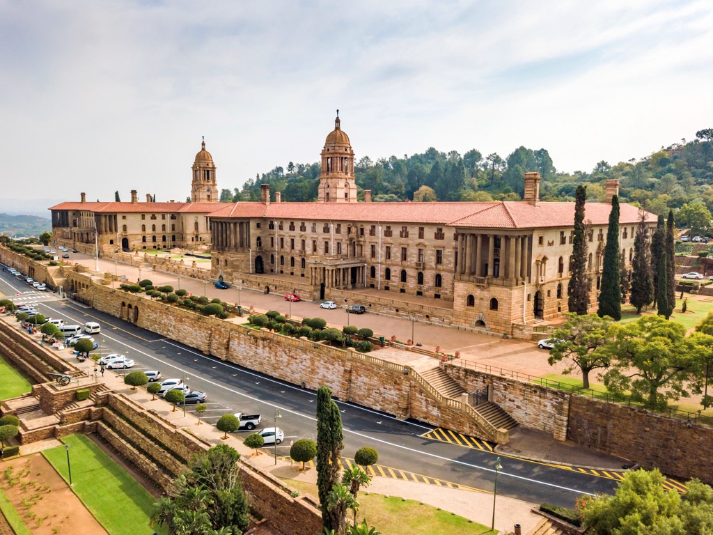
A famous landmark in Pretoria is the Union Buildings, the seat of the South African government. The sandstone buildings are surrounded by terraced gardens that feature statues, fountains, and indigenous plants. A statue of Nelson Mandela stands 9 meters (30 ft) tall and symbolizes his role as a unifying figure for the nation.
Rustenburg is a city located in the North West province of South Africa. It serves as the administrative capital of the province and is situated at the foot of the Magaliesberg mountain range. Rustenburg has a rich history and offers a variety of attractions for visitors.
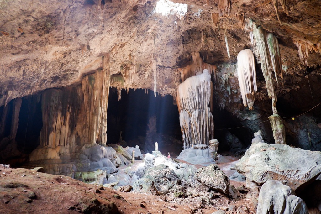
The underground Magaliesberg Caves are a network of limestone caves that date back millions of years. Guided tours take visitors through the caves, showing them the stalactites, stalagmites, fossils, and rock paintings.
Located just a short drive from Rustenburg, Sun City is a world-renowned resort complex with a casino, golf courses, water parks, and entertainment options. It's a popular destination for both locals and tourists.
The nearby Pilanesberg National Park is a game reserve located in an extinct volcanic crater and offers an opportunity to see the Big Five along with various other wildlife species.


