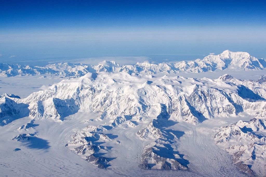
McArthur Peak is a peak in the Saint Elias Mountains of Yukon, Canada. The peak, 13th highest in Canada, sits 11 km NE of Mount Logan, the highest mountain in Canada. A secondary peak two kilometres to the east is known as McArthur East. The peak was named for James Joseph McArthur, a Dominion Land Surveyor who also made the first ascent of a Canadian peak over 10,000 ft (3047 m) — Mount Stephen in 1887.
The first ascent was made in 1961 from the Hubbard Glacier up the north ridge by Barbara Lilley, Alexander McDermott, Donald Monk, Seymour Ossofsky, George Wallerstein.
By elevation McArthur Peak is
# 15 out of 27097 in Canada # 14 out of 1341 in Yukon # 14 out of 191 in Kluane National Park and Reserve # 20 out of 423 in the Saint Elias Mountains
By prominence McArthur Peak is
# 72 out of 1341 in Yukon # 19 out of 191 in Kluane National Park and Reserve # 37 out of 423 in the Saint Elias Mountains
We use GPS information embedded into the photo when it is available.
3D mountains overlay
Adjust mountain panorama to perfectly match your photos because recorded by camera photo position might be imprecise.
Move tool
Rotate tool
Zoom
More customization
Choose which peak labels should make into the final photo and what photo title should be.
Next
Photo Location
Satellitte
Flat map
Relief map
Latitude
Longitude
Altitude
OR
Latitude
°'''
Longitude
°'''
Apply
Register Peak
Peak Name
Latitude
Longitude
Altitude
Register
Teleport
PeakVisor
This 3D model of Sagarmatha National Park in Nepal was made using the PeakVisor app topographic data. The mobile app features higher precision models worldwide, more topographic details, and works offline. Download PeakVisor maps today.
Download OBJ model
PeakVisor
The download should start shortly. If you find it useful please consider supporting the PeakVisor app.
PeakVisor for iOS and Android
Be a superhero of outdoor navigation with state-of-the-art 3D maps and mountain identification in the palm of your hand!