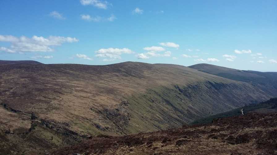
Lugduff (Irish: Log Dubh, meaning 'black hollow') at 652 metres (2,139 ft), is the 154th–highest peak in Ireland on the Arderin scale, and the 186th–highest peak on the Vandeleur-Lynam scale. Lugduff is situated in the southern sector of the Wicklow Mountains range, and forms a broad horseshoe around the Upper Lake of the Glendalough valley with the mountains of Mullacor 661 metres (2,169 ft), Conavalla 734 metres (2,408 ft), the hydroelectric station at Turlough Hill 681 metres (2,234 ft), and Camaderry 699 metres (2,293 ft).
Lugduff's steep western slopes, have a distinctive "corrugated" profile, and form the deep valley sidewall of the eastern flank of Glenmalure; Lugduff's western walls also sit at the T-junction of the Fraughan Rock Glen hanging valley with the Glenmalure valley.
Just below Lugduff's summit, lies the popular 8-kilometre boarded mountain path of The Spinc White Trail around the Upper Lake of Glendalough. To the south of Lugduff is the subsidiary summit of Lugduff SE Top 637 metres (2,090 ft).
There's a hiking trail (T2) leading to the summit.
By elevation Lugduff is
# 35 out of 149 in County Wicklow # 26 out of 53 in Wicklow Mountains National Park
By prominence Lugduff is
# 63 out of 149 in County Wicklow # 15 out of 53 in Wicklow Mountains National Park
We use GPS information embedded into the photo when it is available.
3D mountains overlay
Adjust mountain panorama to perfectly match your photos because recorded by camera photo position might be imprecise.
Move tool
Rotate tool
Zoom
More customization
Choose which peak labels should make into the final photo and what photo title should be.
Next
Photo Location
Satellitte
Flat map
Relief map
Latitude
Longitude
Altitude
OR
Latitude
°'''
Longitude
°'''
Apply
Register Peak
Peak Name
Latitude
Longitude
Altitude
Register
Teleport
PeakVisor
This 3D model of Sagarmatha National Park in Nepal was made using the PeakVisor app topographic data. The mobile app features higher precision models worldwide, more topographic details, and works offline. Download PeakVisor maps today.
Download OBJ model
PeakVisor
The download should start shortly. If you find it useful please consider supporting the PeakVisor app.
PeakVisor for iOS and Android
Be a superhero of outdoor navigation with state-of-the-art 3D maps and mountain identification in the palm of your hand!