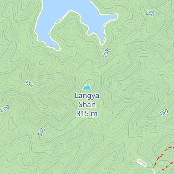
Mount Langya (Chinese: 琅琊山; pinyin: Lángyá shān) is a mountain located south west of Chuzhou City, Anhui Province, People's Republic of China. A National Forest Park, National Scenic Area and 4A Tourism Attraction, the mountain is one of Anhui's five biggest scenic attractions. Along with mountain scenery, rivers and forest, the area also contains the Zuiweng Pavilion, named after the Northern Song Dynasty poet Ouyang Xiu (1007–1072 CE)).
During the early Eastern Jin Dynasty (317–420 CE), Emperor Yuan of Jin, gave the area to King Langya (琅琊王), from which it takes its name.
By elevation Langya Shan is
# 1 out of 1 in 琅琊山国家森林公园 # 1 out of 3 in Nanqiao District # 1 out of 3 in Urban Chuzhou # 1 out of 1 in 琅琊山国家风景名胜区
By prominence Langya Shan is
# 1 out of 1 in 琅琊山国家森林公园 # 1 out of 3 in Nanqiao District # 1 out of 3 in Urban Chuzhou # 1 out of 1 in 琅琊山国家风景名胜区
We use GPS information embedded into the photo when it is available.
3D mountains overlay
Adjust mountain panorama to perfectly match your photos because recorded by camera photo position might be imprecise.
Move tool
Rotate tool
Zoom
More customization
Choose which peak labels should make into the final photo and what photo title should be.
Next
Photo Location
Satellitte
Flat map
Relief map
Latitude
Longitude
Altitude
OR
Latitude
°'''
Longitude
°'''
Apply
Register Peak
Peak Name
Latitude
Longitude
Altitude
Register
Teleport
PeakVisor
This 3D model of Sagarmatha National Park in Nepal was made using the PeakVisor app topographic data. The mobile app features higher precision models worldwide, more topographic details, and works offline. Download PeakVisor maps today.
Download OBJ model
PeakVisor
The download should start shortly. If you find it useful please consider supporting the PeakVisor app.
PeakVisor for iOS and Android
Be a superhero of outdoor navigation with state-of-the-art 3D maps and mountain identification in the palm of your hand!