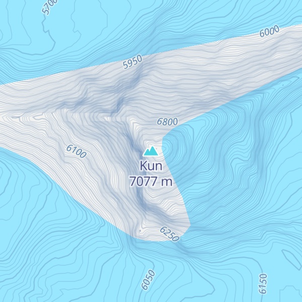
The Kun Peak is a part of Nun Kun mountain massif in Ladakh, India. It is the second highest summit of the massif with elevation of 23,219 ft (7,077 metres) in the western Himalayan Range, located near the Suru valley, on the road connecting Kargil and Zanskar. It is located about 61 km south of Kargil and 141 km west of Leh.
The Kun Peak is located north of Nun Peak 23,409 ft (7,135 metres) which is the highest summit of the massif and is separated from it by a snowy plateau of 4 km in length, in the northeast just at a distance of 2 km rises another peak of the massif known as Pinnacle Peak 22,740 ft (6,930 metres).
By elevation Kun is
# 1 out of 15 in Sankoo # 43 out of 13857 in India # 22 out of 246 in Ladakh
We use GPS information embedded into the photo when it is available.
3D mountains overlay
Adjust mountain panorama to perfectly match your photos because recorded by camera photo position might be imprecise.
Move tool
Rotate tool
Zoom
More customization
Choose which peak labels should make into the final photo and what photo title should be.
Next
Photo Location
Satellitte
Flat map
Relief map
Latitude
Longitude
Altitude
OR
Latitude
°'''
Longitude
°'''
Apply
Register Peak
Peak Name
Latitude
Longitude
Altitude
Register
Teleport
PeakVisor
This 3D model of Sagarmatha National Park in Nepal was made using the PeakVisor app topographic data. The mobile app features higher precision models worldwide, more topographic details, and works offline. Download PeakVisor maps today.
Download OBJ model
PeakVisor
The download should start shortly. If you find it useful please consider supporting the PeakVisor app.
PeakVisor for iOS and Android
Be a superhero of outdoor navigation with state-of-the-art 3D maps and mountain identification in the palm of your hand!